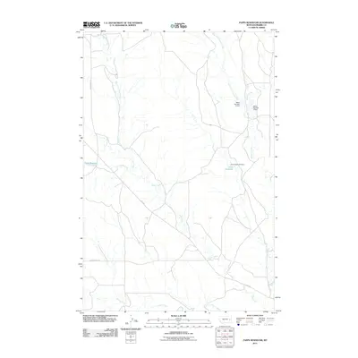
2011 Map of Papps Reservoir
USGS Topo · Published 2011About this map
Papps Reservoir and the drainage basins of eastern Montana define this landscape as it appeared in the early 21st century. The map centers on the hydrological network of Cedar Creek and Brackett Creek, where small-scale water management is evidenced by the Innes Reservoir Dam and the numbered structures of Nefsy Number 2 Dam and Nefsy Number 3 Dam. These features illustrate the vital role of water storage in this semi-arid region, supporting local ranching and agricultural efforts. The terrain is further etched by numerous tributaries including Stouts Creek, East Fork Cedar Creek, and West Fork Brackett Creek. Transportation is limited to a sparse network of secondary routes such as Cedar Creek Rd and Cherry Creek Rd, alongside the state-maintained Fas 253. The layout of these roads and reservoirs reflects a landscape dedicated to large-acreage land use where water sources are the primary landmarks.
Find a feature on this map
14 named features on this map. Tap any name to fly to it.
Don’t see what you’re looking for? This feature index may not catch every label — zoom into the map to look around manually.
Map Details
Editions of this 2011 Papps Reservoir Map
This is the sole edition of this map. No revisions or reprints were ever made.
Other maps of this area

1953 · Miles City
USGS Topo · 1:250,000

1954 · Glendive
USGS Topo · 1:250,000

1957 · Miles City
USGS Topo · 1:250,000

1957 · Glendive
USGS Topo · 1:250,000

1958 · Miles City
USGS Topo · 1:250,000

1958 · Glendive
USGS Topo · 1:250,000

1972 · Calypso
USGS Topo · 1:24,000

1972 · Papps Reservoir
USGS Topo · 1:24,000

1972 · Mc Clure Reservoir
USGS Topo · 1:24,000

1972 · Diamond G Creek
USGS Topo · 1:24,000