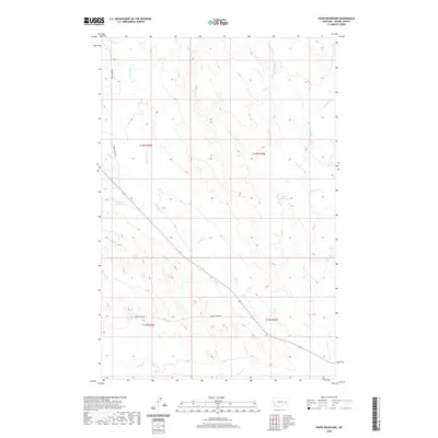
2020 Map of Papps Reservoir
USGS Topo · Published 2020About this map
Papps Reservoir and Innes Reservoir serve as central landmarks in this corner of Prairie County, Montana. The landscape is defined by the branching drainages of the Cedar Cr and Brackett Creek systems, including the E Fork Cedar Cr and W Fork Brackett Cr. These intermittent watercourses and small reservoirs suggest a landscape managed for livestock and seasonal water retention. Local travel in this expansive area centers on established routes like Cedar Creek Rd and Cherry Creek Rd, which provide access through the complex network of draws and ridges such as those around Stouts Cr and Cherry Cr. This 2020 record illustrates the enduring spatial organization of Montana rangeland, where named roads and water sources remain the primary orienting features across the township and range grid.
Find a feature on this map
15 named features on this map. Tap any name to fly to it.
Don’t see what you’re looking for? This feature index may not catch every label — zoom into the map to look around manually.
Map Details
Editions of this 2020 Papps Reservoir Map
This is the sole edition of this map. No revisions or reprints were ever made.
Other maps of this area

1953 · Miles City
USGS Topo · 1:250,000

1954 · Glendive
USGS Topo · 1:250,000

1957 · Miles City
USGS Topo · 1:250,000

1957 · Glendive
USGS Topo · 1:250,000

1958 · Miles City
USGS Topo · 1:250,000

1958 · Glendive
USGS Topo · 1:250,000

1972 · Calypso
USGS Topo · 1:24,000

1972 · Papps Reservoir
USGS Topo · 1:24,000

1972 · Mc Clure Reservoir
USGS Topo · 1:24,000

1972 · Diamond G Creek
USGS Topo · 1:24,000