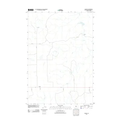
2012 Map of Parade
USGS Topo · Published 2012About this map
Parade anchors the southern portion of this landscape in Dewey County, where the plains are defined by ranching operations and a network of county roads. The settlement patterns in this area are sparse, characterized by isolated holdings like Strong Ranch and Ridgeview Ranch that sit amidst a drainage system feeding into Goose Cr and Hosupa Cr. A significant local landmark is the Goose Creek Dam, which manages water resources for the surrounding prairie. This 2012 survey illustrates the modern road infrastructure of the region, specifically how Co HWY-16 and several branches like Co HWY-16b and Co HWY-17a connect these remote ranching outposts to the main thoroughfares.
Find a feature on this map
15 named features on this map. Tap any name to fly to it.
Don’t see what you’re looking for? This feature index may not catch every label — zoom into the map to look around manually.
Map Details
Editions of this 2012 Parade Map
This is the sole edition of this map. No revisions or reprints were ever made.
Other maps of this area

1951 · Ridgeview NW
USGS Topo · 1:24,000

1952 · Parade NE
USGS Topo · 1:24,000

1952 · Parade NW
USGS Topo · 1:24,000

1953 · McIntosh
USGS Topo · 1:250,000

1954 · Pierre
USGS Topo · 1:250,000

1958 · Pierre
USGS Topo · 1:250,000

1958 · McIntosh
USGS Topo · 1:250,000

1981 · Herbert Creek
USGS Topo · 1:24,000

1981 · Rousseau Creek NW
USGS Topo · 1:24,000

1981 · Herbert Creek NE
USGS Topo · 1:24,000