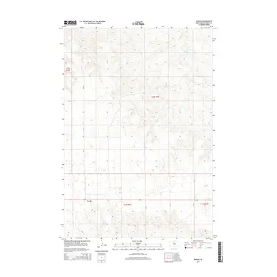
2015 Map of Parade
USGS Topo · Published 2015About this map
The small settlement of Parade sits along a prominent east-west highway corridor in Dewey County, serving as a focal point for this expansive prairie landscape. This 2015 survey documents the drainage patterns of the northern Great Plains, where Goose Cr and Hosupa Cr meander through open terrain punctuated by modest water management infrastructure like the Goose Cr Dam. The mapping of township and range lines, such as t13n r25e and t12n r25e, provides a clear view of the section-line road system that defines local navigation. Significant county routes including CR-17 and CR-16 link the remote homesteads and ranching tracts, illustrating the enduring agricultural grid and the sparse distribution of human settlement in this portion of South Dakota.
Find a feature on this map
14 named features on this map. Tap any name to fly to it.
Don’t see what you’re looking for? This feature index may not catch every label — zoom into the map to look around manually.
Map Details
Editions of this 2015 Parade Map
This is the sole edition of this map. No revisions or reprints were ever made.
Other maps of this area

1951 · Ridgeview NW
USGS Topo · 1:24,000

1952 · Parade NE
USGS Topo · 1:24,000

1952 · Parade NW
USGS Topo · 1:24,000

1953 · McIntosh
USGS Topo · 1:250,000

1954 · Pierre
USGS Topo · 1:250,000

1958 · Pierre
USGS Topo · 1:250,000

1958 · McIntosh
USGS Topo · 1:250,000

1981 · Herbert Creek
USGS Topo · 1:24,000

1981 · Rousseau Creek NW
USGS Topo · 1:24,000

1981 · Herbert Creek NE
USGS Topo · 1:24,000