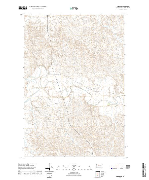
2021 Map of Parade NW
USGS Topo · Published 2021About this map
The Moreau River meanders across this section of Dewey County, defining the drainage patterns of the northern Great Plains. This 2021 survey illustrates the rural infrastructure of the Cheyenne River Reservation area, where primary travel routes like Bia Rd 14 and Green Grass Rd follow the natural contours of the river valley and upland breaks. Tributaries such as Redwater Cr and Meadow Cr feed into the main waterway, carving a network of coulees and draws through the landscape. The layout of section lines and range boundaries, including t15n r24e, reflects the systematic land partitioning that continues to govern this agricultural and ranching region. The map provides a clear look at the contemporary connectivity between isolated homesteads via routes like Co Rd 2, showing how modern local transit adheres to the historical river-path geography.
Find a feature on this map
12 named features on this map. Tap any name to fly to it.
Don’t see what you’re looking for? This feature index may not catch every label — zoom into the map to look around manually.
Map Details
Editions of this 2021 Parade NW Map
This is the sole edition of this map. No revisions or reprints were ever made.
Other maps of this area

1952 · Parade NE
USGS Topo · 1:24,000

1952 · Lantry NE
USGS Topo · 1:24,000

1952 · Parade NW
USGS Topo · 1:24,000

1953 · McIntosh
USGS Topo · 1:250,000

1958 · McIntosh
USGS Topo · 1:250,000

1978 · Peach Lake
USGS Topo · 1:24,000

1978 · Little Moreau Lake
USGS Topo · 1:24,000

1978 · Livermant Lake
USGS Topo · 1:24,000

1981 · Parade SW
USGS Topo · 1:24,000
1981 · Parade
USGS Topo · 1:24,000