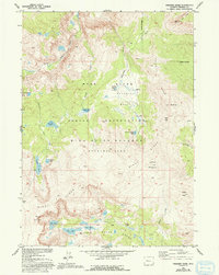
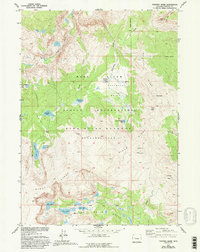
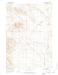
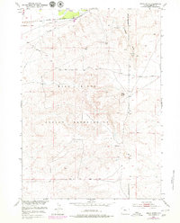
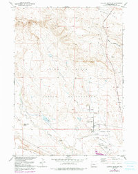
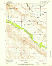
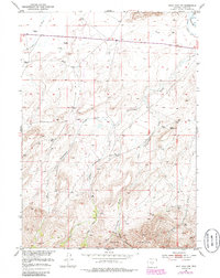
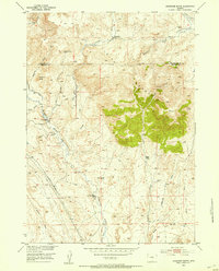
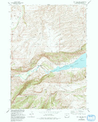
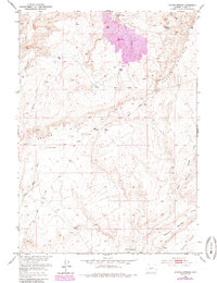
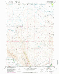
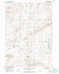
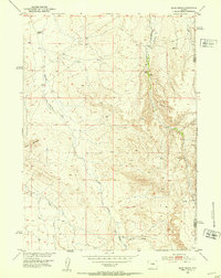
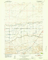
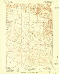
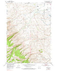
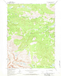
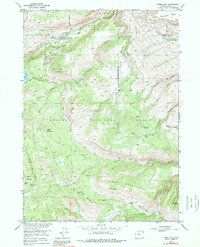
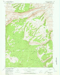
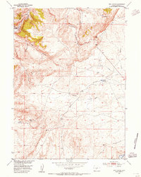
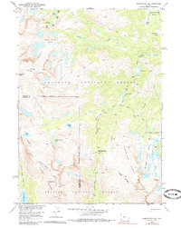
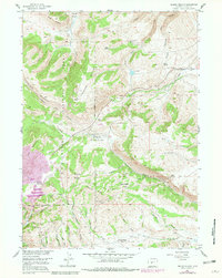
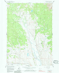
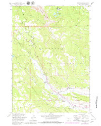
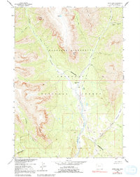
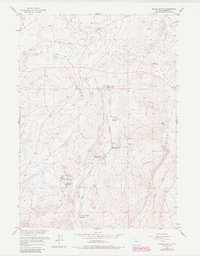
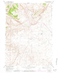
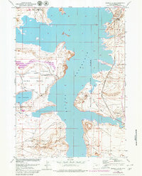
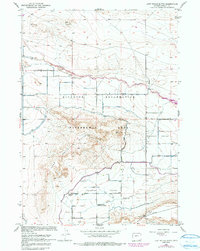
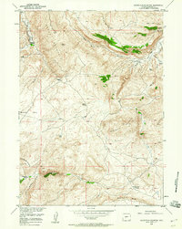
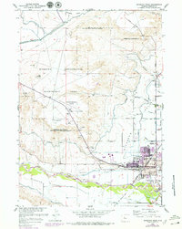
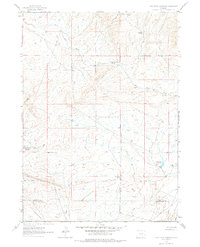
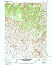
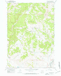
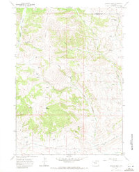
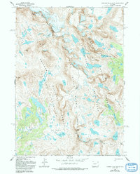
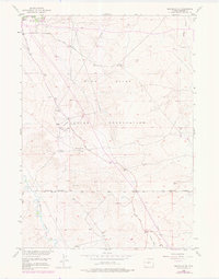
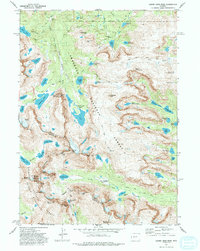
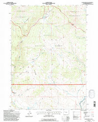
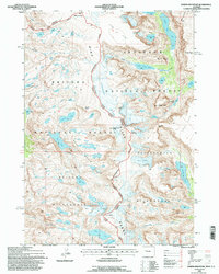
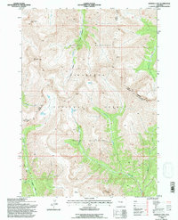
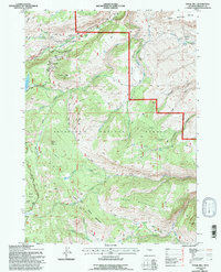
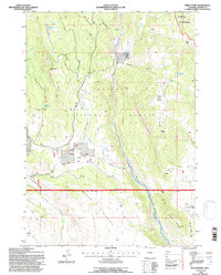
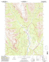
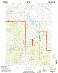
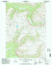
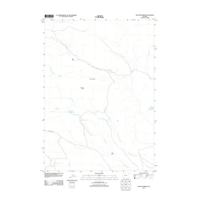
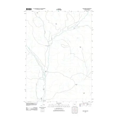
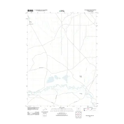
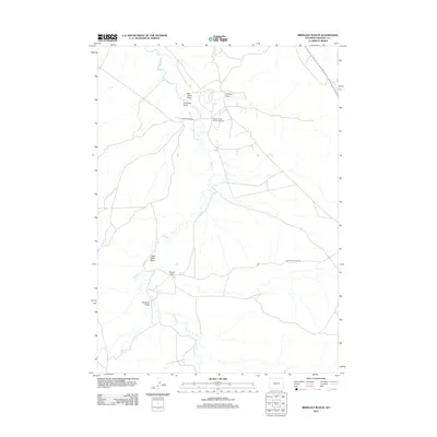
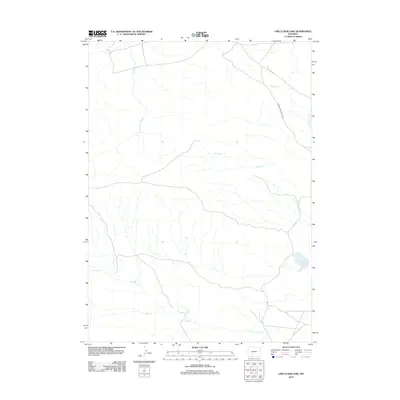
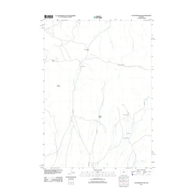
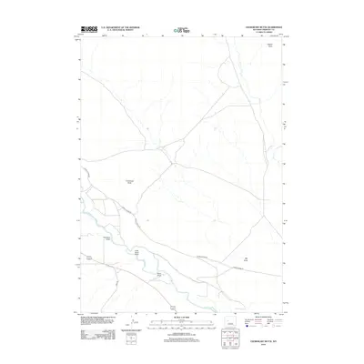
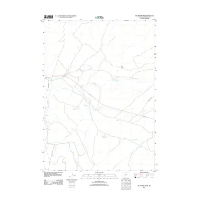
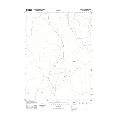
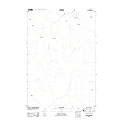
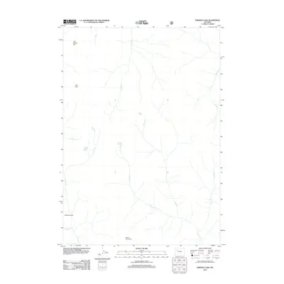
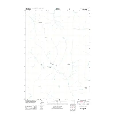
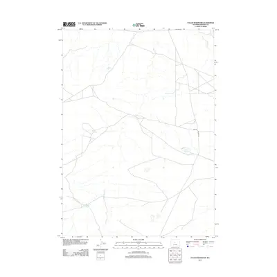
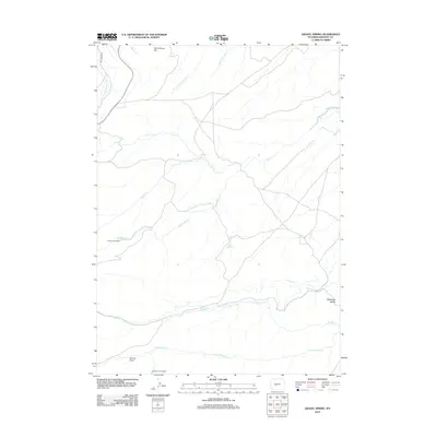
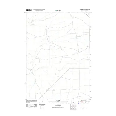
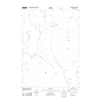
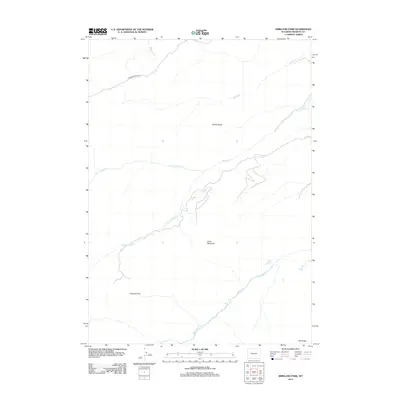
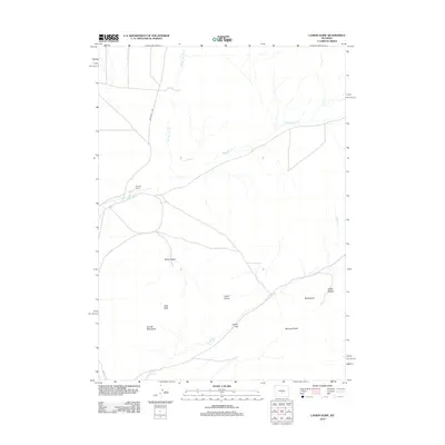
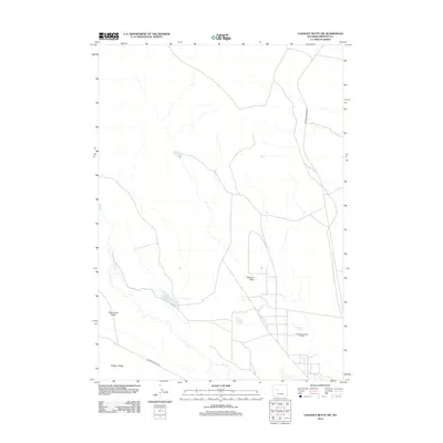
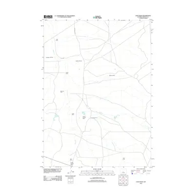
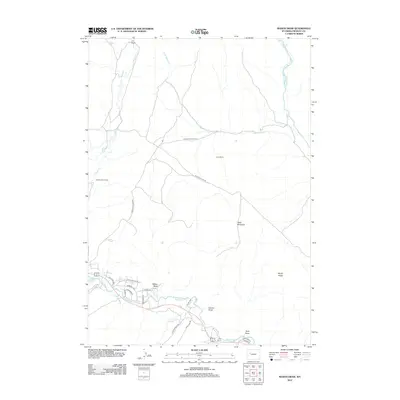
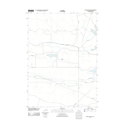
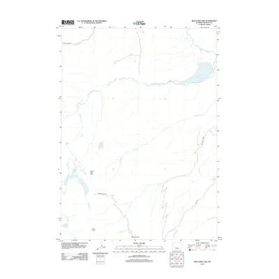
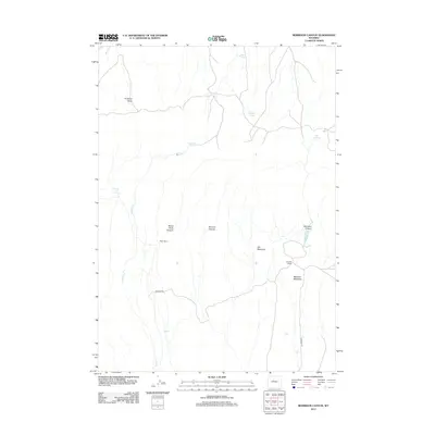
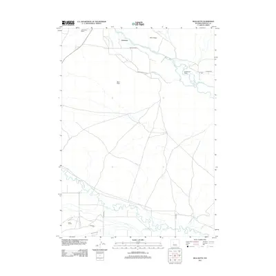
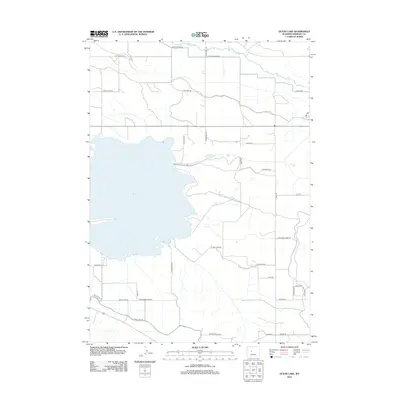
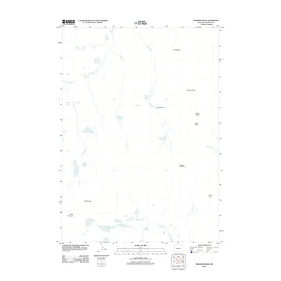
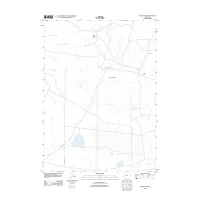
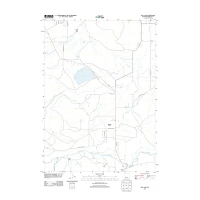
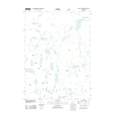
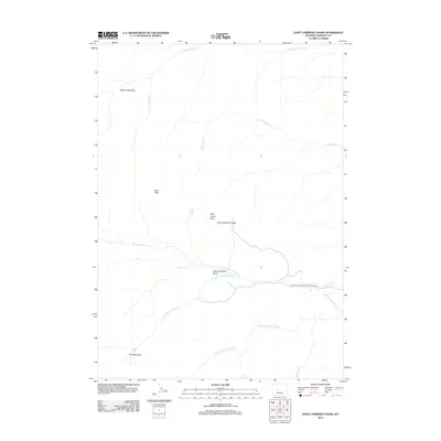
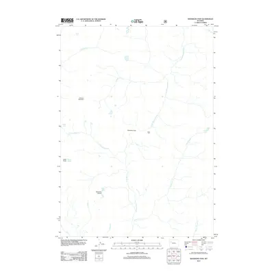
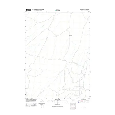
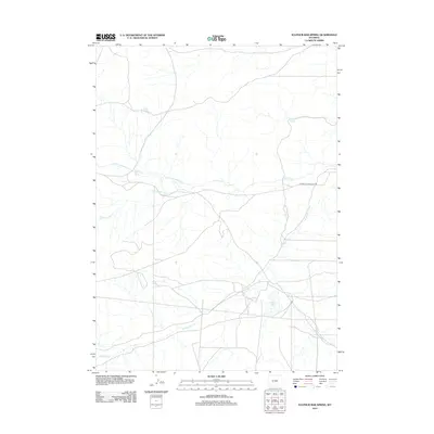
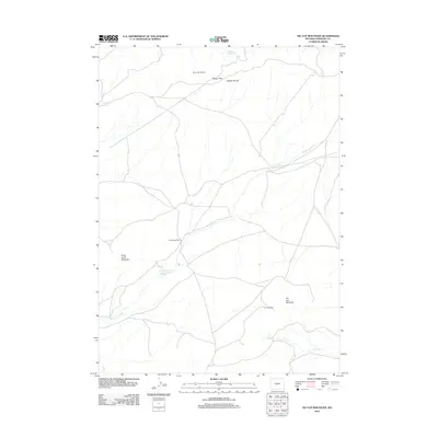
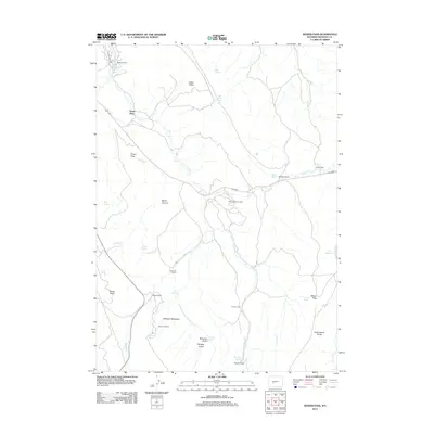
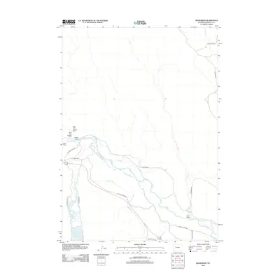
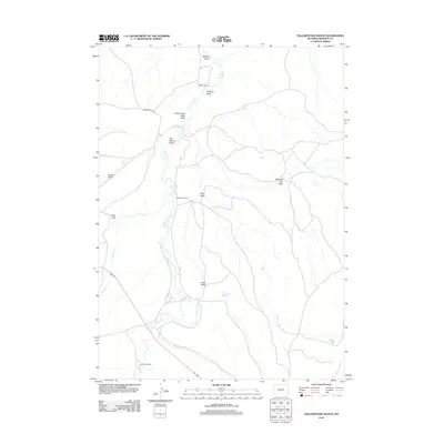
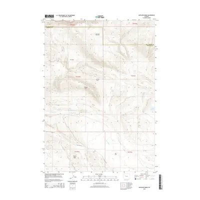
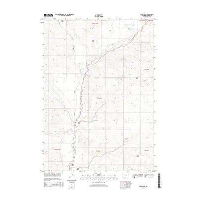
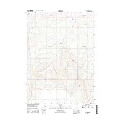
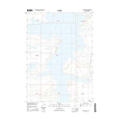
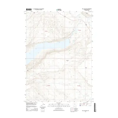
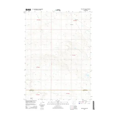
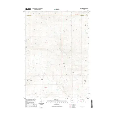
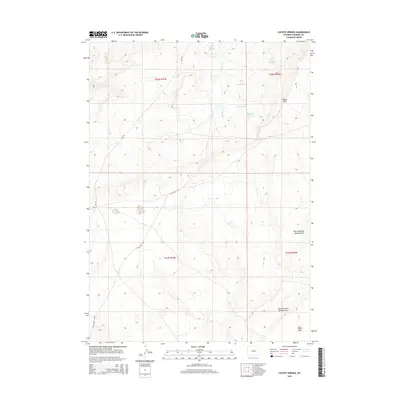
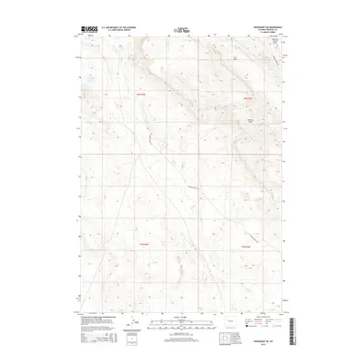
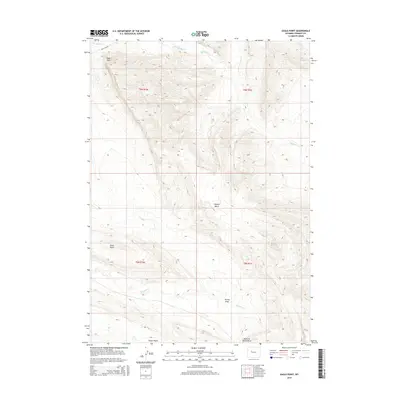
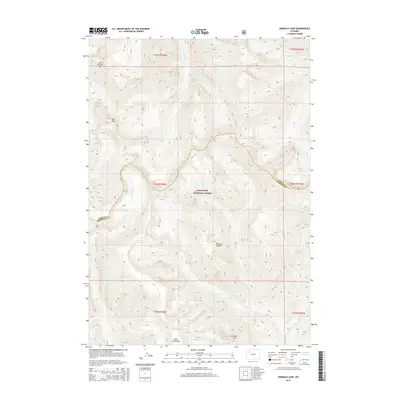
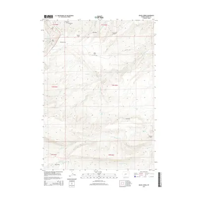
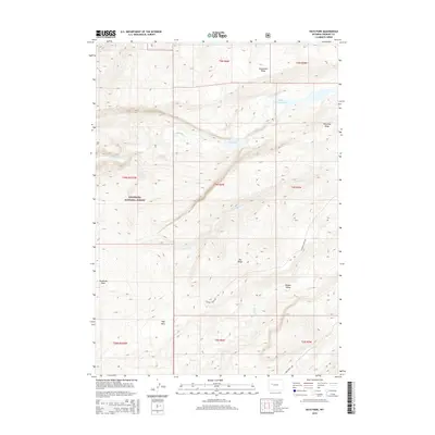
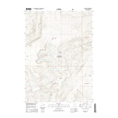
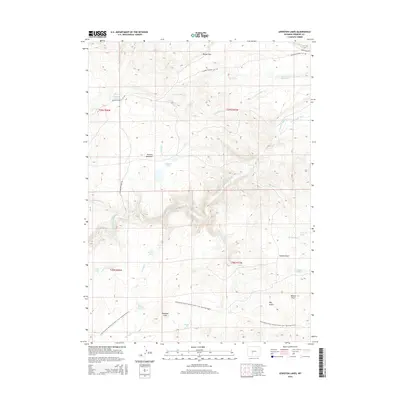
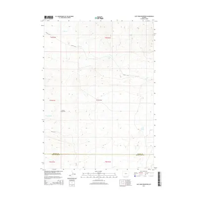
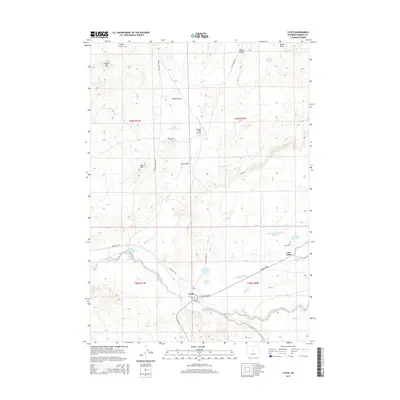
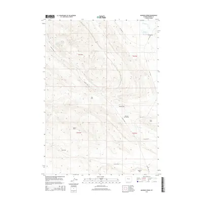
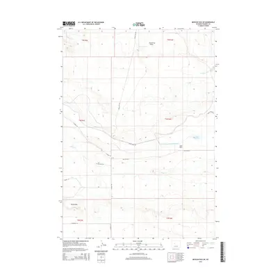
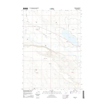
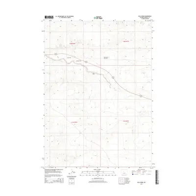
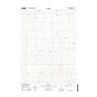
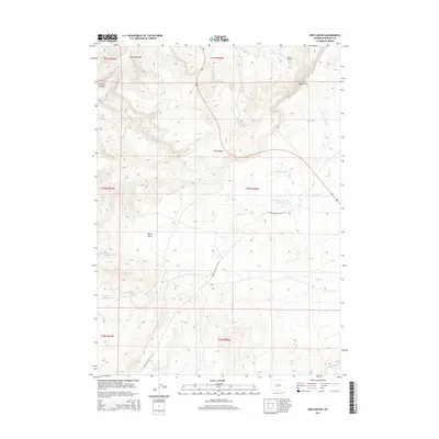
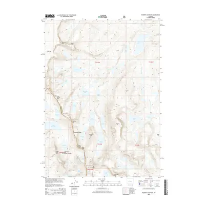
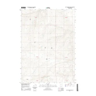
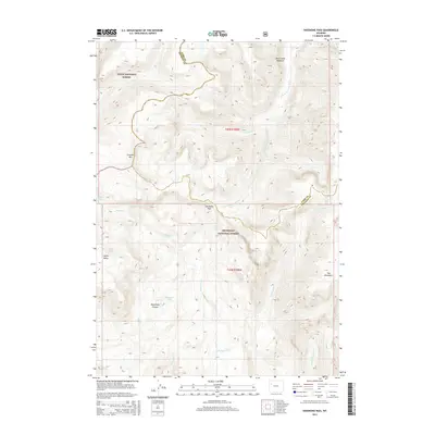
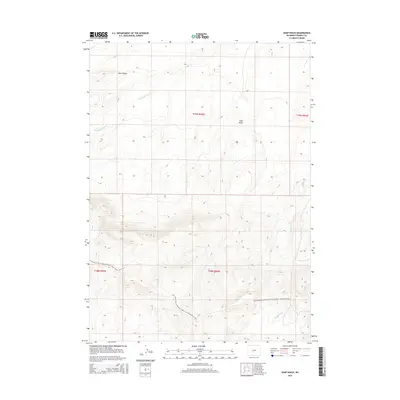
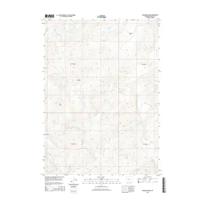
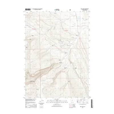
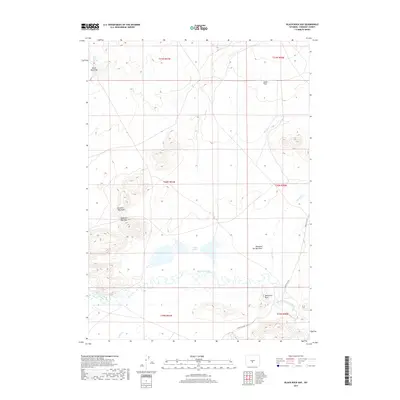
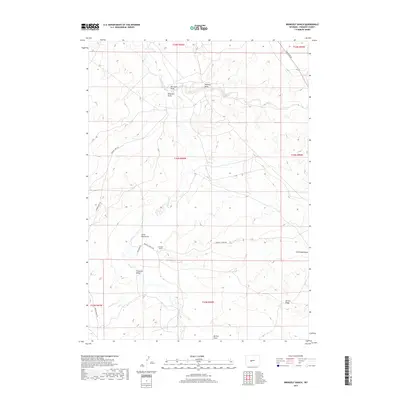
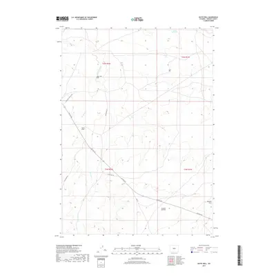
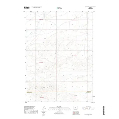
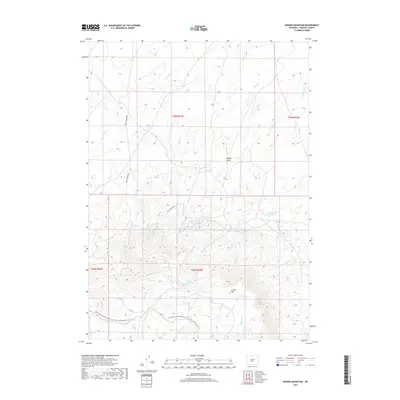
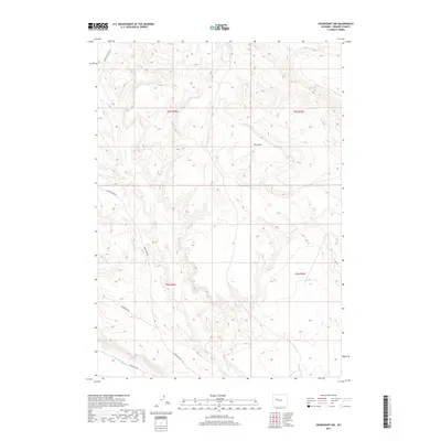
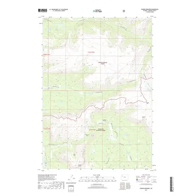
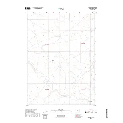
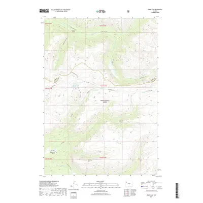
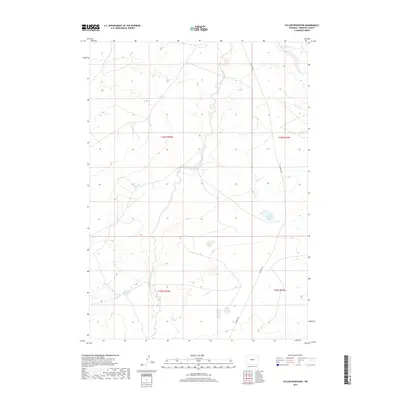
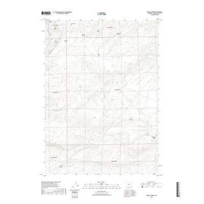
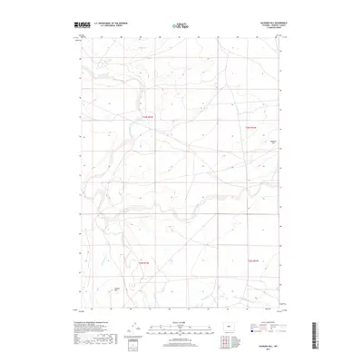
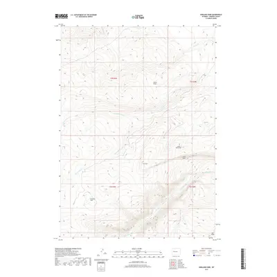
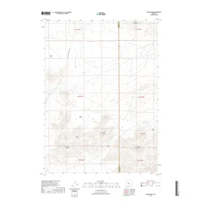
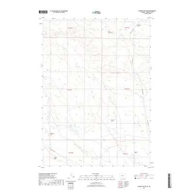
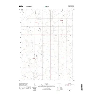
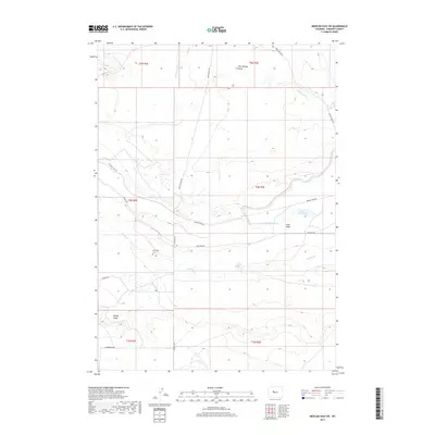
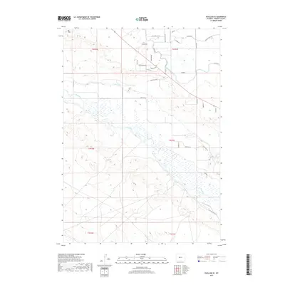
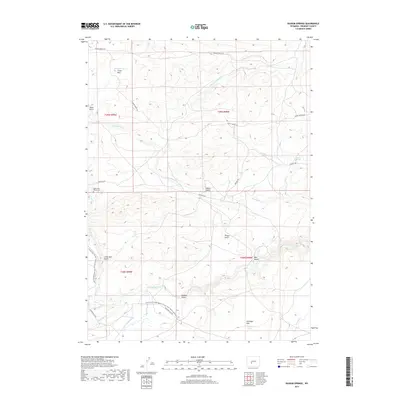
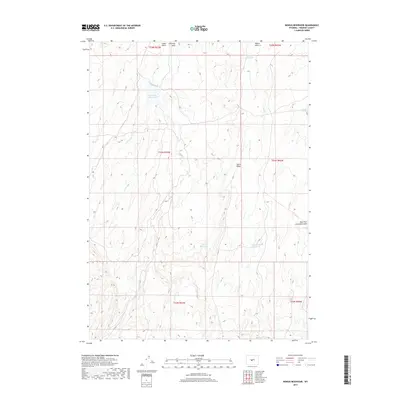
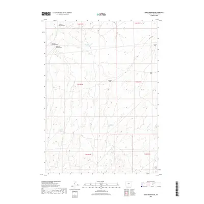
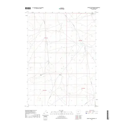
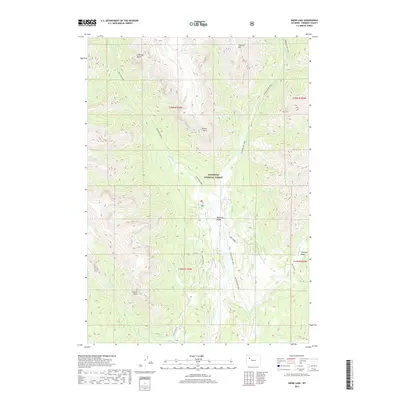
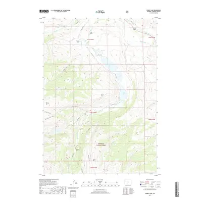
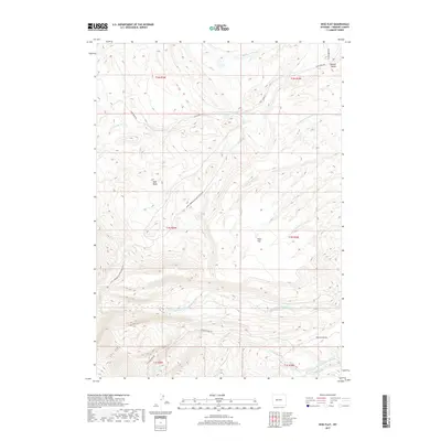
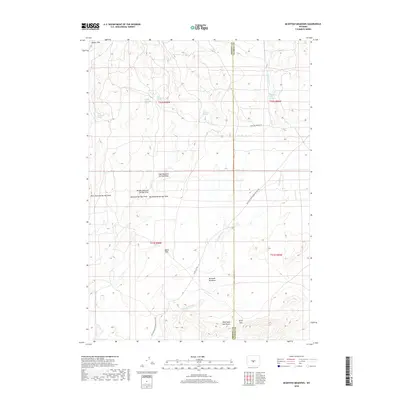
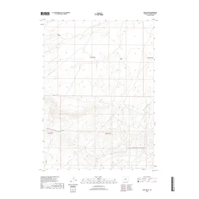
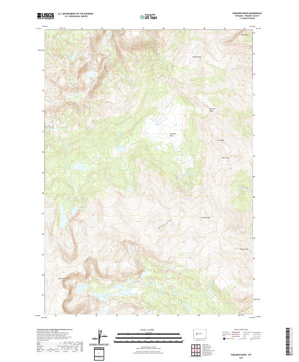
1952 Map of Paradise Basin
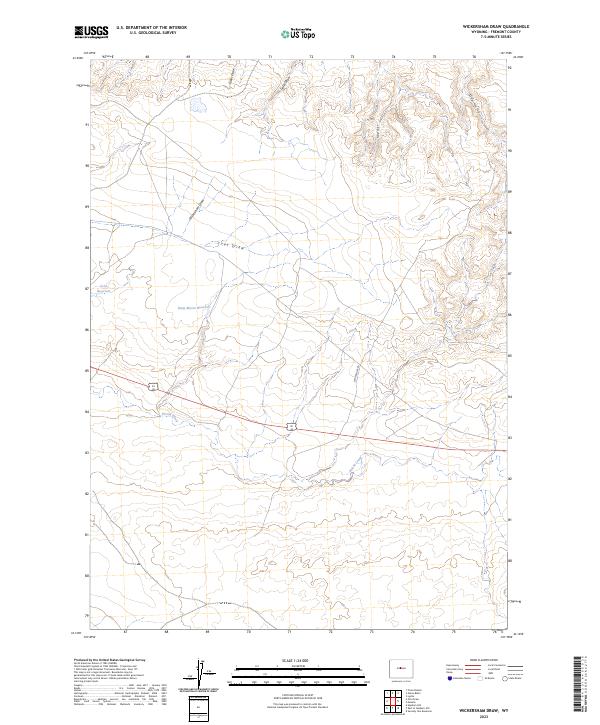
USGS Topo · Published 1993About this map
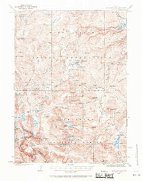
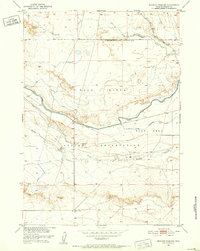
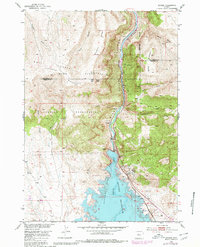
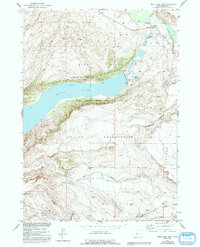
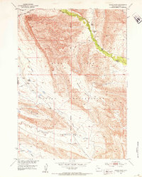
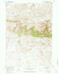
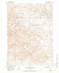
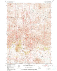
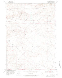
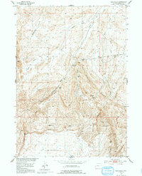
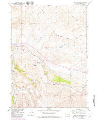
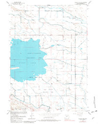
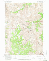
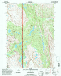
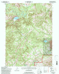
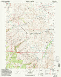
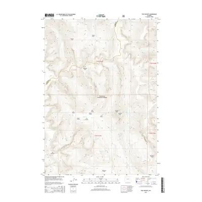
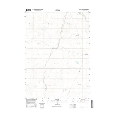
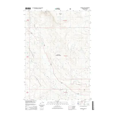
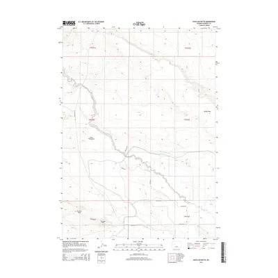
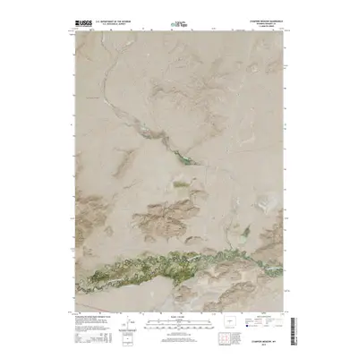
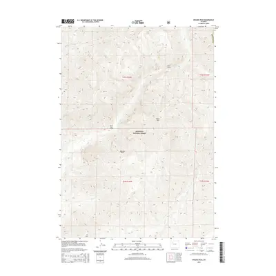
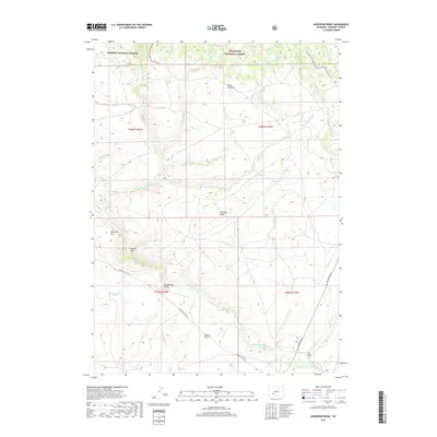
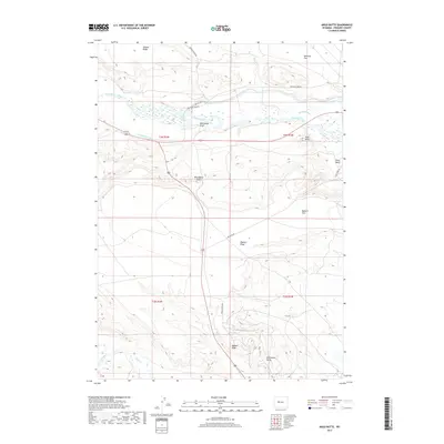
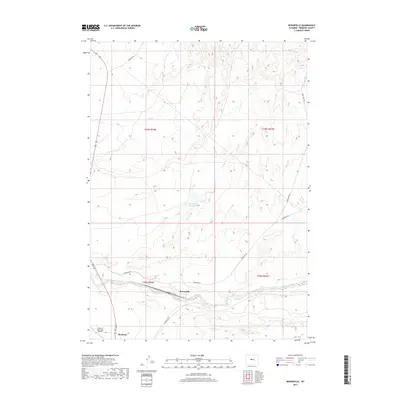
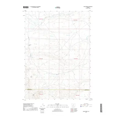
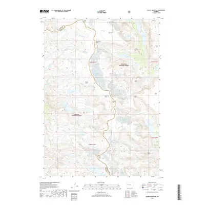
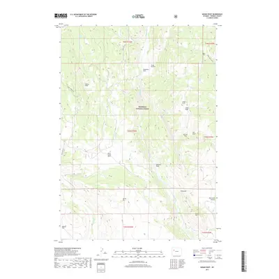
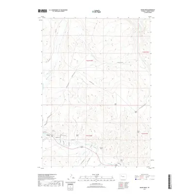
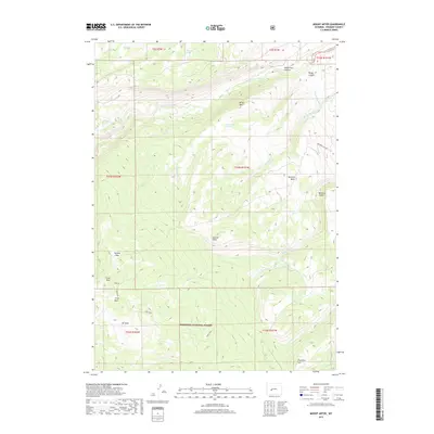
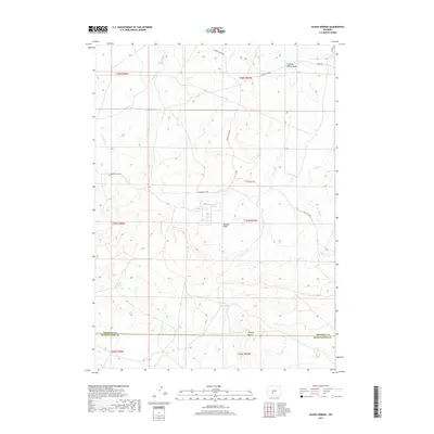
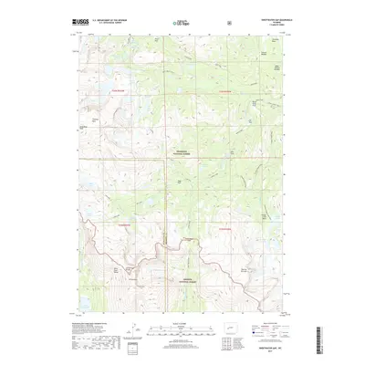
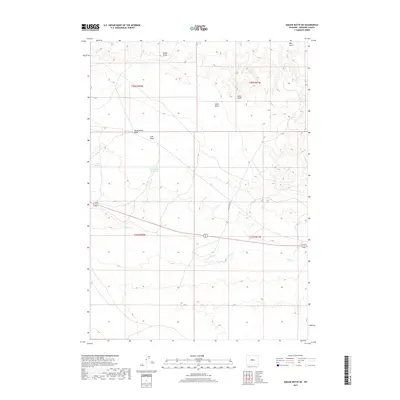
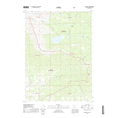
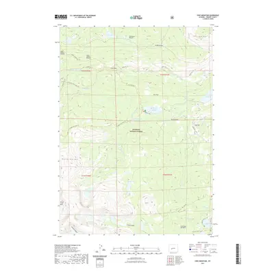
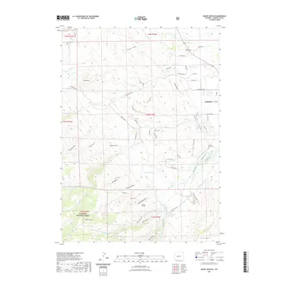
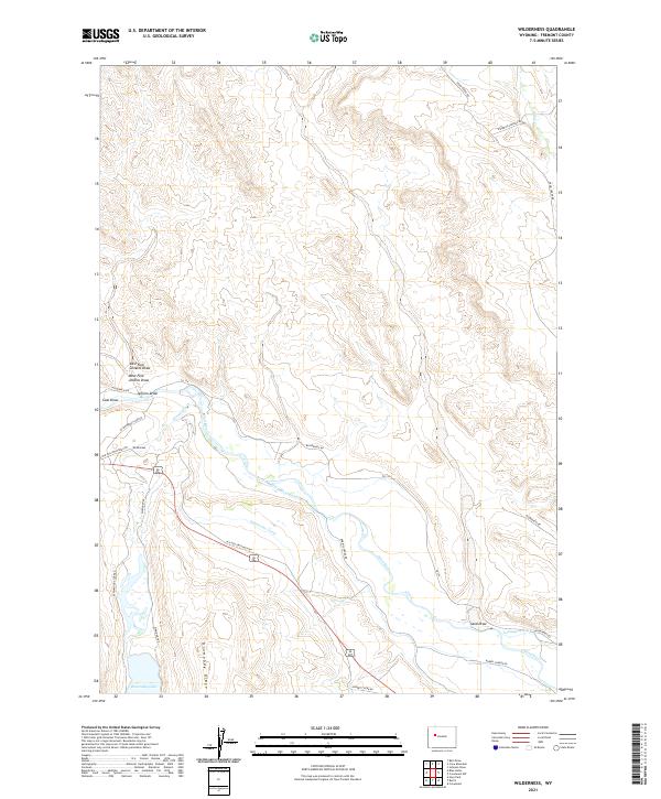
The Wind River Indian Reservation dominates this high-altitude landscape, specifically the area designated as a roadless wilderness. The 1952 field survey reveals a terrain defined by glacial lakes and sharp ridgelines, where Paradise Basin and Paradise Lakes sit beneath the towering Paradise Ridge. The drainage network is complex, with Bull Lake Creek and Paradise Creek carving through the granite heights. This map is particularly valuable for its recording of specific high-mountain landmarks such as Typo Peak, Entigo Peak, and Wittombona Peak. To the south, the Wind River Base Line marks a critical surveying boundary near Wilson Creek and Enos Lake. The absence of roads or permanent structures reflects the intentional preservation of this remote interior, making it a pristine record of the Windy Ridge environment before late-century environmental shifts.
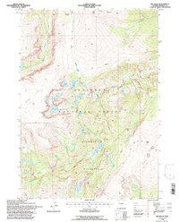
Find a feature on this map
32 named features on this map. Tap any name to fly to it.
Don’t see what you’re looking for? This feature index may not catch every label — zoom into the map to look around manually.
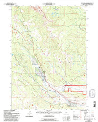
Map Details
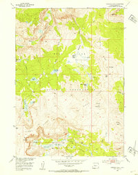
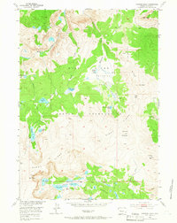
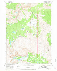
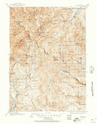
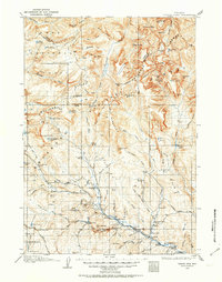
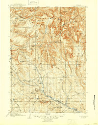
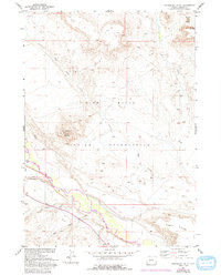
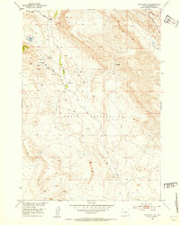
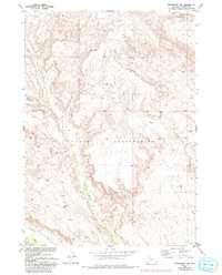
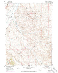
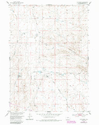
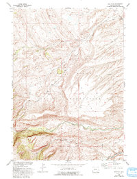
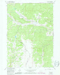
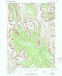
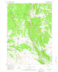
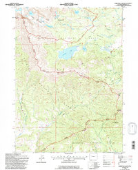
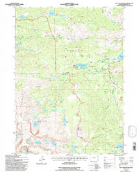
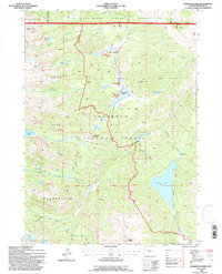
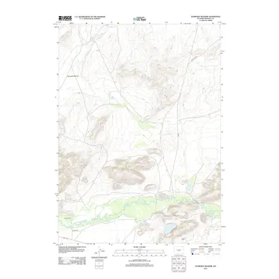
Editions of this 1952 Paradise Basin Map
5 editions found
Historical Maps of Fremont County Through Time
900 maps found
1904 Kirwin
Fremont County, WY
1905 Younts Peak
Fremont County, WY

1906 Kirwin
Fremont County, WY
1907 Younts Peak
Fremont County, WY
1937 Moccasin Lake
Fremont County, WY
1943 Moccasin Lake
Fremont County, WY
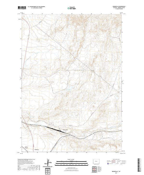
1950 Bonneville SW
Fremont County, WY
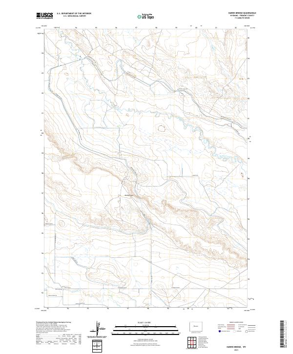
1950 Harris Bridge
Fremont County, WY
1950 Mexican Pass SW
Fremont County, WY
1950 Ocean Lake
Fremont County, WY
1950 Pavillion Butte
Fremont County, WY
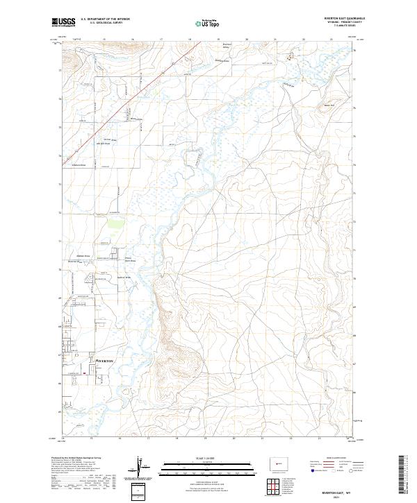
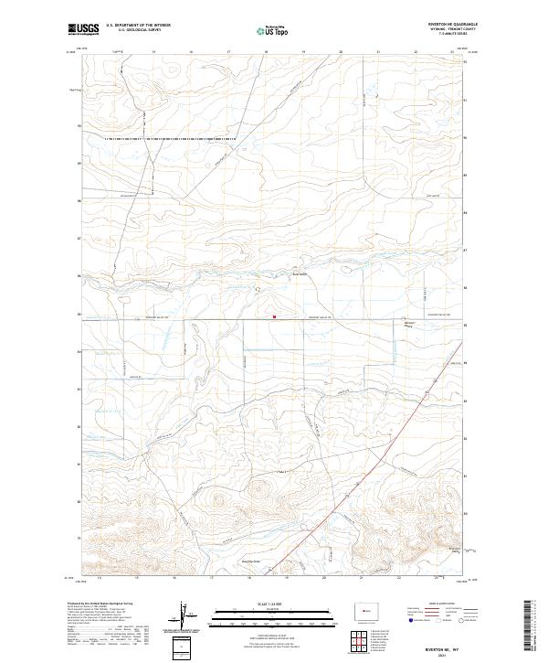
1950 Riverton East
Fremont County, WY
1950 Shotgun Butte
Fremont County, WY
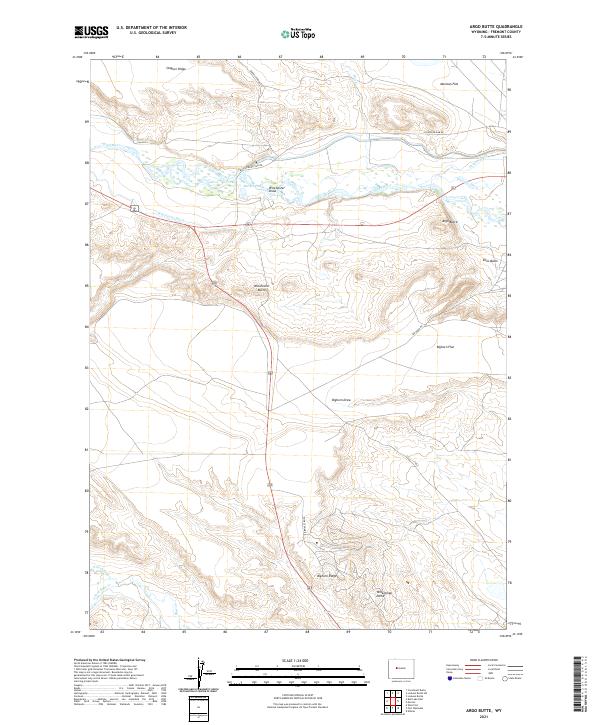
1951 Argo Butte
Fremont County, WY
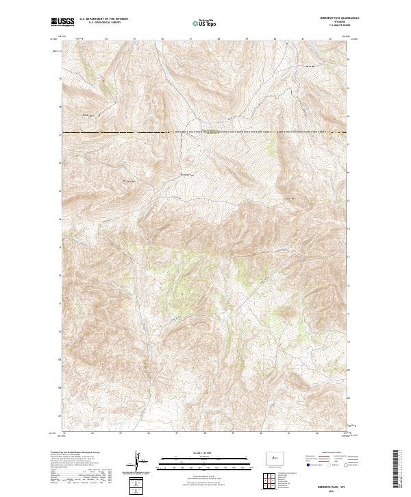
1951 Birdseye Pass
Fremont County, WY

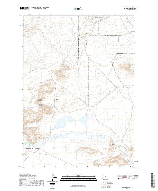
1951 Black Rock Gap
Fremont County, WY
1951 Bonneville
Fremont County, WY
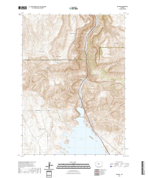
1951 Boysen
Fremont County, WY
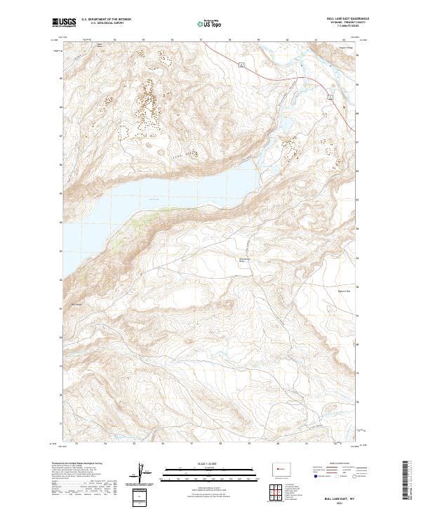
1951 Bull Lake East
Fremont County, WY
1951 Crooks Creek NE
Fremont County, WY
1951 Crooks Mountain
Fremont County, WY
1951 Eagle Point
Fremont County, WY
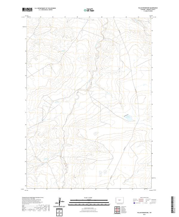
1951 Fuller Reservoir
Fremont County, WY
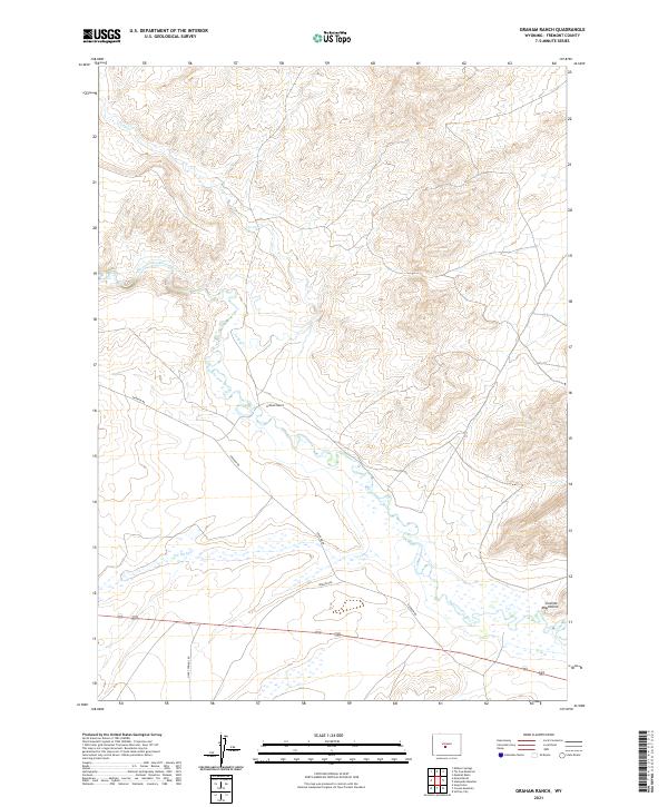
1951 Graham Ranch
Fremont County, WY
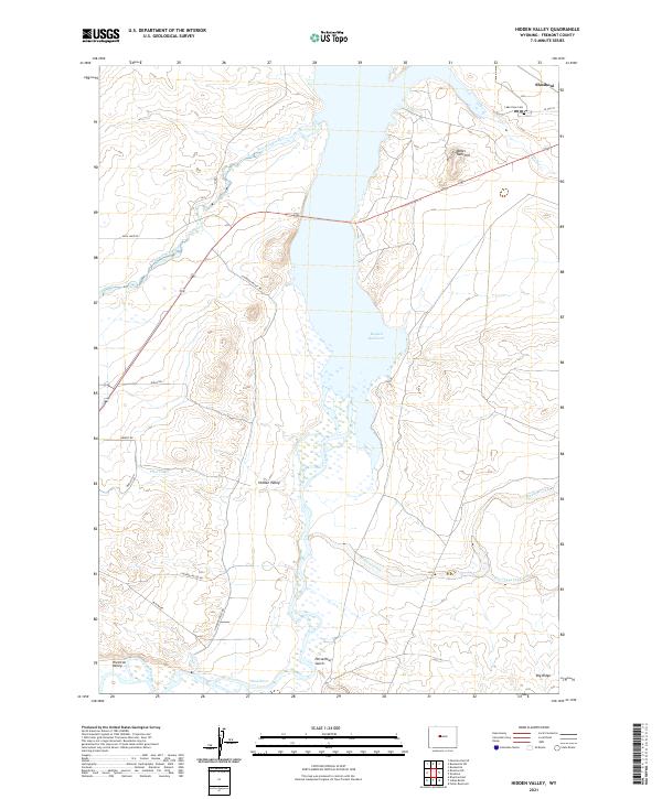
1951 Hidden Valley
Fremont County, WY
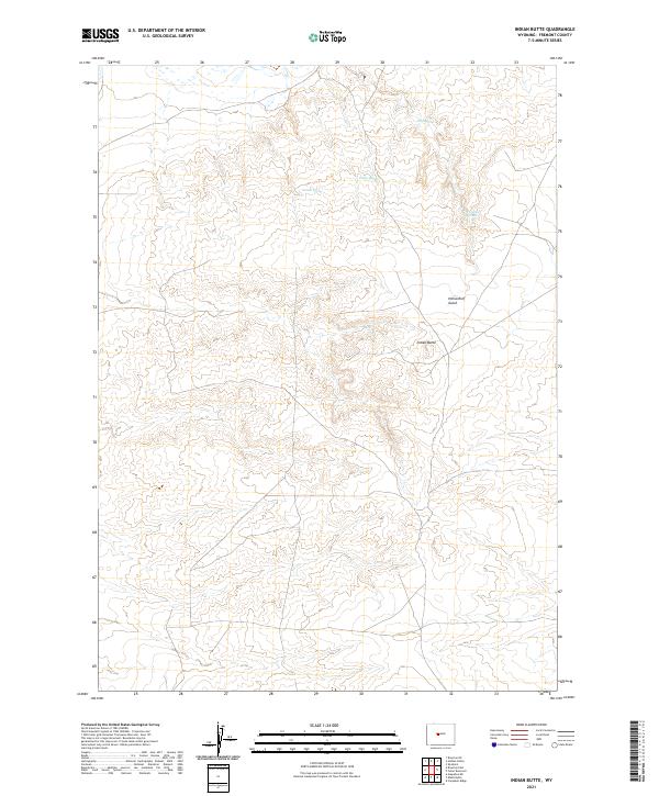
1951 Indian Butte
Fremont County, WY
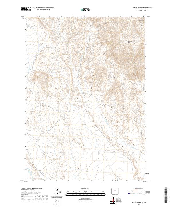
1951 Jenkins Mountain
Fremont County, WY
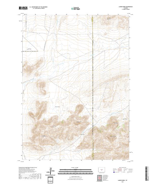
1951 Lankin Dome
Fremont County, WY
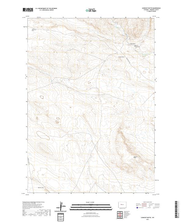
1951 Lookout Butte
Fremont County, WY
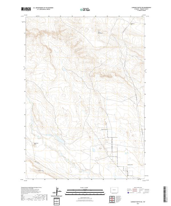
1951 Lookout Butte SW
Fremont County, WY
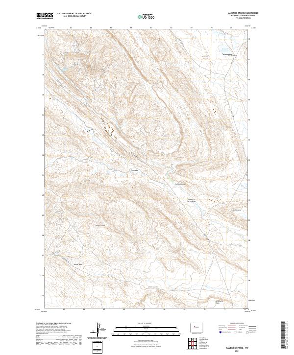
1951 Maverick Spring
Fremont County, WY
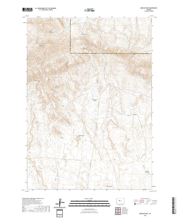
1951 Mexican Pass
Fremont County, WY
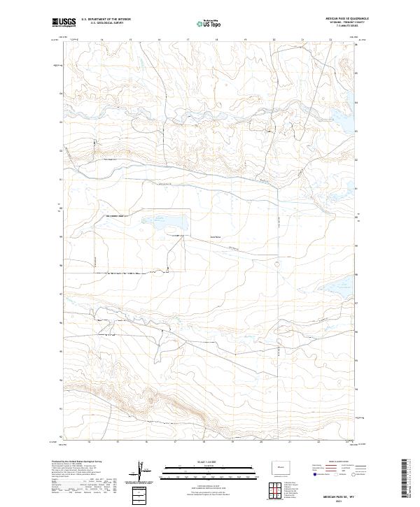
1951 Mexican Pass SE
Fremont County, WY
1951 Morrison Canyon
Fremont County, WY
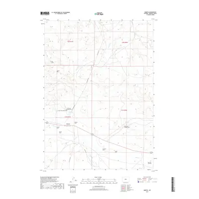
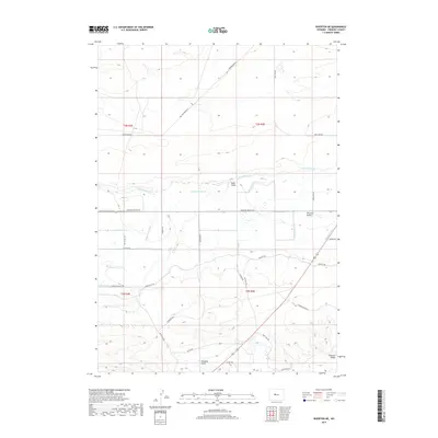
1951 Morton
Fremont County, WY
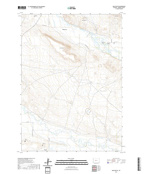
1951 Mule Butte
Fremont County, WY
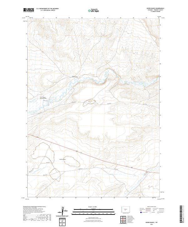
1951 Myers Ranch
Fremont County, WY
1951 Pavillion SE
Fremont County, WY
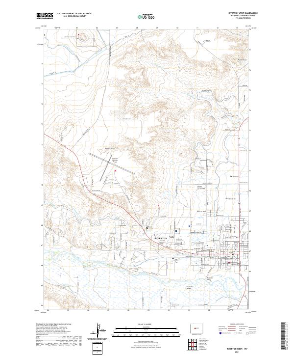
1951 Riverton West
Fremont County, WY
1951 Soap Holes
Fremont County, WY
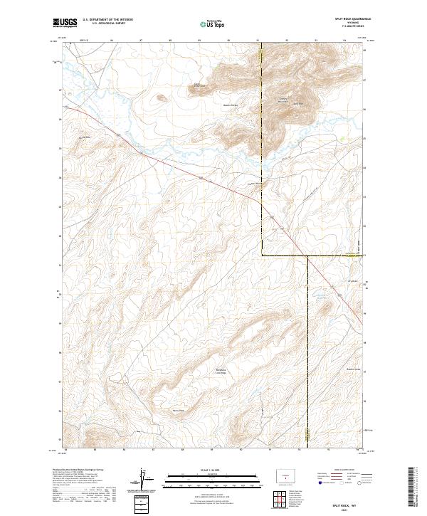
1951 Split Rock
Fremont County, WY
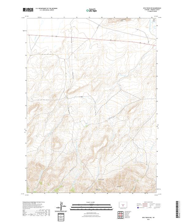
1951 Split Rock NW
Fremont County, WY
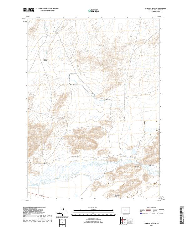
1951 Stampede Meadow
Fremont County, WY
1952 Alpine Lake
Fremont County, WY
1952 Antelope Ridge
Fremont County, WY
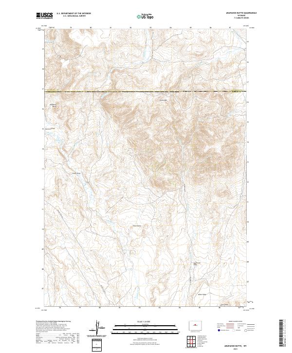
1952 Arapahoe Butte
Fremont County, WY
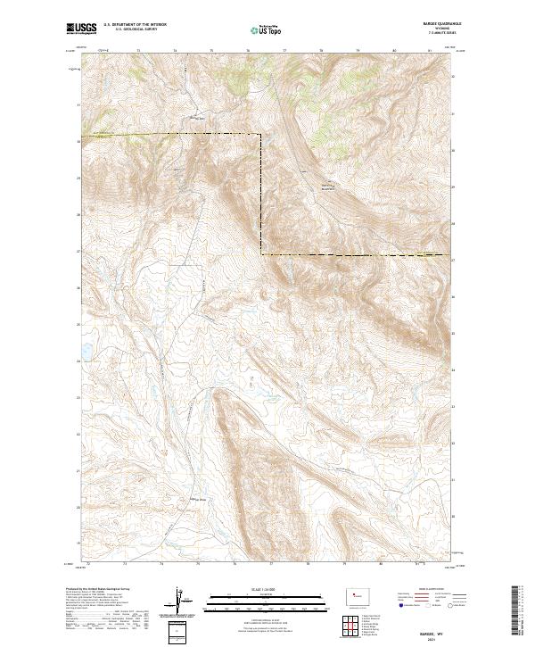
1952 Bargee
Fremont County, WY
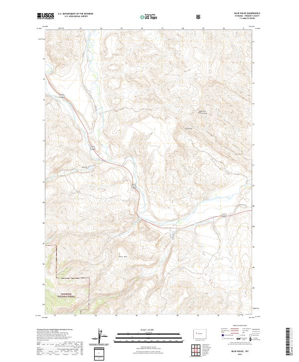
1952 Blue Holes
Fremont County, WY
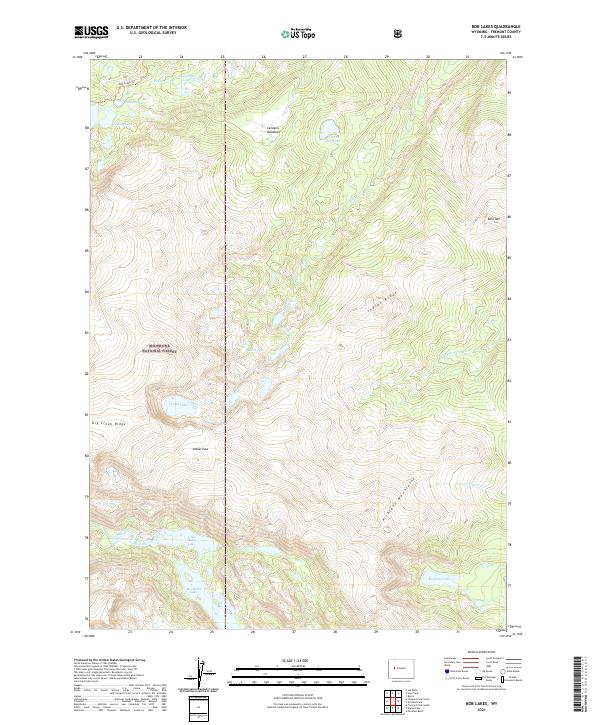
1952 Bob Lakes
Fremont County, WY
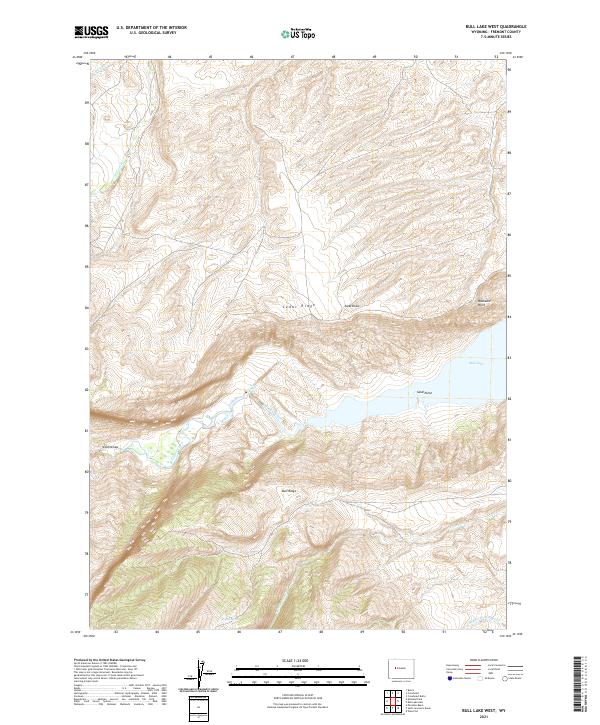
1952 Bull Lake West
Fremont County, WY
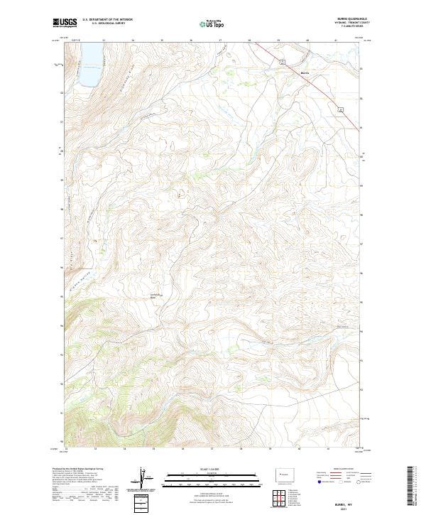
1952 Burris
Fremont County, WY
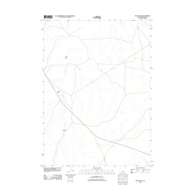
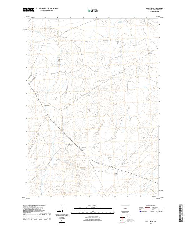
1952 Butte Well
Fremont County, WY
1952 Cottonwood Pass
Fremont County, WY
1952 Coyote Springs
Fremont County, WY
1952 Crowheart Butte
Fremont County, WY
1952 Crowheart NE
Fremont County, WY
1952 Crowheart NW
Fremont County, WY
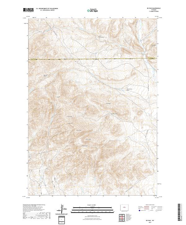
1952 De Pass
Fremont County, WY
1952 Double Butte
Fremont County, WY
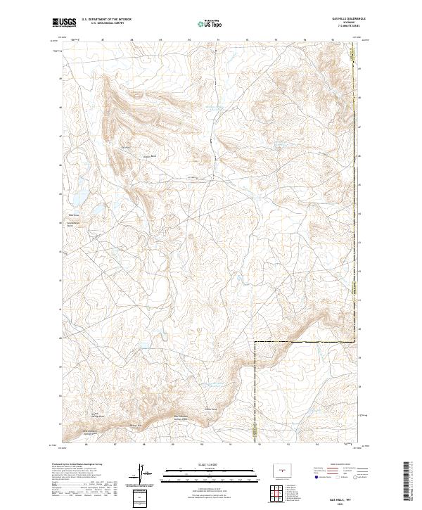
1952 Gas Hills
Fremont County, WY
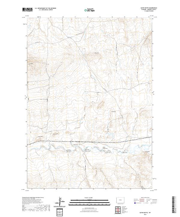
1952 Gates Butte
Fremont County, WY
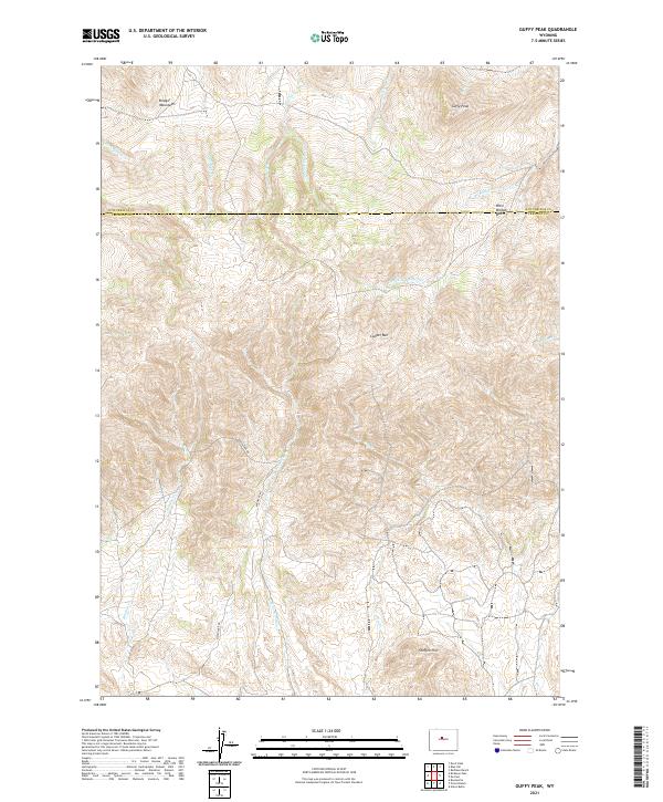
1952 Guffy Peak
Fremont County, WY
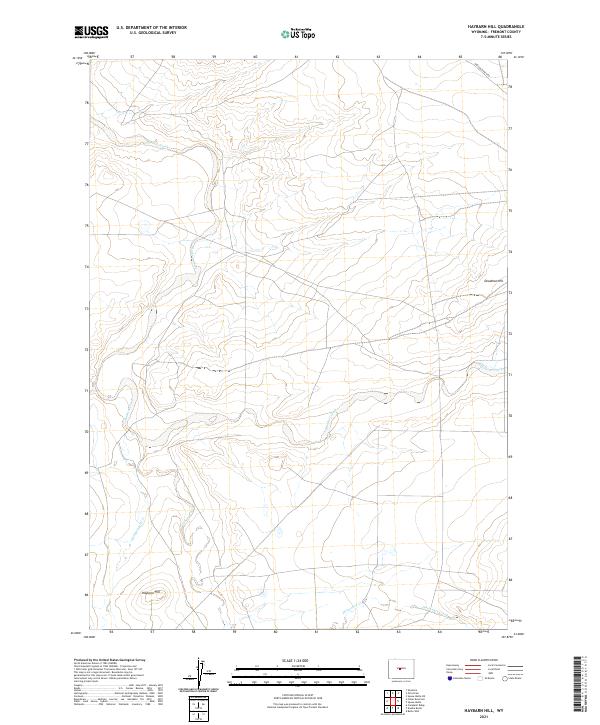
1952 Haybarn Hill
Fremont County, WY
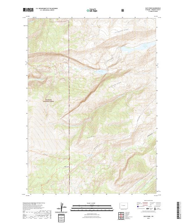
1952 Hays Park
Fremont County, WY
1952 Kirkland Park
Fremont County, WY
1952 Lander NW
Fremont County, WY
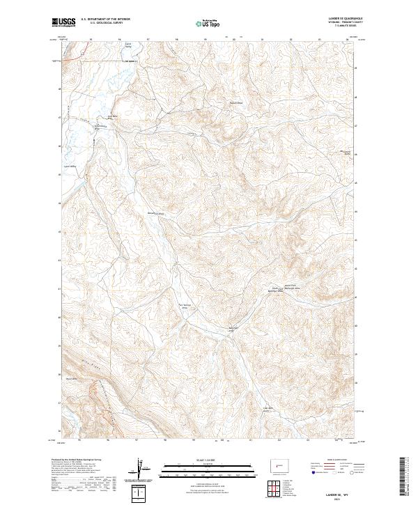
1952 Lander SE
Fremont County, WY
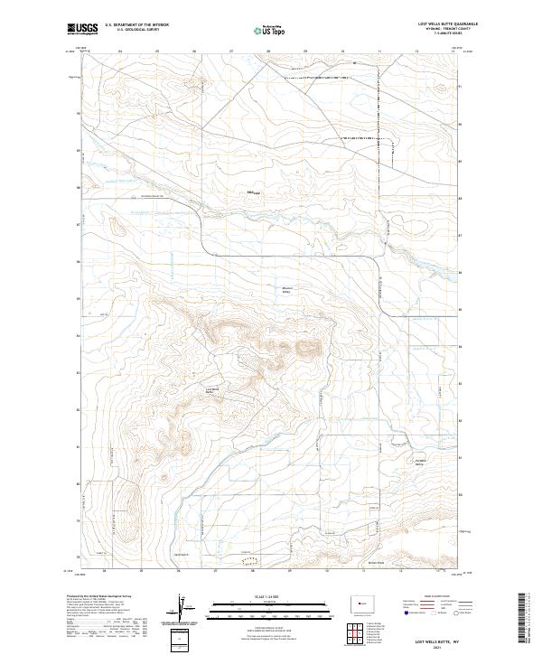
1952 Lost Wells Butte
Fremont County, WY
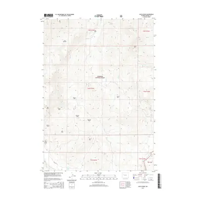
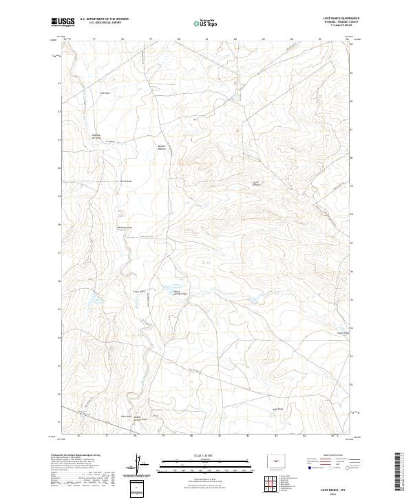
1952 Love Ranch
Fremont County, WY
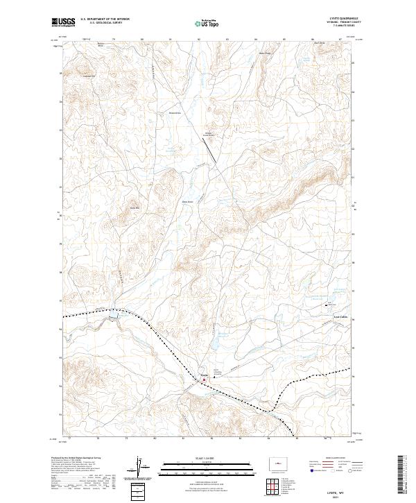
1952 Lysite
Fremont County, WY
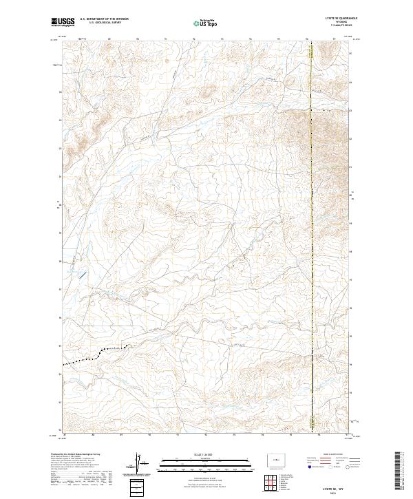
1952 Lysite SE
Fremont County, WY
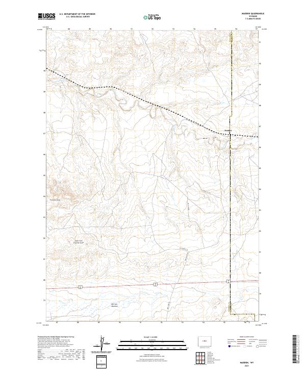
1952 Madden
Fremont County, WY
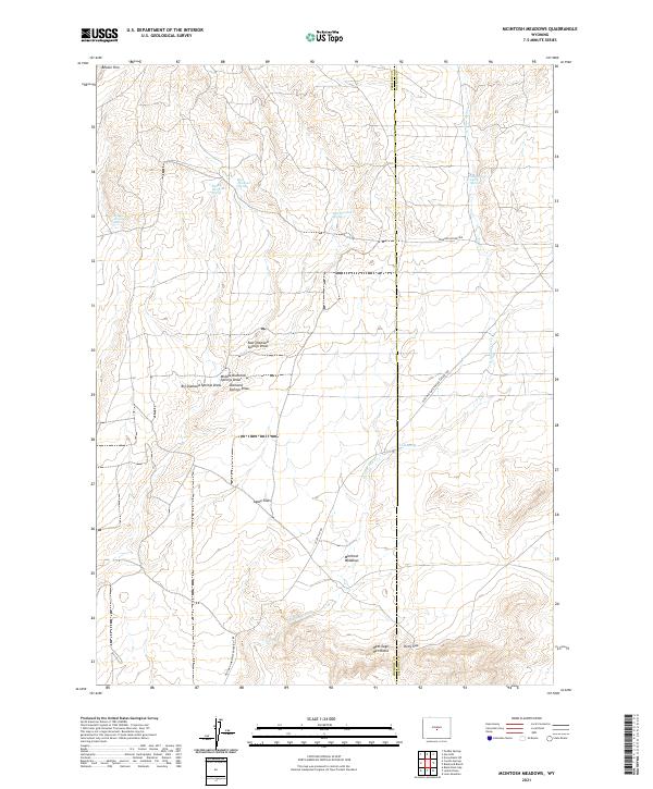
1952 Mc Intosh Meadows
Fremont County, WY
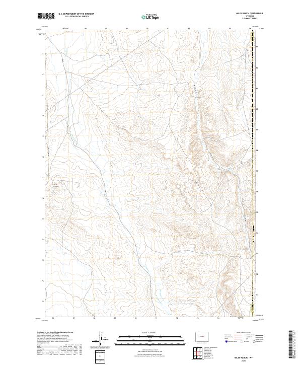
1952 Miles Ranch
Fremont County, WY
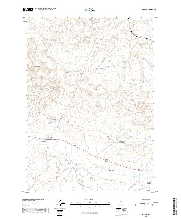
1952 Moneta
Fremont County, WY
1952 Moneta SE
Fremont County, WY
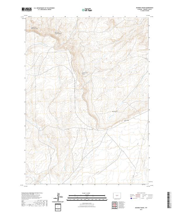
1952 Muskrat Basin
Fremont County, WY
1952 Ocla Draw
Fremont County, WY
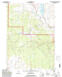
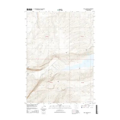
1952 Paradise Basin
Fremont County, WY
1952 Picard Ranch
Fremont County, WY
1952 Puddle Springs
Fremont County, WY
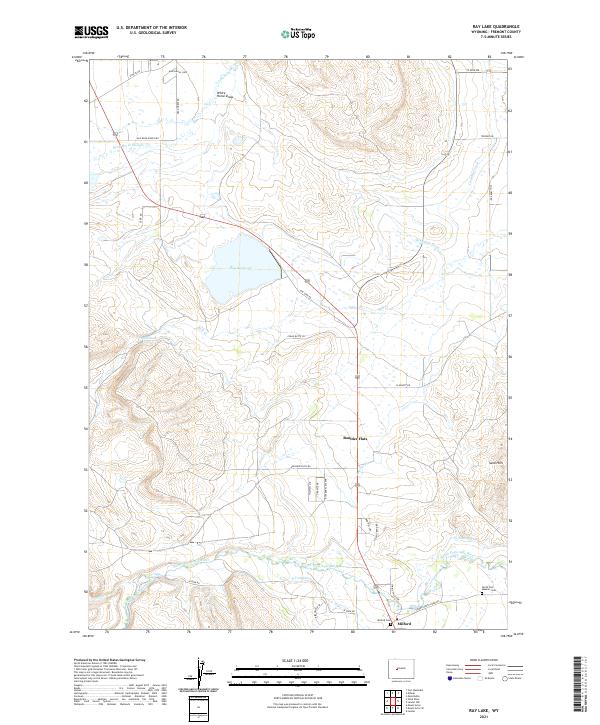
1952 Ray Lake
Fremont County, WY
1952 Riverton NE
Fremont County, WY
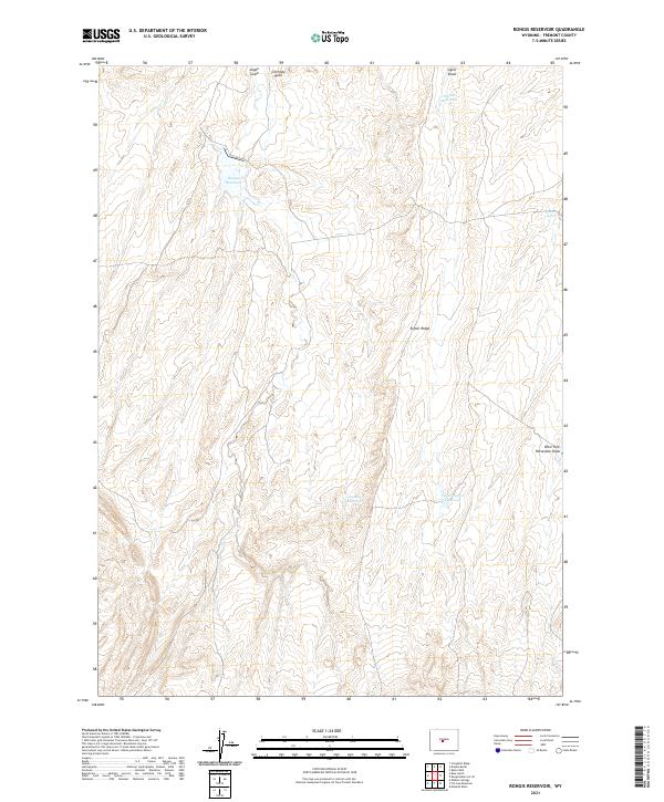
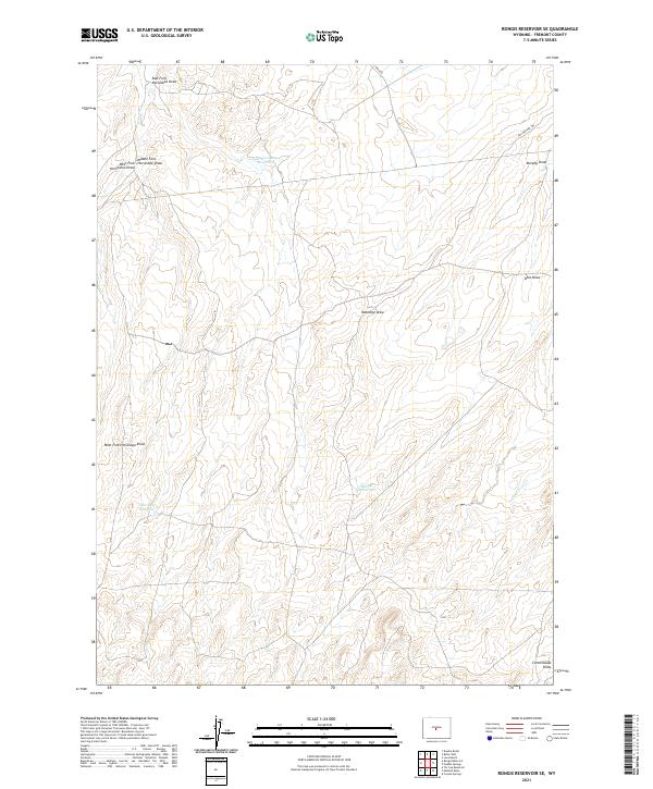
1952 Rongis Reservoir
Fremont County, WY
1952 Rongis Reservoir SE
Fremont County, WY

1952 Seventy-one Reservoir
Fremont County, WY
1952 Squaw Butte
Fremont County, WY
1952 Squaw Butte NE
Fremont County, WY
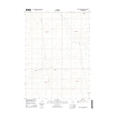
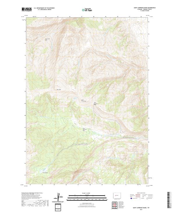
1952 St. Lawrence Basin
Fremont County, WY
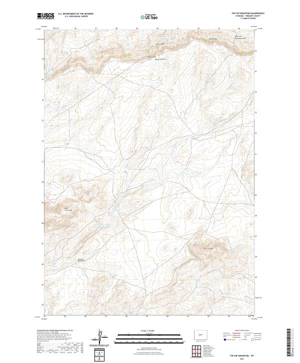
1952 Tin Cup Mountain
Fremont County, WY
1952 Wilderness
Fremont County, WY
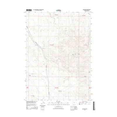
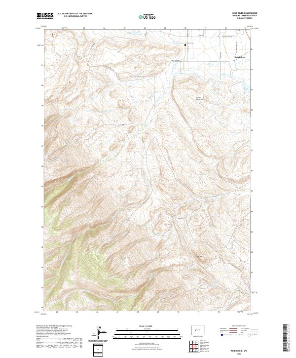
1952 Wind River
Fremont County, WY
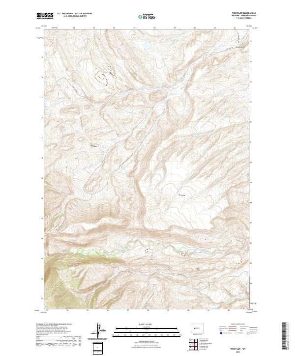
1952 Wise Flat
Fremont County, WY
1953 Arapahoe NE
Fremont County, WY
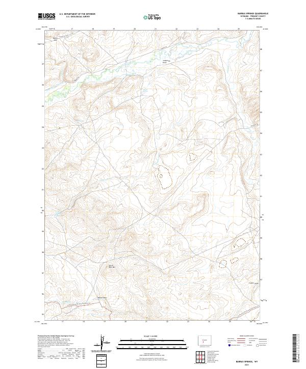
1953 Barras Springs
Fremont County, WY
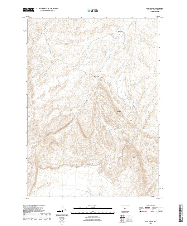
1953 Blue Gulch
Fremont County, WY
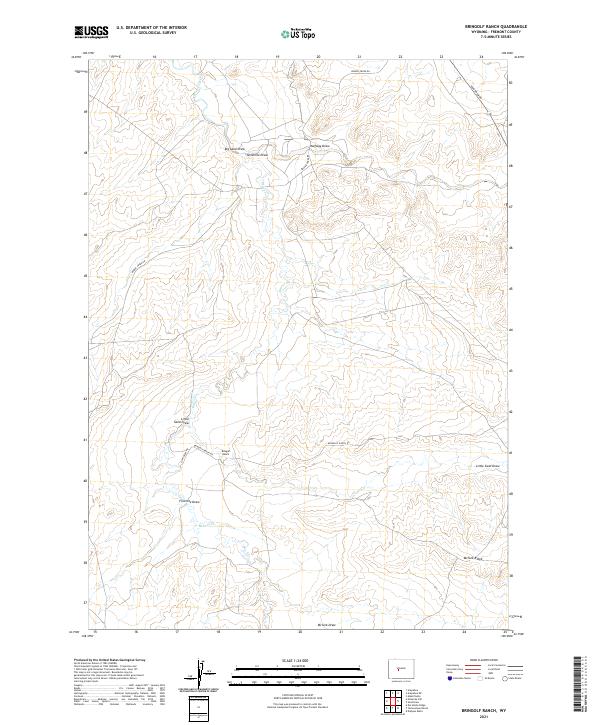
1953 Bringolf Ranch
Fremont County, WY
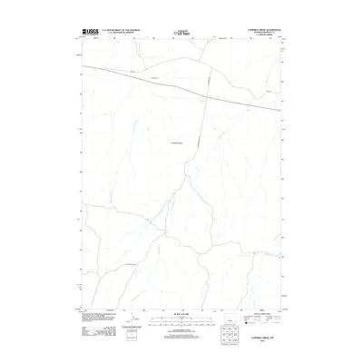
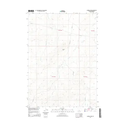
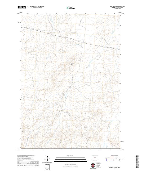
1953 Campbell Ridge
Fremont County, WY
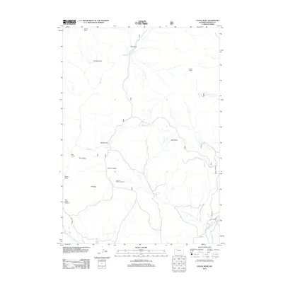
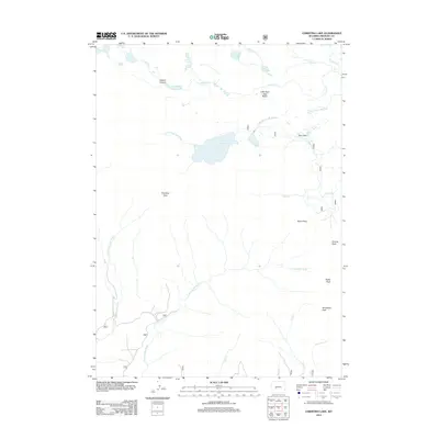
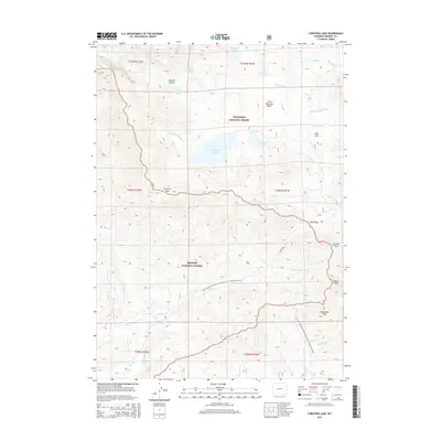
1953 Christina Lake
Fremont County, WY
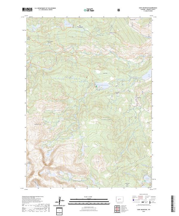
1953 Cony Mountain
Fremont County, WY
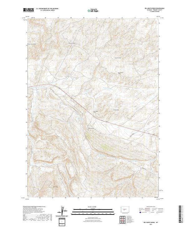
1953 Del Monte Ridge
Fremont County, WY
1953 Dishpan Butte
Fremont County, WY
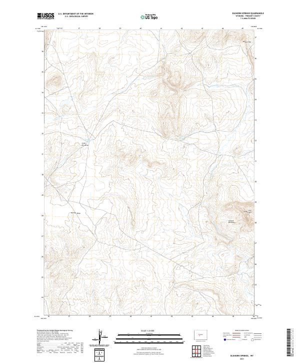
1953 Elkhorn Springs
Fremont County, WY
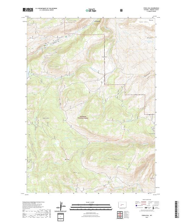
1953 Fossil Hill
Fremont County, WY
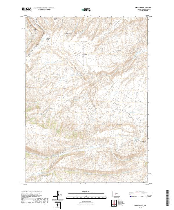
1953 Gravel Spring
Fremont County, WY
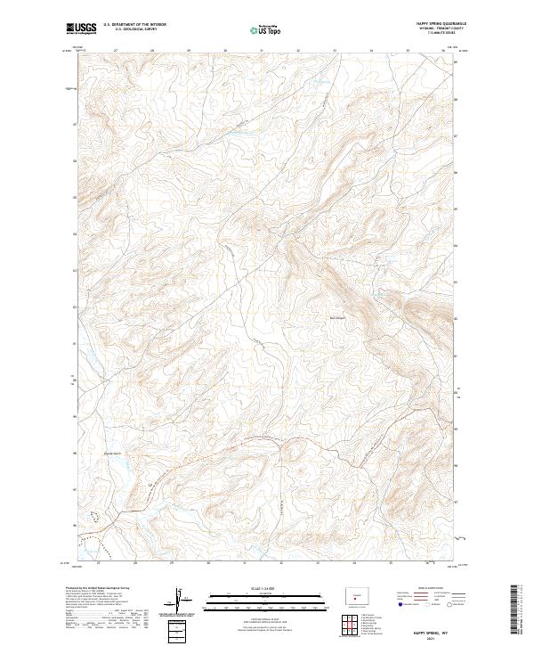
1953 Happy Spring
Fremont County, WY
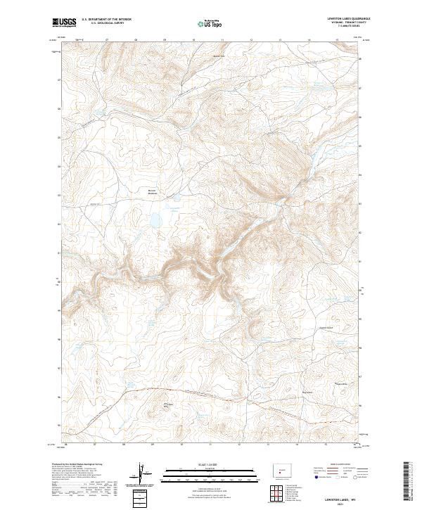
1953 Lewiston Lakes
Fremont County, WY

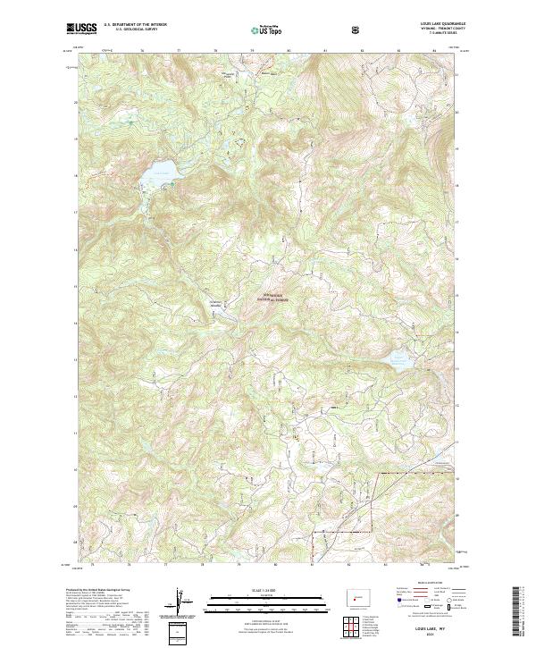
1953 Louis Lake
Fremont County, WY
1953 Mount Arter
Fremont County, WY
1953 Mount Arter SE
Fremont County, WY
1953 Ninemile Hill
Fremont County, WY
1953 Radium Springs
Fremont County, WY
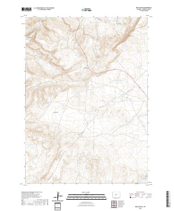
1953 Red Canyon
Fremont County, WY
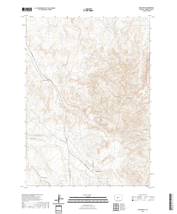
1953 Sand Draw
Fremont County, WY
1953 Schlichting Mountain
Fremont County, WY
1953 South Pass City
Fremont County, WY
1953 Sweetwater Gap
Fremont County, WY
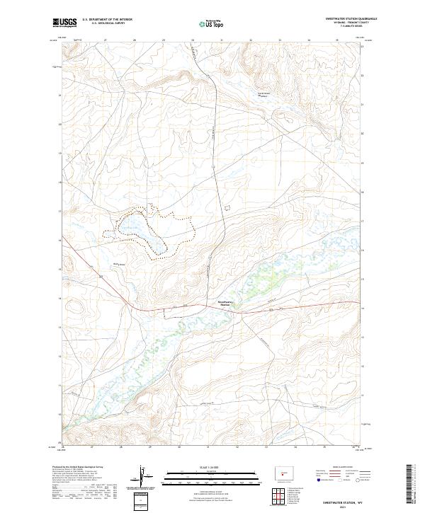
1953 Sweetwater Station
Fremont County, WY
1953 Weiser Pass
Fremont County, WY
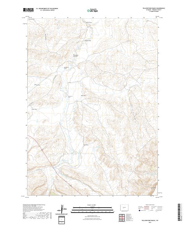
1953 Yellowstone Ranch
Fremont County, WY
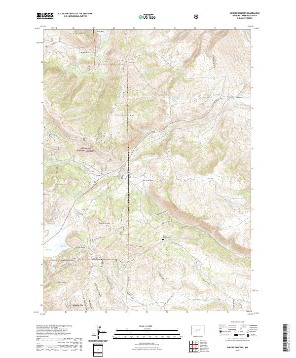
1954 Miners Delight
Fremont County, WY
1954 Wolf Point
Fremont County, WY
1956 Dundee Meadows
Fremont County, WY
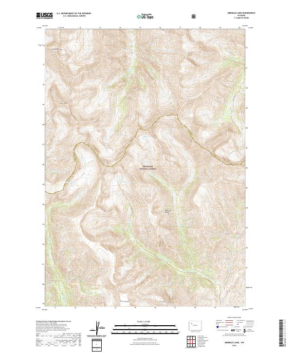
1956 Emerald Lake
Fremont County, WY
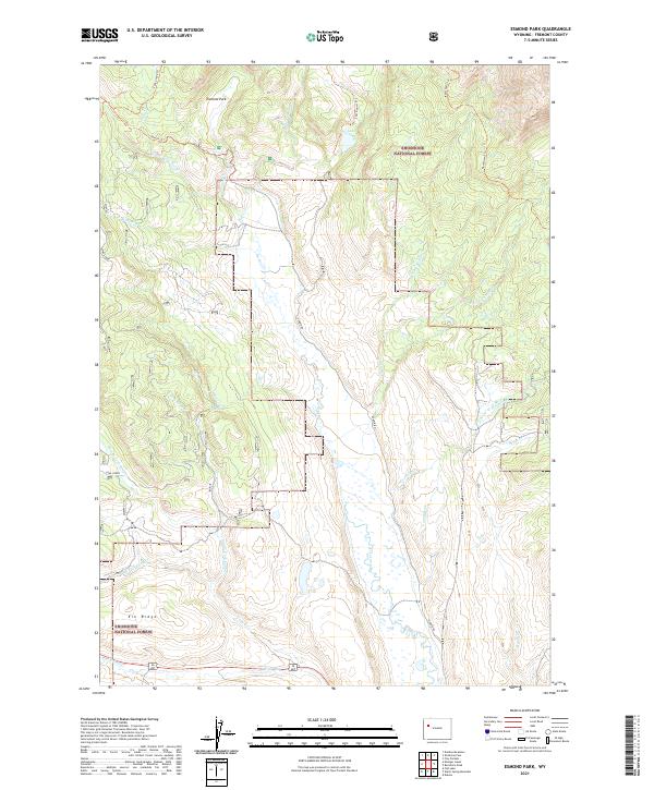
1956 Esmond Park
Fremont County, WY
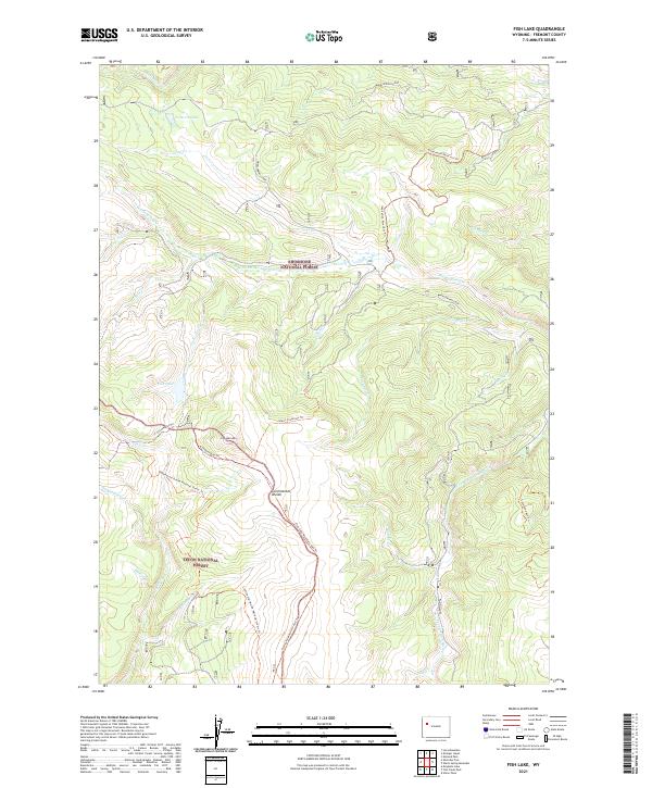
1956 Fish Lake
Fremont County, WY
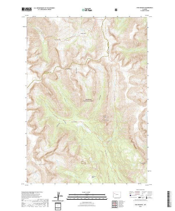
1956 Five Pockets
Fremont County, WY
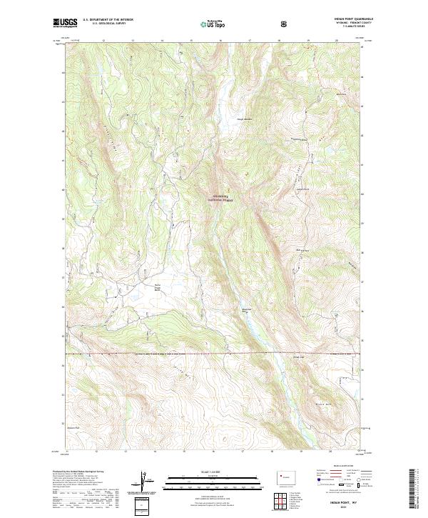
1956 Indian Point
Fremont County, WY
1956 Kisinger Lakes
Fremont County, WY
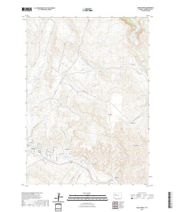
1956 Mason Draw
Fremont County, WY
1956 Ramshorn Peak
Fremont County, WY
1956 Shoshone Pass
Fremont County, WY
1956 Snow Lake
Fremont County, WY
1956 Warm Spring Mountain
Fremont County, WY
1957 Bonneville
Fremont County, WY
1957 Crowheart NE
Fremont County, WY
1957 Double Butte
Fremont County, WY
1957 Hidden Valley
Fremont County, WY

1957 Jenkins Mountain
Fremont County, WY
1957 Miles Ranch
Fremont County, WY
1957 Puddle Springs
Fremont County, WY
1957 Red Canyon
Fremont County, WY
1957 Riverton NE
Fremont County, WY
1958 Alkali Butte
Fremont County, WY
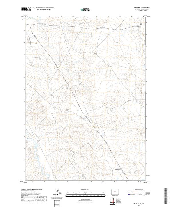
1958 Arapahoe NE
Fremont County, WY
1958 Bonneville SW
Fremont County, WY
1958 Bringolf Ranch
Fremont County, WY
1958 Circle Bar Lake
Fremont County, WY
1958 Continental Peak
Fremont County, WY
1958 Del Monte Ridge
Fremont County, WY
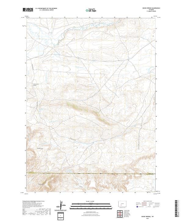
1958 Dickie Springs
Fremont County, WY
1958 Gas Hills
Fremont County, WY
1958 Harris Bridge
Fremont County, WY
1958 Lost Wells Butte
Fremont County, WY
1958 Mexican Pass SE
Fremont County, WY
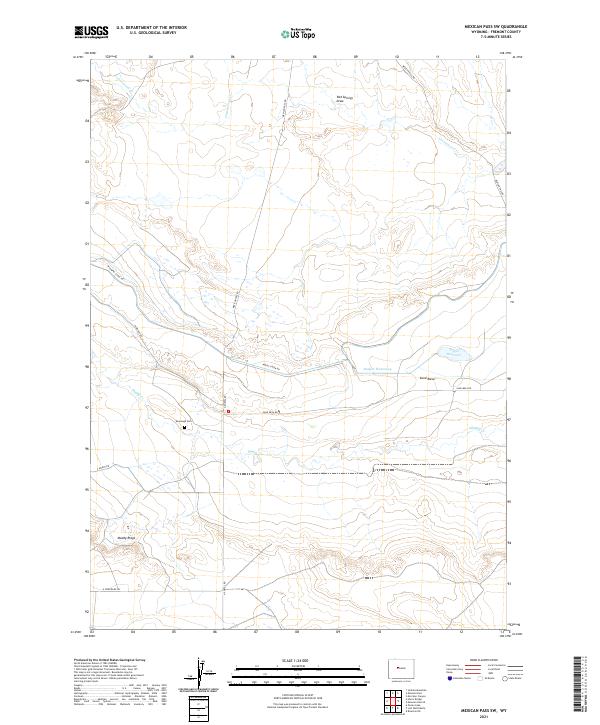
1958 Mexican Pass SW
Fremont County, WY
1958 Ninemile Hill
Fremont County, WY
1958 Ocean Lake
Fremont County, WY
1958 Pacific Springs
Fremont County, WY
1958 Pavillion Butte
Fremont County, WY
1958 Sand Draw
Fremont County, WY
1958 Schoettlin Mountain
Fremont County, WY
1958 Yellowstone Ranch
Fremont County, WY
1959 Morton
Fremont County, WY
1959 Pavillion SE
Fremont County, WY
1959 Riverton West
Fremont County, WY
1960 Fuller Reservoir
Fremont County, WY
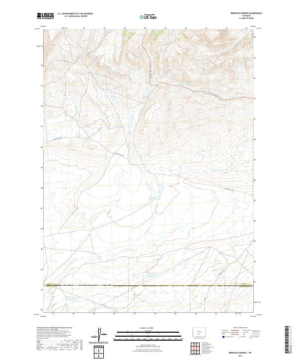
1961 Brenton Springs
Fremont County, WY
1961 Crooks Peak
Fremont County, WY
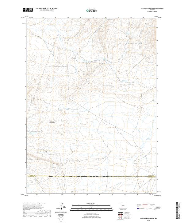
1961 Lost Creek Reservoir
Fremont County, WY
1961 Olson Springs
Fremont County, WY
1961 Picket Lake
Fremont County, WY
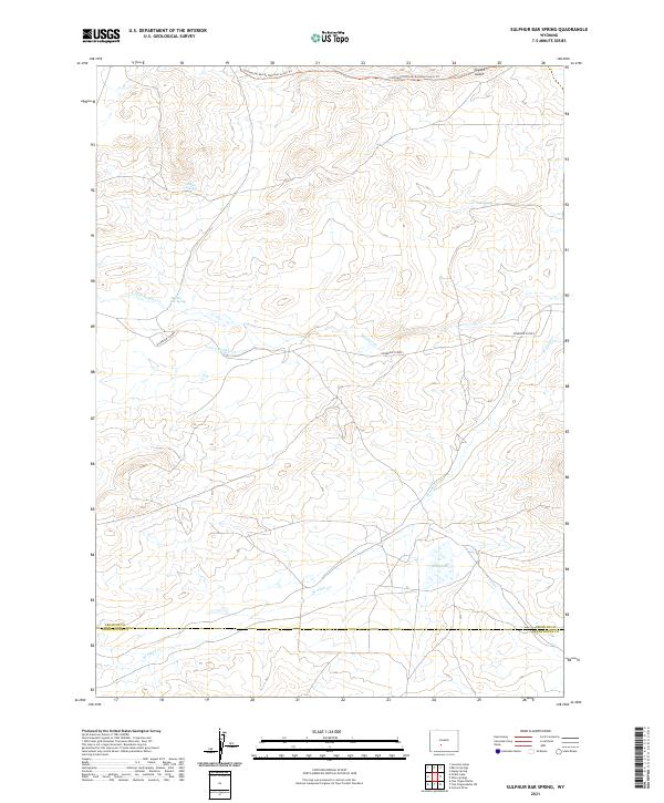
1961 Sulphur Bar Spring
Fremont County, WY
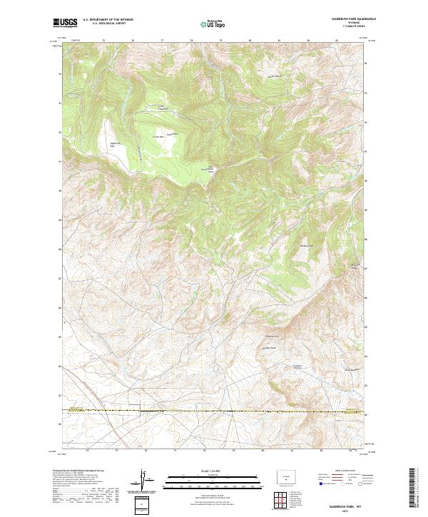
1962 Sagebrush Park
Fremont County, WY
1962 St. Lawrence Basin
Fremont County, WY
1962 Whiskey Peak
Fremont County, WY
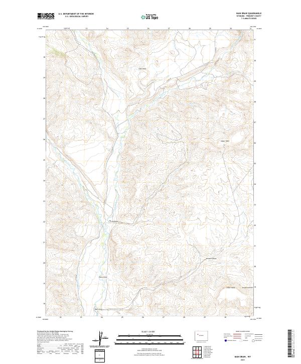
1967 Bain Draw
Fremont County, WY
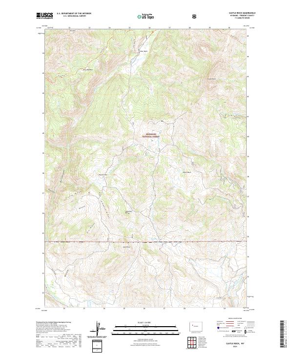
1967 Castle Rock
Fremont County, WY
1967 Circle Ridge
Fremont County, WY
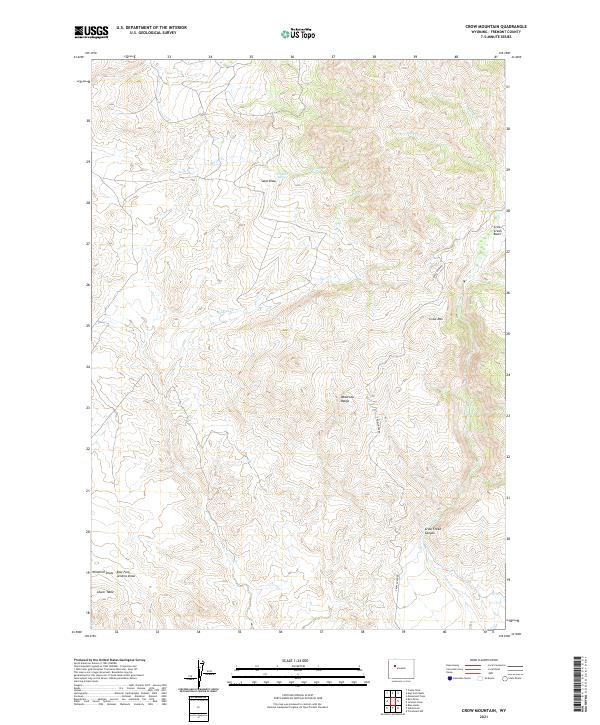
1967 Crow Mountain
Fremont County, WY
1967 East Fork Basin
Fremont County, WY
1967 Johnson Draw
Fremont County, WY
1967 Monument Peak
Fremont County, WY
1968 Downs Mountain
Fremont County, WY
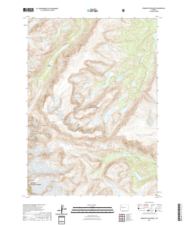
1968 Fremont Peak North
Fremont County, WY
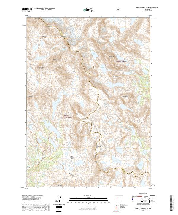
1968 Fremont Peak South
Fremont County, WY
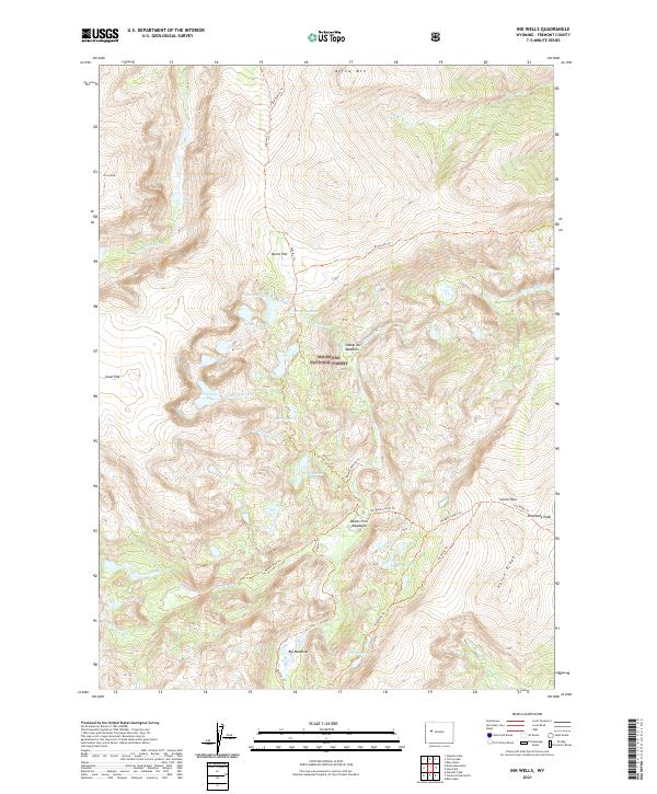
1968 Ink Wells
Fremont County, WY
1968 Simpson Lake
Fremont County, WY
1968 Torrey Lake
Fremont County, WY
1969 Dunrud Peak
Fremont County, WY
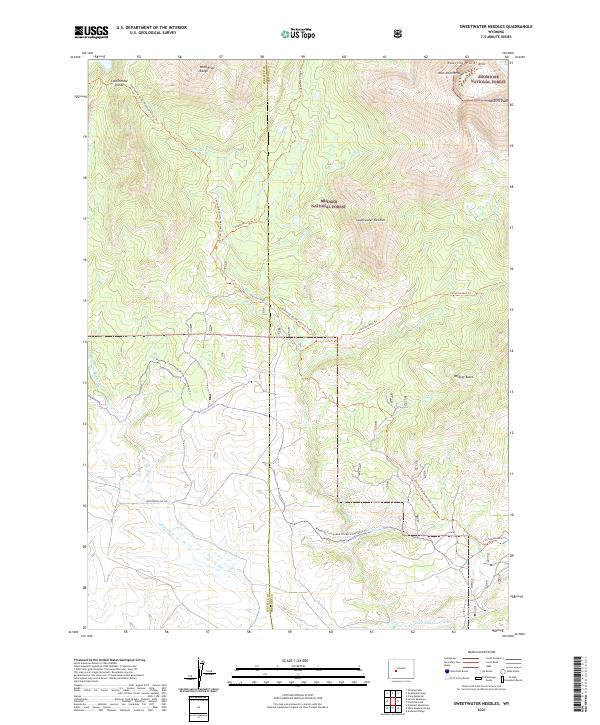
1969 Sweetwater Needles
Fremont County, WY
1969 Wiggins Peak
Fremont County, WY
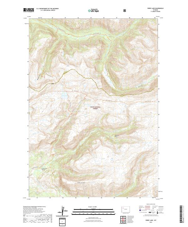
1970 Ferry Lake
Fremont County, WY
1978 Arapahoe NE
Fremont County, WY
1978 Gannett Peak
Fremont County, WY
1978 The Ramshorn
Fremont County, WY
1981 Dickinson Park
Fremont County, WY
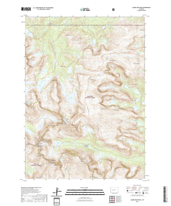
1981 Lizard Head Peak
Fremont County, WY
1981 Moccasin Lake
Fremont County, WY
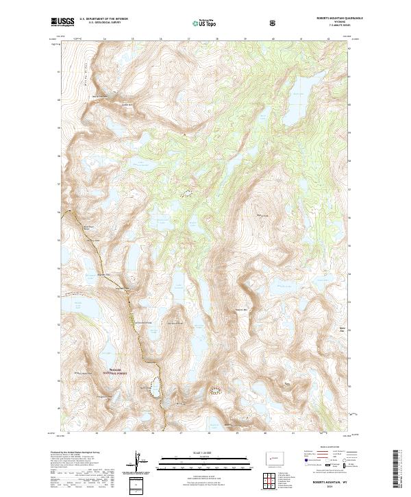
1981 Roberts Mountain
Fremont County, WY
1981 Washakie Park
Fremont County, WY
1991 Alpine Lake
Fremont County, WY
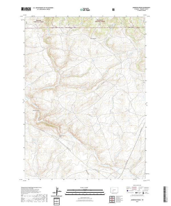
1991 Anderson Ridge
Fremont County, WY
1991 Blue Holes
Fremont County, WY
1991 Bob Lakes
Fremont County, WY
1991 Castle Rock
Fremont County, WY
1991 Christina Lake
Fremont County, WY
1991 Cony Mountain
Fremont County, WY
1991 Dickinson Park
Fremont County, WY
1991 Downs Mountain
Fremont County, WY
1991 Dundee Meadows
Fremont County, WY
1991 Dunrud Peak
Fremont County, WY
1991 East Fork Basin
Fremont County, WY
1991 Emerald Lake
Fremont County, WY
1991 Esmond Park
Fremont County, WY
1991 Fish Lake
Fremont County, WY
1991 Five Pockets
Fremont County, WY
1991 Fossil Hill
Fremont County, WY
1991 Fremont Peak North
Fremont County, WY
1991 Fremont Peak South
Fremont County, WY
1991 Hays Park
Fremont County, WY
1991 Indian Point
Fremont County, WY
1991 Ink Wells
Fremont County, WY
1991 Kisinger Lakes
Fremont County, WY
1991 Lizard Head Peak
Fremont County, WY
1991 Louis Lake
Fremont County, WY
1991 Miners Delight
Fremont County, WY
1991 Monument Peak
Fremont County, WY
1991 Mount Arter
Fremont County, WY
1991 Mount Arter SE
Fremont County, WY
1991 Ramshorn Peak
Fremont County, WY
1991 Shoshone Pass
Fremont County, WY
1991 Simpson Lake
Fremont County, WY
1991 Snow Lake
Fremont County, WY
1991 South Pass City
Fremont County, WY
1991 Sweetwater Gap
Fremont County, WY
1991 Sweetwater Needles
Fremont County, WY
1991 Torrey Lake
Fremont County, WY
1991 Warm Spring Mountain
Fremont County, WY
1991 Wiggins Peak
Fremont County, WY
1991 Wolf Point
Fremont County, WY
1996 Ferry Lake
Fremont County, WY
2012 Alkali Butte
Fremont County, WY
2012 Alpine Lake
Fremont County, WY
2012 Anderson Ridge
Fremont County, WY
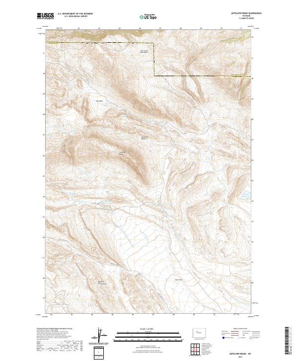
2012 Antelope Ridge
Fremont County, WY
2012 Arapahoe Butte
Fremont County, WY
2012 Arapahoe NE
Fremont County, WY
2012 Argo Butte
Fremont County, WY
2012 Bain Draw
Fremont County, WY
2012 Bargee
Fremont County, WY
2012 Barras Springs
Fremont County, WY
2012 Birdseye Pass
Fremont County, WY
2012 Black Rock Gap
Fremont County, WY
2012 Blue Gulch
Fremont County, WY
2012 Blue Holes
Fremont County, WY
2012 Bob Lakes
Fremont County, WY
2012 Bonneville
Fremont County, WY
2012 Bonneville SW
Fremont County, WY
2012 Boysen
Fremont County, WY
2012 Brenton Springs
Fremont County, WY
2012 Bringolf Ranch
Fremont County, WY
2012 Bull Lake East
Fremont County, WY
2012 Bull Lake West
Fremont County, WY
2012 Burris
Fremont County, WY
2012 Butte Well
Fremont County, WY
2012 Campbell Ridge
Fremont County, WY
2012 Castle Rock
Fremont County, WY
2012 Christina Lake
Fremont County, WY
2012 Circle Bar Lake
Fremont County, WY
2012 Circle Ridge
Fremont County, WY
2012 Continental Peak
Fremont County, WY
2012 Cony Mountain
Fremont County, WY
2012 Cottonwood Pass
Fremont County, WY
2012 Coyote Springs
Fremont County, WY
2012 Crooks Mountain
Fremont County, WY
2012 Crooks Peak
Fremont County, WY
2012 Crowheart Butte
Fremont County, WY
2012 Crowheart NE
Fremont County, WY
2012 Crowheart NW
Fremont County, WY
2012 Crow Mountain
Fremont County, WY
2012 Del Monte Ridge
Fremont County, WY
2012 De Pass
Fremont County, WY
2012 Dickie Springs
Fremont County, WY
2012 Dickinson Park
Fremont County, WY
2012 Dishpan Butte
Fremont County, WY
2012 Double Butte
Fremont County, WY
2012 Downs Mountain
Fremont County, WY
2012 Dundee Meadows
Fremont County, WY
2012 Dunrud Peak
Fremont County, WY

2012 Eagle Point
Fremont County, WY
2012 East Fork Basin
Fremont County, WY
2012 East of Haybarn Hill
Fremont County, WY
2012 Elkhorn Springs
Fremont County, WY
2012 Emerald Lake
Fremont County, WY
2012 Esmond Park
Fremont County, WY
2012 Ferry Lake
Fremont County, WY
2012 Fish Lake
Fremont County, WY
2012 Five Pockets
Fremont County, WY
2012 Fossil Hill
Fremont County, WY
2012 Fremont Peak North
Fremont County, WY
2012 Fremont Peak South
Fremont County, WY
2012 Fuller Reservoir
Fremont County, WY
2012 Gas Hills
Fremont County, WY
2012 Gates Butte
Fremont County, WY
2012 Graham Ranch
Fremont County, WY
2012 Gravel Spring
Fremont County, WY
2012 Guffy Peak
Fremont County, WY
2012 Happy Spring
Fremont County, WY
2012 Harris Bridge
Fremont County, WY
2012 Haybarn Hill
Fremont County, WY
2012 Hays Park
Fremont County, WY
2012 Hidden Valley
Fremont County, WY
2012 Indian Butte
Fremont County, WY
2012 Indian Point
Fremont County, WY
2012 Ink Wells
Fremont County, WY
2012 Jenkins Mountain
Fremont County, WY
2012 Johnson Draw
Fremont County, WY
2012 Kirkland Park
Fremont County, WY
2012 Kisinger Lakes
Fremont County, WY
2012 Lander NW
Fremont County, WY
2012 Lander SE
Fremont County, WY
2012 Lankin Dome
Fremont County, WY
2012 Lewiston Lakes
Fremont County, WY
2012 Lizard Head Peak
Fremont County, WY
2012 Lookout Butte
Fremont County, WY
2012 Lookout Butte SW
Fremont County, WY
2012 Lost Creek Reservoir
Fremont County, WY
2012 Lost Wells Butte
Fremont County, WY
2012 Louis Lake
Fremont County, WY
2012 Love Ranch
Fremont County, WY
2012 Lysite
Fremont County, WY
2012 Lysite SE
Fremont County, WY
2012 Madden
Fremont County, WY
2012 Mason Draw
Fremont County, WY
2012 Maverick Spring
Fremont County, WY
2012 McIntosh Meadows
Fremont County, WY
2012 Mexican Pass
Fremont County, WY
2012 Mexican Pass SE
Fremont County, WY
2012 Mexican Pass SW
Fremont County, WY
2012 Miles Ranch
Fremont County, WY
2012 Miners Delight
Fremont County, WY
2012 Moccasin Lake
Fremont County, WY
2012 Moneta
Fremont County, WY
2012 Moneta SE
Fremont County, WY
2012 Monument Peak
Fremont County, WY
2012 Morrison Canyon
Fremont County, WY
2012 Morton
Fremont County, WY
2012 Mount Arter
Fremont County, WY
2012 Mount Arter SE
Fremont County, WY
2012 Mule Butte
Fremont County, WY
2012 Muskrat Basin
Fremont County, WY
2012 Myers Ranch
Fremont County, WY
2012 Ninemile Hill
Fremont County, WY
2012 Ocean Lake
Fremont County, WY
2012 Ocla Draw
Fremont County, WY
2012 Olson Springs
Fremont County, WY
2012 Pacific Springs
Fremont County, WY
2012 Paradise Basin
Fremont County, WY
2012 Pavillion Butte
Fremont County, WY
2012 Pavillion SE
Fremont County, WY
2012 Picard Ranch
Fremont County, WY
2012 Picket Lake
Fremont County, WY
2012 Puddle Springs
Fremont County, WY
2012 Radium Springs
Fremont County, WY
2012 Ramshorn Peak
Fremont County, WY
2012 Ray Lake
Fremont County, WY
2012 Red Canyon
Fremont County, WY

2012 Riverton East
Fremont County, WY
2012 Riverton NE
Fremont County, WY
2012 Riverton West
Fremont County, WY
2012 Roberts Mountain
Fremont County, WY
2012 Rongis Reservoir
Fremont County, WY
2012 Rongis Reservoir SE
Fremont County, WY
2012 Sagebrush Park
Fremont County, WY
2012 Saint Lawrence Basin
Fremont County, WY
2012 Sand Draw
Fremont County, WY
2012 Schoettlin Mountain
Fremont County, WY
2012 Seventy One Reservoir
Fremont County, WY
2012 Shoshone Pass
Fremont County, WY
2012 Shotgun Butte
Fremont County, WY
2012 Simpson Lake
Fremont County, WY
2012 Snow Lake
Fremont County, WY
2012 Soap Holes
Fremont County, WY
2012 South Pass City
Fremont County, WY

2012 Split Rock
Fremont County, WY
2012 Split Rock NW
Fremont County, WY
2012 Stampede Meadow
Fremont County, WY
2012 Sulphur Bar Spring
Fremont County, WY
2012 Sweetwater Gap
Fremont County, WY
2012 Sweetwater Needles
Fremont County, WY
2012 Sweetwater Station
Fremont County, WY
2012 Tin Cup Mountain
Fremont County, WY
2012 Torrey Lake
Fremont County, WY
2012 Warm Spring Mountain
Fremont County, WY
2012 Washakie Park
Fremont County, WY
2012 Weiser Pass
Fremont County, WY
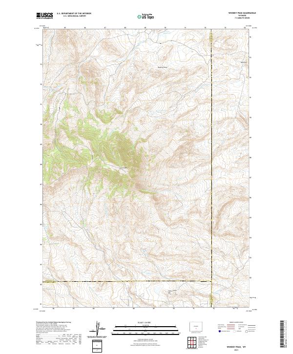
2012 Whiskey Peak
Fremont County, WY
2012 Wickersham Draw
Fremont County, WY
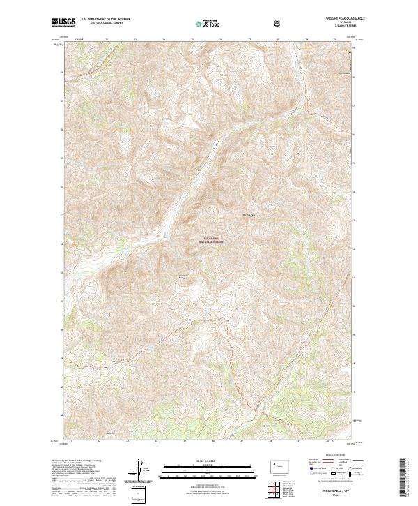
2012 Wiggins Peak
Fremont County, WY
2012 Wilderness
Fremont County, WY
2012 Wind River
Fremont County, WY
2012 Wise Flat
Fremont County, WY
2012 Wolf Point
Fremont County, WY
2012 Yellowstone Ranch
Fremont County, WY
2015 Alkali Butte
Fremont County, WY
2015 Alpine Lake
Fremont County, WY
2015 Anderson Ridge
Fremont County, WY
2015 Antelope Ridge
Fremont County, WY
2015 Arapahoe Butte
Fremont County, WY
2015 Arapahoe NE
Fremont County, WY
2015 Argo Butte
Fremont County, WY
2015 Bain Draw
Fremont County, WY
2015 Bargee
Fremont County, WY
2015 Barras Springs
Fremont County, WY
2015 Birdseye Pass
Fremont County, WY

2015 Black Rock Gap
Fremont County, WY
2015 Blue Gulch
Fremont County, WY
2015 Blue Holes
Fremont County, WY
2015 Bob Lakes
Fremont County, WY
2015 Bonneville
Fremont County, WY
2015 Bonneville SW
Fremont County, WY
2015 Boysen
Fremont County, WY
2015 Brenton Springs
Fremont County, WY
2015 Bringolf Ranch
Fremont County, WY
2015 Bull Lake East
Fremont County, WY
2015 Bull Lake West
Fremont County, WY
2015 Burris
Fremont County, WY
2015 Butte Well
Fremont County, WY
2015 Campbell Ridge
Fremont County, WY
2015 Castle Rock
Fremont County, WY
2015 Christina Lake
Fremont County, WY
2015 Circle Bar Lake
Fremont County, WY
2015 Circle Ridge
Fremont County, WY
2015 Continental Peak
Fremont County, WY
2015 Cony Mountain
Fremont County, WY
2015 Cottonwood Pass
Fremont County, WY
2015 Coyote Springs
Fremont County, WY
2015 Crooks Mountain
Fremont County, WY
2015 Crooks Peak
Fremont County, WY
2015 Crowheart Butte
Fremont County, WY
2015 Crowheart NE
Fremont County, WY
2015 Crowheart NW
Fremont County, WY
2015 Crow Mountain
Fremont County, WY
2015 Del Monte Ridge
Fremont County, WY
2015 De Pass
Fremont County, WY
2015 Dickie Springs
Fremont County, WY
2015 Dickinson Park
Fremont County, WY
2015 Dishpan Butte
Fremont County, WY
2015 Double Butte
Fremont County, WY
2015 Downs Mountain
Fremont County, WY
2015 Dundee Meadows
Fremont County, WY
2015 Dunrud Peak
Fremont County, WY
2015 Eagle Point
Fremont County, WY
2015 East Fork Basin
Fremont County, WY
2015 East of Haybarn Hill
Fremont County, WY
2015 Elkhorn Springs
Fremont County, WY
2015 Emerald Lake
Fremont County, WY
2015 Esmond Park
Fremont County, WY
2015 Ferry Lake
Fremont County, WY
2015 Fish Lake
Fremont County, WY
2015 Five Pockets
Fremont County, WY
2015 Fossil Hill
Fremont County, WY
2015 Fremont Peak North
Fremont County, WY
2015 Fremont Peak South
Fremont County, WY
2015 Fuller Reservoir
Fremont County, WY
2015 Gas Hills
Fremont County, WY
2015 Gates Butte
Fremont County, WY
2015 Graham Ranch
Fremont County, WY
2015 Gravel Spring
Fremont County, WY
2015 Guffy Peak
Fremont County, WY
2015 Happy Spring
Fremont County, WY
2015 Harris Bridge
Fremont County, WY

2015 Haybarn Hill
Fremont County, WY
2015 Hays Park
Fremont County, WY
2015 Hidden Valley
Fremont County, WY
2015 Indian Butte
Fremont County, WY
2015 Indian Point
Fremont County, WY
2015 Ink Wells
Fremont County, WY
2015 Jenkins Mountain
Fremont County, WY
2015 Johnson Draw
Fremont County, WY
2015 Kirkland Park
Fremont County, WY
2015 Kisinger Lakes
Fremont County, WY
2015 Lander NW
Fremont County, WY
2015 Lander SE
Fremont County, WY
2015 Lankin Dome
Fremont County, WY
2015 Lewiston Lakes
Fremont County, WY
2015 Lizard Head Peak
Fremont County, WY
2015 Lookout Butte
Fremont County, WY
2015 Lookout Butte SW
Fremont County, WY
2015 Lost Creek Reservoir
Fremont County, WY
2015 Lost Wells Butte
Fremont County, WY
2015 Louis Lake
Fremont County, WY
2015 Love Ranch
Fremont County, WY
2015 Lysite
Fremont County, WY
2015 Lysite SE
Fremont County, WY
2015 Madden
Fremont County, WY
2015 Mason Draw
Fremont County, WY
2015 Maverick Spring
Fremont County, WY
2015 McIntosh Meadows
Fremont County, WY
2015 Mexican Pass
Fremont County, WY
2015 Mexican Pass SE
Fremont County, WY
2015 Mexican Pass SW
Fremont County, WY
2015 Miles Ranch
Fremont County, WY
2015 Miners Delight
Fremont County, WY
2015 Moccasin Lake
Fremont County, WY
2015 Moneta
Fremont County, WY
2015 Moneta SE
Fremont County, WY
2015 Monument Peak
Fremont County, WY
2015 Morrison Canyon
Fremont County, WY
2015 Morton
Fremont County, WY
2015 Mount Arter
Fremont County, WY
2015 Mount Arter SE
Fremont County, WY
2015 Mule Butte
Fremont County, WY
2015 Muskrat Basin
Fremont County, WY
2015 Myers Ranch
Fremont County, WY
2015 Ninemile Hill
Fremont County, WY
2015 Ocean Lake
Fremont County, WY
2015 Ocla Draw
Fremont County, WY
2015 Olson Springs
Fremont County, WY
2015 Pacific Springs
Fremont County, WY
2015 Paradise Basin
Fremont County, WY
2015 Pavillion Butte
Fremont County, WY
2015 Pavillion SE
Fremont County, WY
2015 Picard Ranch
Fremont County, WY
2015 Picket Lake
Fremont County, WY
2015 Puddle Springs
Fremont County, WY
2015 Radium Springs
Fremont County, WY
2015 Ramshorn Peak
Fremont County, WY
2015 Ray Lake
Fremont County, WY
2015 Red Canyon
Fremont County, WY
2015 Riverton East
Fremont County, WY
2015 Riverton NE
Fremont County, WY
2015 Riverton West
Fremont County, WY
2015 Roberts Mountain
Fremont County, WY
2015 Rongis Reservoir
Fremont County, WY
2015 Rongis Reservoir SE
Fremont County, WY
2015 Sagebrush Park
Fremont County, WY
2015 Saint Lawrence Basin
Fremont County, WY
2015 Sand Draw
Fremont County, WY
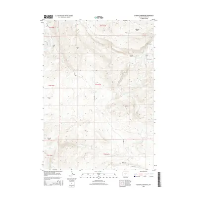
2015 Schoettlin Mountain
Fremont County, WY
2015 Seventy One Reservoir
Fremont County, WY
2015 Shoshone Pass
Fremont County, WY
2015 Shotgun Butte
Fremont County, WY
2015 Simpson Lake
Fremont County, WY
2015 Snow Lake
Fremont County, WY
2015 Soap Holes
Fremont County, WY
2015 South Pass City
Fremont County, WY
2015 Split Rock
Fremont County, WY
2015 Split Rock NW
Fremont County, WY
2015 Stampede Meadow
Fremont County, WY
2015 Sulphur Bar Spring
Fremont County, WY
2015 Sweetwater Gap
Fremont County, WY
2015 Sweetwater Needles
Fremont County, WY
2015 Sweetwater Station
Fremont County, WY
2015 Tin Cup Mountain
Fremont County, WY
2015 Torrey Lake
Fremont County, WY
2015 Warm Spring Mountain
Fremont County, WY
2015 Washakie Park
Fremont County, WY
2015 Weiser Pass
Fremont County, WY
2015 Whiskey Peak
Fremont County, WY
2015 Wickersham Draw
Fremont County, WY
2015 Wiggins Peak
Fremont County, WY
2015 Wilderness
Fremont County, WY
2015 Wind River
Fremont County, WY
2015 Wise Flat
Fremont County, WY
2015 Wolf Point
Fremont County, WY
2015 Yellowstone Ranch
Fremont County, WY
2017 Alkali Butte
Fremont County, WY
2017 Alpine Lake
Fremont County, WY
2017 Anderson Ridge
Fremont County, WY
2017 Antelope Ridge
Fremont County, WY
2017 Arapahoe Butte
Fremont County, WY
2017 Arapahoe NE
Fremont County, WY
2017 Argo Butte
Fremont County, WY
2017 Bain Draw
Fremont County, WY

2017 Bargee
Fremont County, WY
2017 Barras Springs
Fremont County, WY
2017 Birdseye Pass
Fremont County, WY
2017 Black Rock Gap
Fremont County, WY
2017 Blue Gulch
Fremont County, WY
2017 Blue Holes
Fremont County, WY
2017 Bob Lakes
Fremont County, WY
2017 Bonneville
Fremont County, WY
2017 Bonneville SW
Fremont County, WY
2017 Boysen
Fremont County, WY
2017 Brenton Springs
Fremont County, WY
2017 Bringolf Ranch
Fremont County, WY
2017 Bull Lake East
Fremont County, WY
2017 Bull Lake West
Fremont County, WY
2017 Burris
Fremont County, WY
2017 Butte Well
Fremont County, WY
2017 Castle Rock
Fremont County, WY
2017 Circle Bar Lake
Fremont County, WY
2017 Circle Ridge
Fremont County, WY
2017 Continental Peak
Fremont County, WY
2017 Cony Mountain
Fremont County, WY
2017 Cottonwood Pass
Fremont County, WY
2017 Coyote Springs
Fremont County, WY
2017 Crooks Mountain
Fremont County, WY
2017 Crooks Peak
Fremont County, WY
2017 Crowheart Butte
Fremont County, WY
2017 Crowheart NE
Fremont County, WY
2017 Crowheart NW
Fremont County, WY
2017 Crow Mountain
Fremont County, WY
2017 Del Monte Ridge
Fremont County, WY
2017 De Pass
Fremont County, WY
2017 Dickie Springs
Fremont County, WY
2017 Dickinson Park
Fremont County, WY
2017 Dishpan Butte
Fremont County, WY
2017 Downs Mountain
Fremont County, WY
2017 Dundee Meadows
Fremont County, WY
2017 Dunrud Peak
Fremont County, WY
2017 Eagle Point
Fremont County, WY
2017 East Fork Basin
Fremont County, WY
2017 East of Haybarn Hill
Fremont County, WY
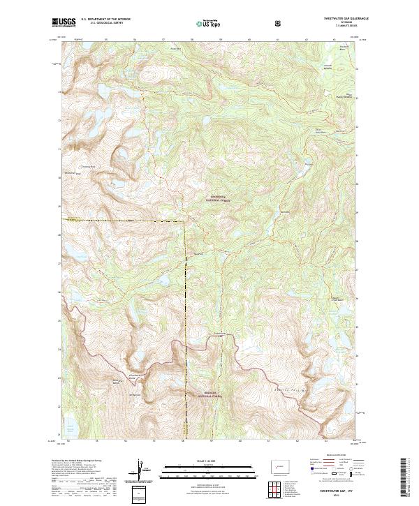
2017 Elkhorn Springs
Fremont County, WY
2017 Emerald Lake
Fremont County, WY
2017 Esmond Park
Fremont County, WY
2017 Ferry Lake
Fremont County, WY
2017 Fish Lake
Fremont County, WY
2017 Five Pockets
Fremont County, WY
2017 Fremont Peak South
Fremont County, WY
2017 Fuller Reservoir
Fremont County, WY
2017 Gas Hills
Fremont County, WY
2017 Gates Butte
Fremont County, WY
2017 Graham Ranch
Fremont County, WY
2017 Gravel Spring
Fremont County, WY
2017 Guffy Peak
Fremont County, WY
2017 Happy Spring
Fremont County, WY
2017 Harris Bridge
Fremont County, WY
2017 Haybarn Hill
Fremont County, WY
2017 Hays Park
Fremont County, WY
2017 Hidden Valley
Fremont County, WY
2017 Indian Butte
Fremont County, WY
2017 Indian Point
Fremont County, WY
2017 Ink Wells
Fremont County, WY
2017 Jenkins Mountain
Fremont County, WY
2017 Johnson Draw
Fremont County, WY
2017 Kirkland Park
Fremont County, WY
2017 Kisinger Lakes
Fremont County, WY
2017 Lander NW
Fremont County, WY
2017 Lander SE
Fremont County, WY
2017 Lankin Dome
Fremont County, WY
2017 Lewiston Lakes
Fremont County, WY
2017 Lizard Head Peak
Fremont County, WY
2017 Lookout Butte
Fremont County, WY
2017 Lookout Butte SW
Fremont County, WY
2017 Lost Creek Reservoir
Fremont County, WY
2017 Lost Wells Butte
Fremont County, WY
2017 Louis Lake
Fremont County, WY
2017 Love Ranch
Fremont County, WY
2017 Lysite
Fremont County, WY
2017 Lysite SE
Fremont County, WY
2017 Madden
Fremont County, WY
2017 Mason Draw
Fremont County, WY
2017 Maverick Spring
Fremont County, WY
2017 Mexican Pass
Fremont County, WY
2017 Mexican Pass SE
Fremont County, WY
2017 Mexican Pass SW
Fremont County, WY
2017 Miles Ranch
Fremont County, WY
2017 Miners Delight
Fremont County, WY
2017 Moccasin Lake
Fremont County, WY
2017 Moneta
Fremont County, WY
2017 Moneta SE
Fremont County, WY
2017 Morrison Canyon
Fremont County, WY
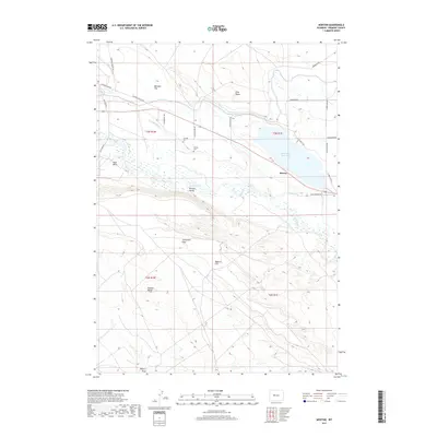
2017 Morton
Fremont County, WY
2017 Mount Arter
Fremont County, WY
2017 Mount Arter SE
Fremont County, WY
2017 Mule Butte
Fremont County, WY
2017 Muskrat Basin
Fremont County, WY
2017 Myers Ranch
Fremont County, WY
2017 Ninemile Hill
Fremont County, WY
2017 Ocean Lake
Fremont County, WY
2017 Ocla Draw
Fremont County, WY
2017 Olson Springs
Fremont County, WY
2017 Pacific Springs
Fremont County, WY
2017 Paradise Basin
Fremont County, WY
2017 Pavillion Butte
Fremont County, WY
2017 Pavillion SE
Fremont County, WY
2017 Picard Ranch
Fremont County, WY
2017 Picket Lake
Fremont County, WY
2017 Puddle Springs
Fremont County, WY
2017 Radium Springs
Fremont County, WY
2017 Ramshorn Peak
Fremont County, WY
2017 Red Canyon
Fremont County, WY
2017 Riverton East
Fremont County, WY
2017 Riverton NE
Fremont County, WY
2017 Riverton West
Fremont County, WY
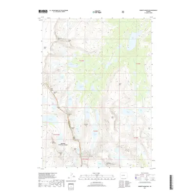
2017 Roberts Mountain
Fremont County, WY
2017 Rongis Reservoir
Fremont County, WY
2017 Rongis Reservoir SE
Fremont County, WY
2017 Sagebrush Park
Fremont County, WY
2017 Saint Lawrence Basin
Fremont County, WY
2017 Schoettlin Mountain
Fremont County, WY
2017 Seventy One Reservoir
Fremont County, WY
2017 Shoshone Pass
Fremont County, WY
2017 Shotgun Butte
Fremont County, WY
2017 Simpson Lake
Fremont County, WY
2017 Snow Lake
Fremont County, WY

2017 South Pass City
Fremont County, WY

2017 Split Rock
Fremont County, WY
2017 Split Rock NW
Fremont County, WY
2017 Stampede Meadow
Fremont County, WY
2017 Sulphur Bar Spring
Fremont County, WY
2017 Sweetwater Gap
Fremont County, WY
2017 Sweetwater Needles
Fremont County, WY
2017 Sweetwater Station
Fremont County, WY
2017 Tin Cup Mountain
Fremont County, WY
2017 Torrey Lake
Fremont County, WY
2017 Warm Spring Mountain
Fremont County, WY
2017 Washakie Park
Fremont County, WY
2017 Weiser Pass
Fremont County, WY
2017 Wickersham Draw
Fremont County, WY
2017 Wiggins Peak
Fremont County, WY
2017 Wilderness
Fremont County, WY
2017 Wind River
Fremont County, WY
2017 Wise Flat
Fremont County, WY
2017 Wolf Point
Fremont County, WY
2017 Yellowstone Ranch
Fremont County, WY
2018 Campbell Ridge
Fremont County, WY
2018 Christina Lake
Fremont County, WY
2018 Double Butte
Fremont County, WY
2018 Fossil Hill
Fremont County, WY
2018 Fremont Peak North
Fremont County, WY
2018 McIntosh Meadows
Fremont County, WY
2018 Monument Peak
Fremont County, WY
2018 Ray Lake
Fremont County, WY
2018 Sand Draw
Fremont County, WY
2018 Soap Holes
Fremont County, WY
2018 Whiskey Peak
Fremont County, WY
2021 Alkali Butte
Fremont County, WY
2021 Alpine Lake
Fremont County, WY
2021 Anderson Ridge
Fremont County, WY
2021 Antelope Ridge
Fremont County, WY
2021 Arapahoe Butte
Fremont County, WY
2021 Arapahoe NE
Fremont County, WY
2021 Argo Butte
Fremont County, WY
2021 Bain Draw
Fremont County, WY
2021 Bargee
Fremont County, WY
2021 Barras Springs
Fremont County, WY
2021 Birdseye Pass
Fremont County, WY
2021 Black Rock Gap
Fremont County, WY
2021 Blue Gulch
Fremont County, WY
2021 Blue Holes
Fremont County, WY
2021 Bob Lakes
Fremont County, WY
2021 Bonneville
Fremont County, WY
2021 Bonneville SW
Fremont County, WY
2021 Boysen
Fremont County, WY
2021 Brenton Springs
Fremont County, WY
2021 Bringolf Ranch
Fremont County, WY
2021 Bull Lake East
Fremont County, WY
2021 Bull Lake West
Fremont County, WY
2021 Burris
Fremont County, WY
2021 Butte Well
Fremont County, WY
2021 Campbell Ridge
Fremont County, WY
2021 Castle Rock
Fremont County, WY
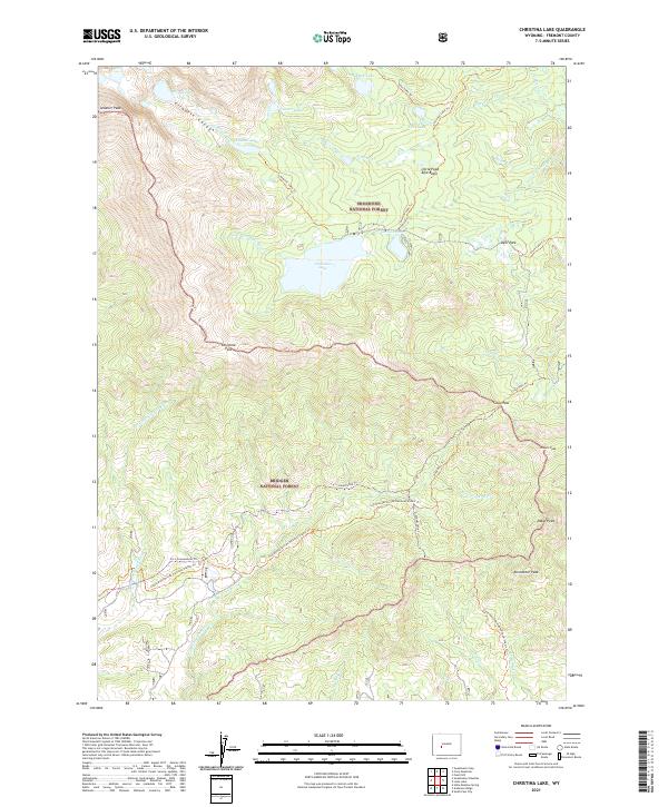
2021 Christina Lake
Fremont County, WY
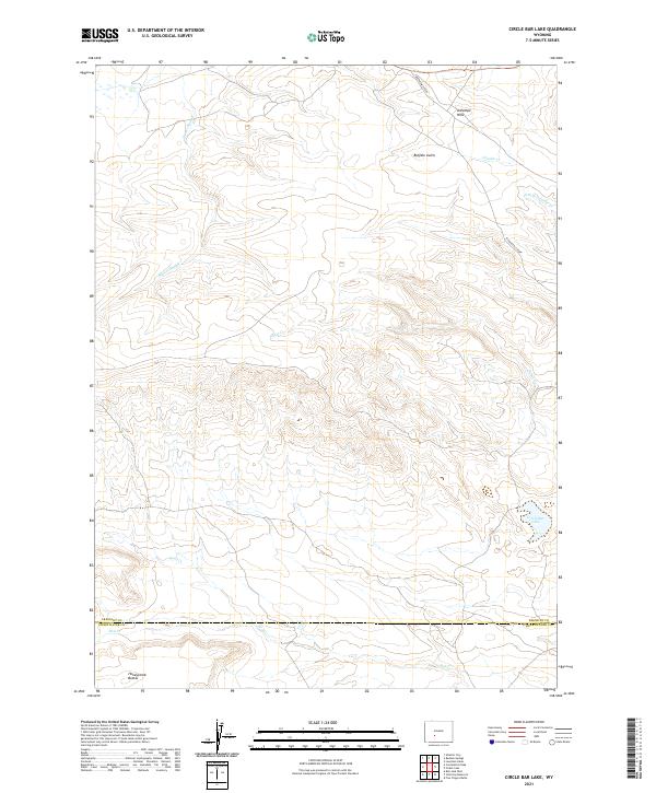
2021 Circle Bar Lake
Fremont County, WY
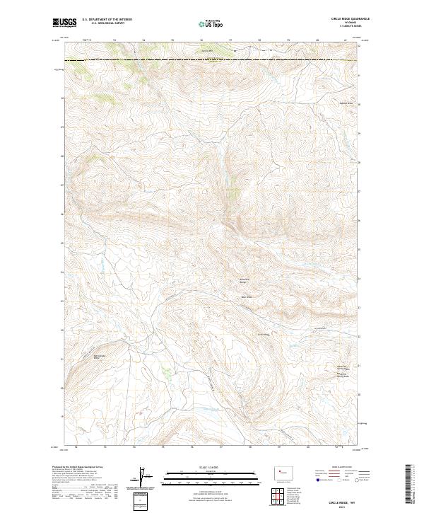
2021 Circle Ridge
Fremont County, WY
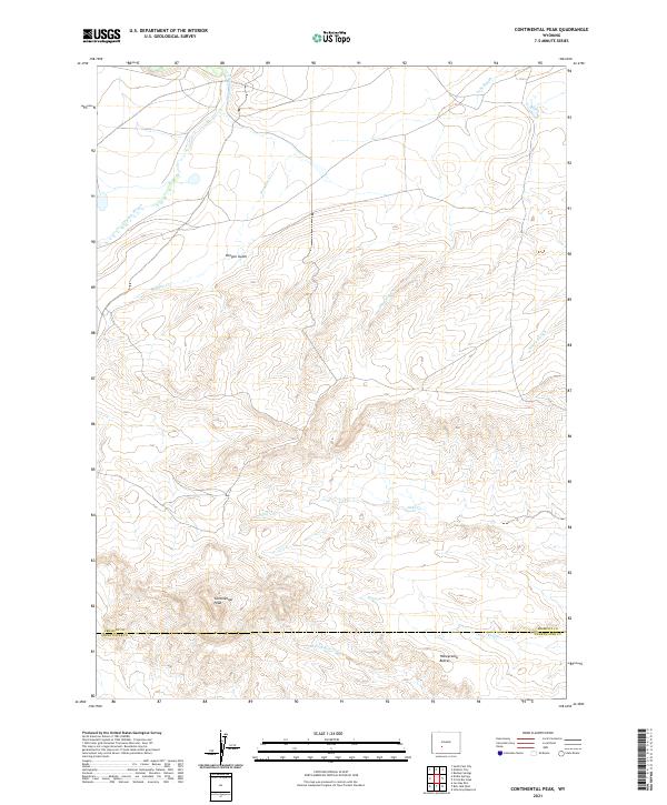
2021 Continental Peak
Fremont County, WY
2021 Cony Mountain
Fremont County, WY
2021 Cottonwood Pass
Fremont County, WY
2021 Coyote Springs
Fremont County, WY
2021 Crooks Mountain
Fremont County, WY
2021 Crooks Peak
Fremont County, WY
2021 Crowheart Butte
Fremont County, WY
2021 Crowheart NE
Fremont County, WY
2021 Crowheart NW
Fremont County, WY
2021 Crow Mountain
Fremont County, WY
2021 Del Monte Ridge
Fremont County, WY
2021 De Pass
Fremont County, WY
2021 Dickie Springs
Fremont County, WY
2021 Dickinson Park
Fremont County, WY
2021 Dishpan Butte
Fremont County, WY
2021 Double Butte
Fremont County, WY

2021 Downs Mountain
Fremont County, WY
2021 Dundee Meadows
Fremont County, WY
2021 Dunrud Peak
Fremont County, WY
2021 Eagle Point
Fremont County, WY
2021 East Fork Basin
Fremont County, WY
2021 East of Haybarn Hill
Fremont County, WY
2021 Elkhorn Springs
Fremont County, WY
2021 Emerald Lake
Fremont County, WY
2021 Esmond Park
Fremont County, WY
2021 Ferry Lake
Fremont County, WY
2021 Fish Lake
Fremont County, WY
2021 Five Pockets
Fremont County, WY
2021 Fossil Hill
Fremont County, WY
2021 Fremont Peak North
Fremont County, WY
2021 Fremont Peak South
Fremont County, WY
2021 Fuller Reservoir
Fremont County, WY
2021 Gas Hills
Fremont County, WY
2021 Gates Butte
Fremont County, WY
2021 Graham Ranch
Fremont County, WY
2021 Gravel Spring
Fremont County, WY
2021 Guffy Peak
Fremont County, WY
2021 Happy Spring
Fremont County, WY
2021 Harris Bridge
Fremont County, WY
2021 Haybarn Hill
Fremont County, WY
2021 Hays Park
Fremont County, WY
2021 Hidden Valley
Fremont County, WY
2021 Indian Butte
Fremont County, WY
2021 Indian Point
Fremont County, WY
2021 Ink Wells
Fremont County, WY
2021 Jenkins Mountain
Fremont County, WY
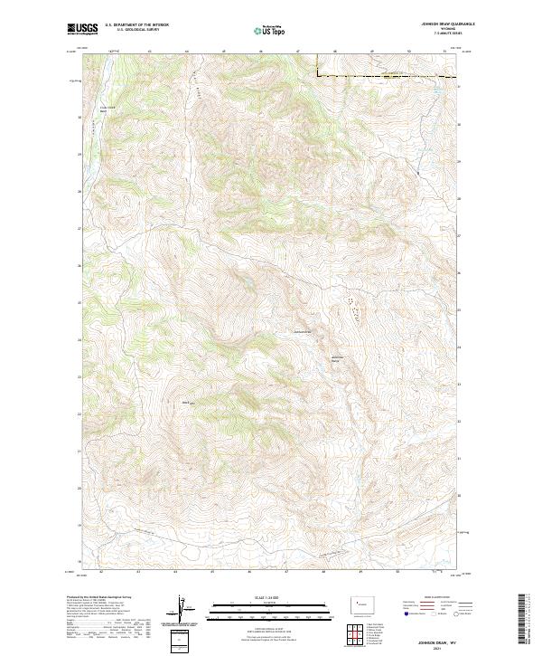
2021 Johnson Draw
Fremont County, WY
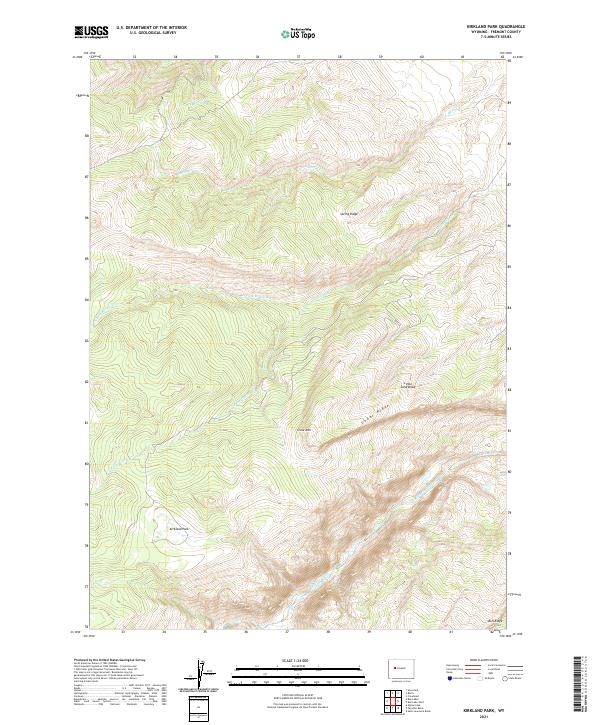
2021 Kirkland Park
Fremont County, WY
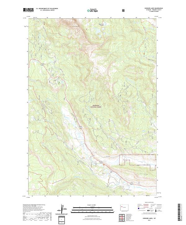
2021 Kisinger Lakes
Fremont County, WY
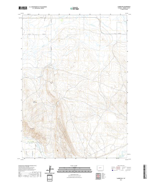
2021 Lander NW
Fremont County, WY
2021 Lander SE
Fremont County, WY
2021 Lankin Dome
Fremont County, WY
2021 Lewiston Lakes
Fremont County, WY
2021 Lizard Head Peak
Fremont County, WY
2021 Lookout Butte
Fremont County, WY
2021 Lookout Butte SW
Fremont County, WY
2021 Lost Creek Reservoir
Fremont County, WY
2021 Lost Wells Butte
Fremont County, WY
2021 Louis Lake
Fremont County, WY
2021 Love Ranch
Fremont County, WY
2021 Lysite
Fremont County, WY
2021 Lysite SE
Fremont County, WY
2021 Madden
Fremont County, WY
2021 Mason Draw
Fremont County, WY
2021 Maverick Spring
Fremont County, WY
2021 McIntosh Meadows
Fremont County, WY
2021 Mexican Pass
Fremont County, WY
2021 Mexican Pass SE
Fremont County, WY
2021 Mexican Pass SW
Fremont County, WY
2021 Miles Ranch
Fremont County, WY
2021 Miners Delight
Fremont County, WY
2021 Moccasin Lake
Fremont County, WY
2021 Moneta
Fremont County, WY
2021 Moneta SE
Fremont County, WY
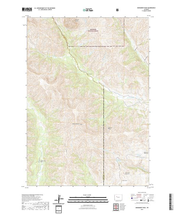
2021 Monument Peak
Fremont County, WY
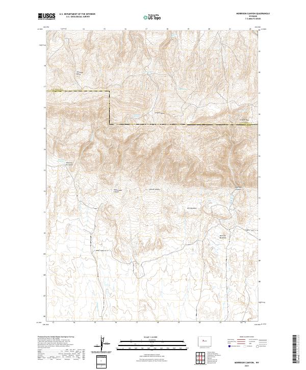
2021 Morrison Canyon
Fremont County, WY
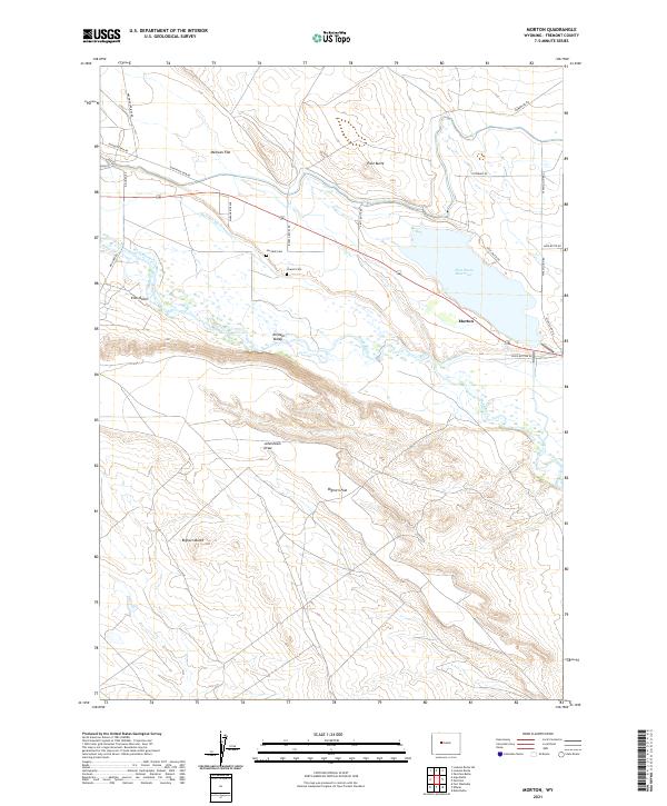
2021 Morton
Fremont County, WY
2021 Mount Arter
Fremont County, WY
2021 Mount Arter SE
Fremont County, WY
2021 Mule Butte
Fremont County, WY
2021 Muskrat Basin
Fremont County, WY
2021 Myers Ranch
Fremont County, WY
2021 Ninemile Hill
Fremont County, WY
2021 Ocean Lake
Fremont County, WY
2021 Ocla Draw
Fremont County, WY
2021 Olson Springs
Fremont County, WY
2021 Pacific Springs
Fremont County, WY
2021 Paradise Basin
Fremont County, WY
2021 Pavillion Butte
Fremont County, WY
2021 Pavillion SE
Fremont County, WY
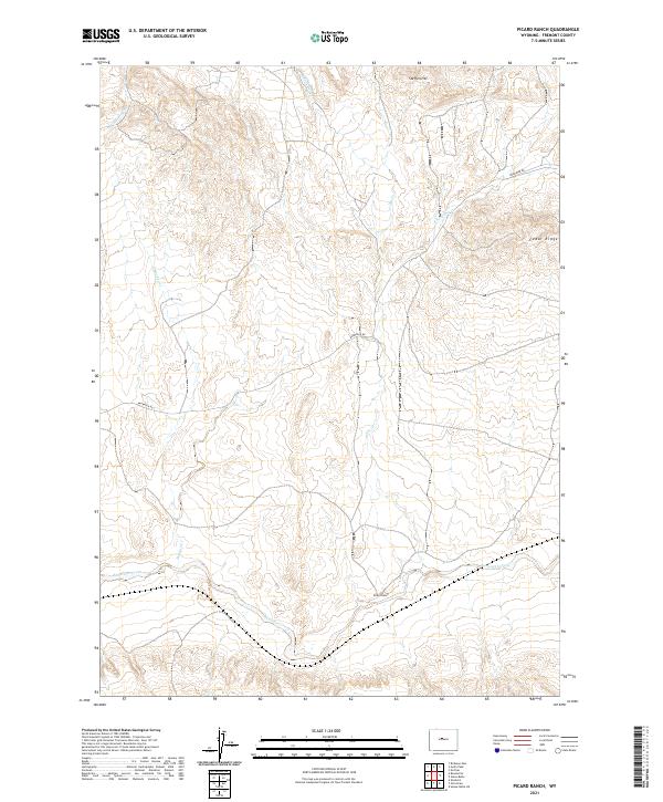
2021 Picard Ranch
Fremont County, WY
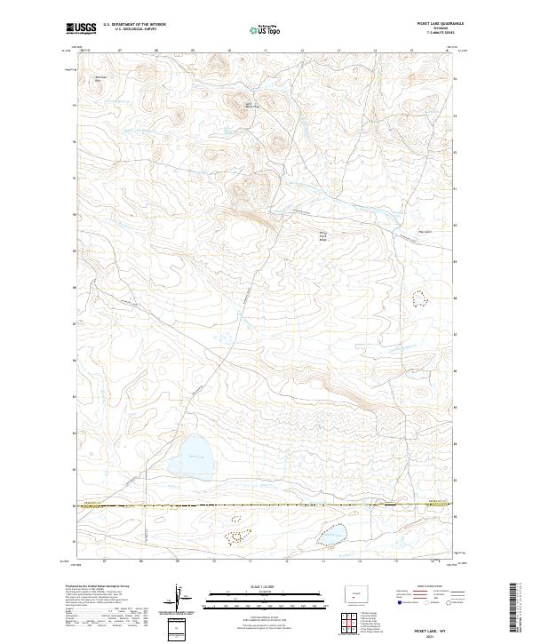
2021 Picket Lake
Fremont County, WY
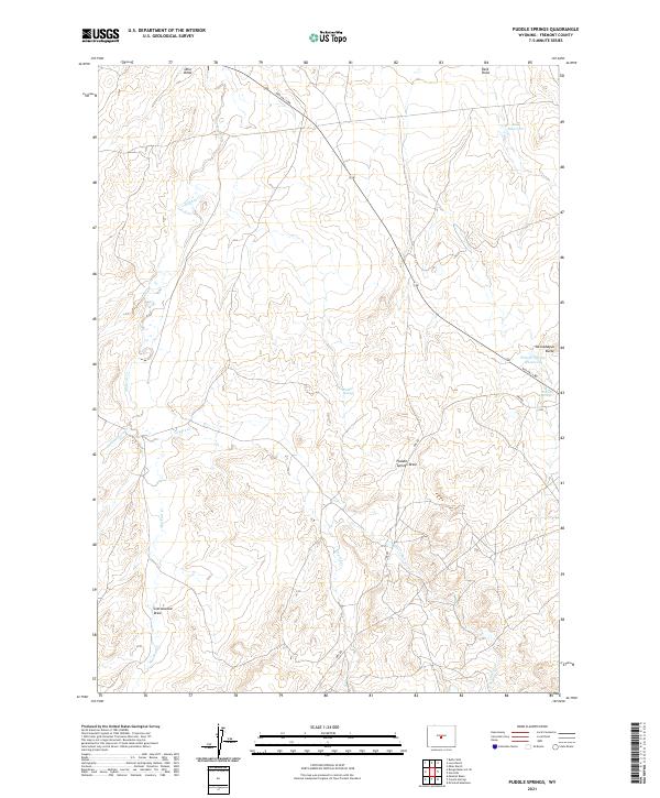
2021 Puddle Springs
Fremont County, WY
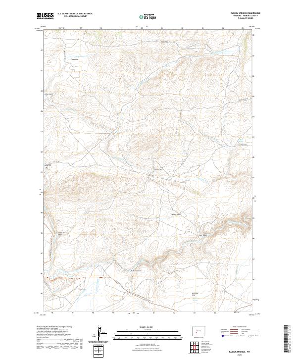
2021 Radium Springs
Fremont County, WY
2021 Ramshorn Peak
Fremont County, WY
2021 Ray Lake
Fremont County, WY
2021 Red Canyon
Fremont County, WY
2021 Riverton East
Fremont County, WY
2021 Riverton NE
Fremont County, WY
2021 Riverton West
Fremont County, WY
2021 Roberts Mountain
Fremont County, WY
2021 Rongis Reservoir
Fremont County, WY
2021 Rongis Reservoir SE
Fremont County, WY
2021 Sagebrush Park
Fremont County, WY
2021 Saint Lawrence Basin
Fremont County, WY
2021 Sand Draw
Fremont County, WY
2021 Schoettlin Mountain
Fremont County, WY
2021 Seventy One Reservoir
Fremont County, WY
2021 Shoshone Pass
Fremont County, WY
2021 Shotgun Butte
Fremont County, WY
2021 Simpson Lake
Fremont County, WY
2021 Snow Lake
Fremont County, WY
2021 Soap Holes
Fremont County, WY
2021 South Pass City
Fremont County, WY
2021 Split Rock
Fremont County, WY
2021 Split Rock NW
Fremont County, WY
2021 Stampede Meadow
Fremont County, WY
2021 Sulphur Bar Spring
Fremont County, WY
2021 Sweetwater Gap
Fremont County, WY
2021 Sweetwater Needles
Fremont County, WY
2021 Sweetwater Station
Fremont County, WY
2021 Tin Cup Mountain
Fremont County, WY
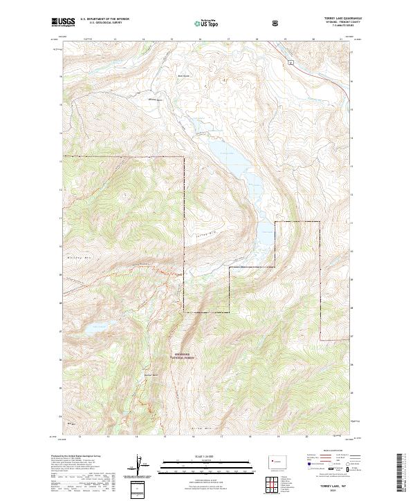
2021 Torrey Lake
Fremont County, WY
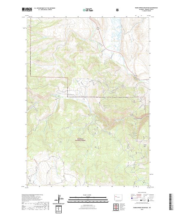
2021 Warm Spring Mountain
Fremont County, WY
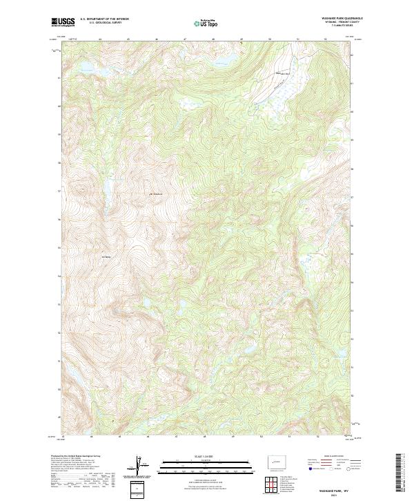
2021 Washakie Park
Fremont County, WY
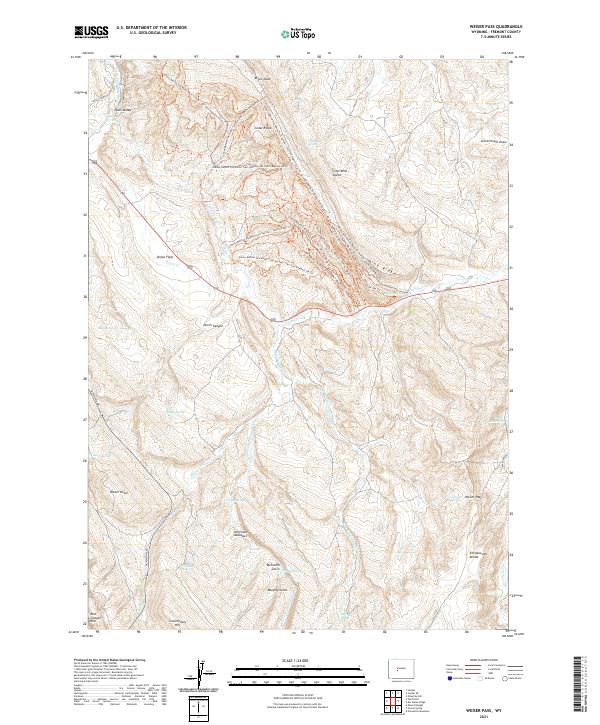
2021 Weiser Pass
Fremont County, WY
2021 Whiskey Peak
Fremont County, WY
2021 Wickersham Draw
Fremont County, WY
2021 Wiggins Peak
Fremont County, WY
2021 Wilderness
Fremont County, WY
2021 Wind River
Fremont County, WY
2021 Wise Flat
Fremont County, WY

2021 Wolf Point
Fremont County, WY
2021 Yellowstone Ranch
Fremont County, WY
2023 Cony Mountain
Fremont County, WY
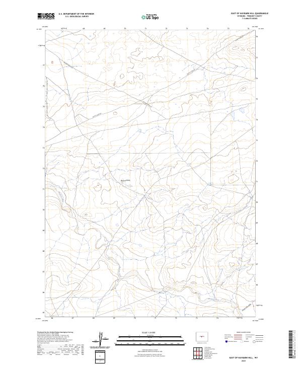
2023 East of Haybarn Hill
Fremont County, WY
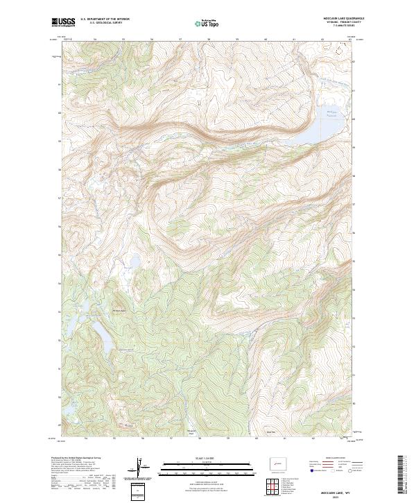
2023 Moccasin Lake
Fremont County, WY
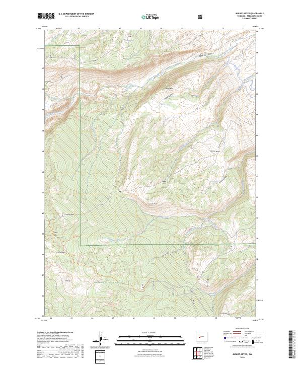
2023 Mount Arter
Fremont County, WY
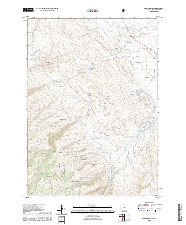
2023 Mount Arter SE
Fremont County, WY
2023 Wickersham Draw
Fremont County, WY