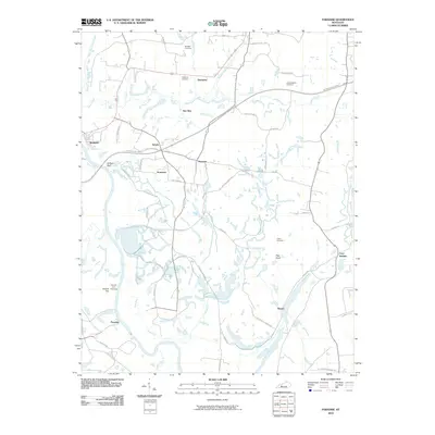
2010 Map of Paradise
USGS Topo · Published 2010About this map
The Green River carves a deep path through this Western Kentucky landscape, framing industrial and agricultural history. Near the riverbanks stands the Airdrie Iron Furnace, a prominent landmark adjacent to Airdrie Hill and the settlement of Paradise. This area, documented in 2010, shows a complex network of transportation and topography, from the high ground at Jackson Bluff to the winding course of Pond Run.
Find a feature on this map
55 named features on this map. Tap any name to fly to it.
Don’t see what you’re looking for? This feature index may not catch every label — zoom into the map to look around manually.
Map Details
Editions of this 2010 Paradise Map
This is the sole edition of this map. No revisions or reprints were ever made.
Other maps of this area

1909 · Hartford
USGS Topo · 1:62,500

1909 · Central City
USGS Topo · 1:62,500

1911 · Drakesboro
USGS Topo · 1:48,000

1911 · Dunmor
USGS Topo · 1:48,000

1913 · Drakesboro
USGS Topo · 1:62,500

1914 · Dunmor
USGS Topo · 1:62,500

1952 · Equality
USGS Topo · 1:24,000

1953 · Drakesboro
USGS Topo · 1:24,000

1953 · Central City East
USGS Topo · 1:24,000

1953 · South Hill
USGS Topo · 1:24,000