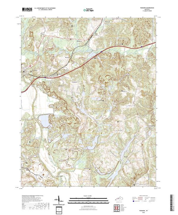
2022 Map of Paradise
USGS Topo · Published 2022About this map
The Green River carves a winding path through the southwestern portion of this landscape, creating dramatic bends like Hollimans Bend near the Muhlenberg and Ohio county line. This riverine environment is defined by steep elevation changes, most notably at Jackson Bluff and Airdrie Hill, which overlook the expansive wetlands along Pond Cr. The distribution of family burial sites, such as the Campfield Family Burying Ground and Chinn Family Cem, suggests a long history of local land ownership and ancestral ties to the ridges between Lewis Creek and Spur Creek.
Find a feature on this map
86 named features on this map. Tap any name to fly to it.
Don’t see what you’re looking for? This feature index may not catch every label — zoom into the map to look around manually.
Map Details
Editions of this 2022 Paradise Map
This is the sole edition of this map. No revisions or reprints were ever made.
Other maps of this area

1909 · Hartford
USGS Topo · 1:62,500

1909 · Central City
USGS Topo · 1:62,500

1911 · Drakesboro
USGS Topo · 1:48,000

1911 · Dunmor
USGS Topo · 1:48,000

1913 · Drakesboro
USGS Topo · 1:62,500

1914 · Dunmor
USGS Topo · 1:62,500

1952 · Equality
USGS Topo · 1:24,000

1953 · Drakesboro
USGS Topo · 1:24,000

1953 · Central City East
USGS Topo · 1:24,000

1953 · South Hill
USGS Topo · 1:24,000