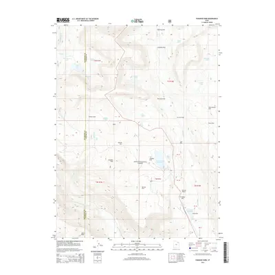
2014 Map of Paradise Park
USGS Topo · Published 2014About this map
Ashley National Forest dominates this high-altitude landscape in northeast Utah, where the headwaters of the Whiterocks River and Paradise Cr flow through deep glacial basins. The region is defined by a sophisticated system of water management dating back to the early 20th century, evidenced by features such as the Mosby Canal and Paradise Park Reservoir. These works were critical for diverting water from the higher elevations of the Uinta Mountains to the agricultural valleys below. High alpine meadows and parks are scattered throughout the terrain, including Lonesome Park, Blanchett Park, and Lost Park, many of which were historically used for seasonal grazing. Landmarks like Mosby Mtn and Paradise Peak serve as prominent markers for the rugged topography, while the Dry Fork Bridge indicates the limited road infrastructure accessing these remote areas. For those researching land use or early irrigation engineering, the map provides a clear look at the relationship between the Mill Pond and larger reservoirs like Julius Park Reservoir.
Find a feature on this map
54 named features on this map. Tap any name to fly to it.
Don’t see what you’re looking for? This feature index may not catch every label — zoom into the map to look around manually.
Map Details
Editions of this 2014 Paradise Park Map
This is the sole edition of this map. No revisions or reprints were ever made.
Other maps of this area

1885 · Ashley
USGS Topo · 1:250,000

1885 · Uinta
USGS Topo · 1:250,000

1905 · Gilbert Peak
USGS Topo · 1:125,000

1906 · Gilbert Peak
USGS Topo · 1:125,000

1906 · Marsh Peak
USGS Topo · 1:125,000

1908 · Marsh Peak
USGS Topo · 1:125,000

1954 · Salt Lake City
USGS Topo · 1:250,000

1954 · Vernal
USGS Topo · 1:250,000

1958 · Vernal
USGS Topo · 1:250,000

1958 · Salt Lake City
USGS Topo · 1:250,000