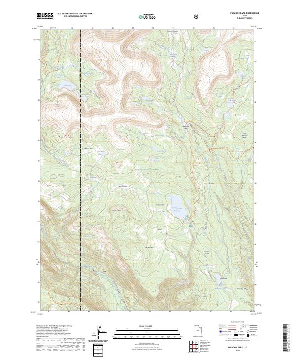
2023 Map of Paradise Park
USGS Topo · Published 2023About this map
Paradise Park Reservoir and the Paradise Park area serve as the focal points of this high-elevation landscape within the Ashley National Forest. The map documents a complex system of water management and natural hydrology, featuring the Mosby Canal and a dense network of mountain lakes such as Cliff Lake, Moap Lake, and the Twin Lakes. The terrain is defined by dramatic elevation changes, ranging from the heights of Paradise Peak and Mosby Mtn down to the drainage of the Whiterocks River. Notable family-named and descriptive landmarks like Hen Lee Bench and Tool Box Park are interspersed with numerous backcountry routes including the Deadman Lake Trl and Red Belly Lake Trl, illustrating the region's history of recreation and resource management.
Find a feature on this map
52 named features on this map. Tap any name to fly to it.
Don’t see what you’re looking for? This feature index may not catch every label — zoom into the map to look around manually.
Map Details
Editions of this 2023 Paradise Park Map
This is the sole edition of this map. No revisions or reprints were ever made.
Other maps of this area

1885 · Ashley
USGS Topo · 1:250,000

1885 · Uinta
USGS Topo · 1:250,000

1905 · Gilbert Peak
USGS Topo · 1:125,000

1906 · Gilbert Peak
USGS Topo · 1:125,000

1906 · Marsh Peak
USGS Topo · 1:125,000

1908 · Marsh Peak
USGS Topo · 1:125,000

1954 · Salt Lake City
USGS Topo · 1:250,000

1954 · Vernal
USGS Topo · 1:250,000

1958 · Vernal
USGS Topo · 1:250,000

1958 · Salt Lake City
USGS Topo · 1:250,000