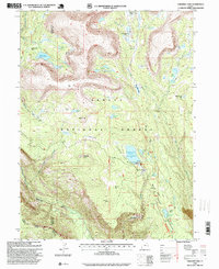
1996 Map of Paradise Park
USGS Topo · Published 1999About this map
High-elevation alpine lakes and managed forest infrastructure define this section of the Ashley National Forest during the mid-1990s. The landscape is dominated by the storage and movement of water, centered on the Paradise Park Reservoir and the Whiterocks River drainage. Federal management of these public lands is evident in the inclusion of the Paradise Guard Station and the Paradise Creek Campground, which served as hubs for both administrative oversight and recreational access.
Find a feature on this map
46 named features on this map. Tap any name to fly to it.
Don’t see what you’re looking for? This feature index may not catch every label — zoom into the map to look around manually.
Map Details
Editions of this 1996 Paradise Park Map
This is the sole edition of this map. No revisions or reprints were ever made.
Other maps of this area

1885 · Ashley
USGS Topo · 1:250,000

1885 · Uinta
USGS Topo · 1:250,000

1905 · Gilbert Peak
USGS Topo · 1:125,000

1906 · Gilbert Peak
USGS Topo · 1:125,000

1906 · Marsh Peak
USGS Topo · 1:125,000

1908 · Marsh Peak
USGS Topo · 1:125,000

1954 · Salt Lake City
USGS Topo · 1:250,000

1954 · Vernal
USGS Topo · 1:250,000

1958 · Vernal
USGS Topo · 1:250,000

1958 · Salt Lake City
USGS Topo · 1:250,000