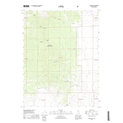
2018 Map of Paradise Peak
USGS Topo · Published 2018About this map
Paradise Mine and Chestnut Mine anchor this high-elevation landscape within the Toiyabe National Forest, where the complex geology of the Paradise Range meets the southern Pactolus Hills. The terrain is defined by a series of steep drainages including Tungsten Canyon, Granite Canyon, and Bell Canyon, which reveal the region's long-standing connection to mineral extraction.
Find a feature on this map
35 named features on this map. Tap any name to fly to it.
Don’t see what you’re looking for? This feature index may not catch every label — zoom into the map to look around manually.
Map Details
Editions of this 2018 Paradise Peak Map
This is the sole edition of this map. No revisions or reprints were ever made.
Other maps of this area

1907 · Tonopah
USGS Topo · 1:250,000

1908 · Tonopah
USGS Topo · 1:250,000

1948 · Paradise Peak
USGS Topo · 1:62,500

1948 · Ione
USGS Topo · 1:62,500

1950 · Paradise Peak
USGS Topo · 1:62,500

1950 · Ione
USGS Topo · 1:62,500

1956 · Tonopah
USGS Topo · 1:250,000

1959 · Tonopah
USGS Topo · 1:250,000

1962 · Tonopah
USGS Topo · 1:250,000
1979 · Goldyke
USGS Topo · 1:24,000