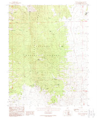
1988 Map of Paradise Peak
USGS Topo · Published 1988About this map
The high-desert terrain of the Paradise Range dominates this late-twentieth-century study, revealing a landscape defined by significant mineral extraction and remote water sources. In the heart of the Toiyabe National Forest, the Paradise Mine and nearby Mildred Mine sit surrounded by numerous adits and prospects, marking a persistent history of mining activity near the prominent Paradise Peak. The eastern edge of the map includes a portion of the Yomba Ind Res, situated along the valley floor. Given the arid environment, the mapping of vital water points such as Baxter Spring, Alum Spring, and Ford Well highlights the essential infrastructure for both wildlife and industry in Nye County. To the south, the Pactolus Hills and Coyote Spring provide further evidence of the region's complex geology and sparse but critical desert hydrology.
Find a feature on this map
32 named features on this map. Tap any name to fly to it.
Don’t see what you’re looking for? This feature index may not catch every label — zoom into the map to look around manually.
Map Details
Editions of this 1988 Paradise Peak Map
This is the sole edition of this map. No revisions or reprints were ever made.
Other maps of this area

1907 · Tonopah
USGS Topo · 1:250,000

1908 · Tonopah
USGS Topo · 1:250,000

1948 · Paradise Peak
USGS Topo · 1:62,500

1948 · Ione
USGS Topo · 1:62,500

1950 · Paradise Peak
USGS Topo · 1:62,500

1950 · Ione
USGS Topo · 1:62,500

1956 · Tonopah
USGS Topo · 1:250,000

1959 · Tonopah
USGS Topo · 1:250,000

1962 · Tonopah
USGS Topo · 1:250,000
1979 · Goldyke
USGS Topo · 1:24,000