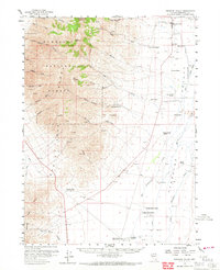
1958 Map of Paradise Valley
USGS Topo · Published 1967About this map
Paradise Valley sits at the intersection of a sprawling high-desert ranching economy and the steep, mineral-rich slopes of the Humboldt National Forest. In the late 1950s, this landscape was defined by its extensive system of family-run operations, including the Marie Miller Ranch, Ferraro Ranch, and Old Colony Ranch, all situated within the broad expanse of Big Valley. The map records the remnants of earlier frontier travel, specifically the Paradise Well (Old Stage Sta) and Willow Point (Old Stage Sta), marking former stops on the stage lines that once traversed this basin.
Find a feature on this map
71 named features on this map. Tap any name to fly to it.
Don’t see what you’re looking for? This feature index may not catch every label — zoom into the map to look around manually.
Map Details
Editions of this 1958 Paradise Valley Map
2 editions found
Other maps of this area

1882 · Paradise
USGS Topo · 1:250,000

1893 · Paradise
USGS Topo · 1:250,000

1945 · Osgood Mountains
USGS Topo · 1:62,500

1945 · Hot Springs
USGS Topo · 1:62,500

1947 · Osgood Mountains
USGS Topo · 1:62,500

1947 · Hot Springs Peak
USGS Topo · 1:62,500

1955 · McDermitt
USGS Topo · 1:250,000

1958 · Paradise Valley
USGS Topo · 1:62,500

1958 · Awakening Peak
USGS Topo · 1:62,500

1959 · McDermitt
USGS Topo · 1:250,000