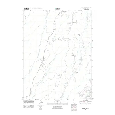
2012 Map of Paradise West
USGS Topo · Published 2012About this map
Forest Ranch and the northern outskirts of Paradise define this portion of the Sierra Nevada foothills, where steep drainages and prominent ridges dictate the pattern of settlement. The landscape is deeply incised by Butte Cr and Little Chico Cr, creating natural corridors for early waypoints such as Fourteenmile House and Tenmile House. These locations reflect the area's historical reliance on established stage or wagon routes through the rugged terrain.
Find a feature on this map
56 named features on this map. Tap any name to fly to it.
Don’t see what you’re looking for? This feature index may not catch every label — zoom into the map to look around manually.
Map Details
Editions of this 2012 Paradise West Map
This is the sole edition of this map. No revisions or reprints were ever made.
Other maps of this area

1891 · Chico
USGS Topo · 1:125,000

1893 · Chico
USGS Topo · 1:125,000

1895 · Chico
USGS Topo · 1:125,000

1912 · Durham
USGS Topo · 1:31,680

1912 · Keefers
USGS Topo · 1:31,680

1912 · Clear Creek
USGS Topo · 1:31,680

1942 · Oroville
USGS Topo · 1:62,500
1944 · Oroville
USGS Topo · 1:62,500

1944 · Richardson Springs
USGS Topo · 1:62,500
1947 · Cherokee
USGS Topo · 1:24,000