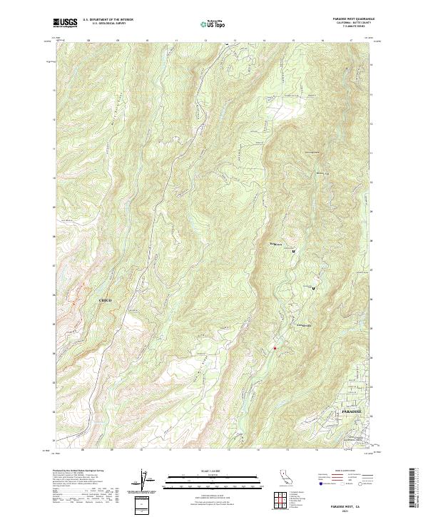
2021 Map of Paradise West
USGS Topo · Published 2021About this map
Butte Creek and Big Chico Cr carve deep canyons through the volcanic ridges of Butte County, defining a landscape of steep divides and isolated flats. This modern survey shows the interface between the growing western edge of Paradise and the historic canyon settlements. Helltown and Centerville remain as small, localized hubs in the rugged geography between Chico and the higher Sierra Nevada foothills. Long-established travel routes such as Harris Wagon Rd and Doe Mill Rd trace the spines of Musty Buck Ridge and Doe Mill Ridge, reflecting a historical transport pattern dictated by the vertical terrain. Genealogical interest is anchored by the Centerville Cem and Nicholl Cem, while landmarks like Whiskey Flat and Chimney Rock highlight the distinctive topographical features that have served as local reference points for generations.
Find a feature on this map
129 named features on this map. Tap any name to fly to it.
Don’t see what you’re looking for? This feature index may not catch every label — zoom into the map to look around manually.
Map Details
Editions of this 2021 Paradise West Map
This is the sole edition of this map. No revisions or reprints were ever made.
Other maps of this area

1891 · Chico
USGS Topo · 1:125,000

1893 · Chico
USGS Topo · 1:125,000

1895 · Chico
USGS Topo · 1:125,000

1912 · Durham
USGS Topo · 1:31,680

1912 · Keefers
USGS Topo · 1:31,680

1912 · Clear Creek
USGS Topo · 1:31,680

1942 · Oroville
USGS Topo · 1:62,500
1944 · Oroville
USGS Topo · 1:62,500

1944 · Richardson Springs
USGS Topo · 1:62,500
1947 · Cherokee
USGS Topo · 1:24,000