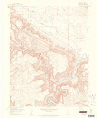
1960 Map of Paradox
USGS Topo · Published 1961About this map
Paradox Valley is the center of this 1960s study, revealing the distinctive topography where the Dolores River cuts across the valley floor. The map highlights the small community of Paradox and the nearby Paradox Cem, alongside the settlement of Bedrock situated at the river's bend. This era represents a period of resource exploration in western Montrose County, evidenced by the Morning Glory Mine, an Oil Well, and a Gravel Pit. The landscape is dominated by the massive plateaus of Wronger Mesa and Skein Mesa, which rise sharply from the valley floor. These geological features are dissected by dramatic drainage systems like Wild Steer Canyon, showing the complex erosion patterns along the Utah State Line.
Find a feature on this map
13 named features on this map. Tap any name to fly to it.
Don’t see what you’re looking for? This feature index may not catch every label — zoom into the map to look around manually.
Map Details
Editions of this 1960 Paradox Map
4 editions found
Other maps of this area

1885 · La Sal
USGS Topo · 1:250,000

1916 · Paradox Valley
USGS Topo · 1:125,000

1922 · Paradox Valley
USGS Topo · 1:125,000

1948 · Roc Creek
USGS Topo · 1:24,000

1948 · Bull Canyon
USGS Topo · 1:24,000

1948 · Paradox
USGS Topo · 1:24,000

1949 · Bull Canyon
USGS Topo · 1:24,000

1949 · Davis Mesa
USGS Topo · 1:24,000

1949 · Paradox
USGS Topo · 1:24,000

1949 · Roc Creek
USGS Topo · 1:24,000