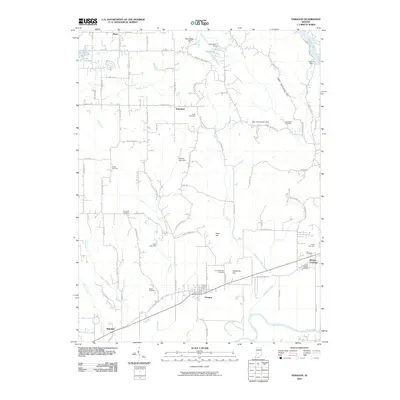
2010 Map of Paragon
USGS Topo · Published 2010About this map
Paragon sits at the heart of this Morgan County landscape, where the flatlands near the White River transition into a series of named elevations such as Goat Hill and Gallimore Hill. This 2010 survey reveals a community deeply rooted in its local history, evidenced by a high density of small family and community burial grounds including Mount Gilead Cemetery, Friendship Park Cemetery, and Ratts Cemetery. The settlement pattern is defined by traditional crossroads like Plano and Wakeland, connected by a grid of rural routes such as S Olive Church Rd and S Graveyard Rd. Water management is a visible priority across the terrain, with infrastructure like the Amy Lake Dam and Hren Lake Dam creating small reservoirs along the tributaries of Fall Creek and Burkhart Creek. In the southeast corner, the small settlement of Browns Crossing sits near the river, marking a point where the local transportation network meets the waterway.
Find a feature on this map
87 named features on this map. Tap any name to fly to it.
Don’t see what you’re looking for? This feature index may not catch every label — zoom into the map to look around manually.
Map Details
Editions of this 2010 Paragon Map
This is the sole edition of this map. No revisions or reprints were ever made.
Other maps of this area

1942 · Franklin
USGS Topo · 1:125,000

1947 · Gosport
USGS Topo · 1:24,000

1948 · Hindustan
USGS Topo · 1:24,000

1949 · Quincy
USGS Topo · 1:24,000

1950 · Gosport
USGS Topo · 1:24,000

1953 · Indianapolis
USGS Topo · 1:250,000

1955 · Hall
USGS Topo · 1:24,000

1955 · Mooresville West
USGS Topo · 1:24,000

1955 · Martinsville
USGS Topo · 1:24,000

1956 · Indianapolis
USGS Topo · 1:250,000