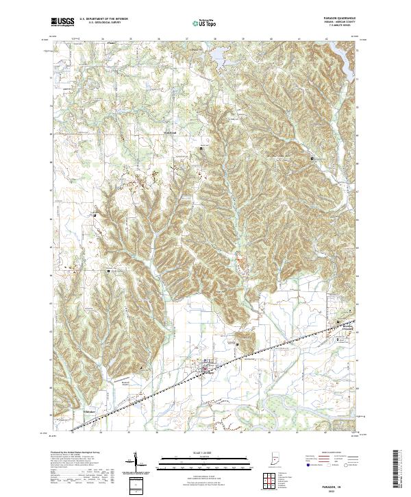
2022 Map of Paragon
USGS Topo · Published 2022About this map
Paragon sits at the heart of this Morgan County landscape, positioned north of the winding White River. The terrain is defined by a series of prominent rises including Big Hurricane Hill and Goat Hill, which dictate the drainage patterns of Fall Cr and Burkhart Creek. Small-scale infrastructure like the Bluebird Airport and the Guthrie Lake Dam are interspersed with older agricultural settlements such as Plano and Wakeland. The area maintains a high density of small family and community burial grounds, from the Stierwalt Cem in the west to the Mount Gilead Cem near Browns Crossing in the east. These landmarks, along with many named hills like Gallimore Hill and Shumaker Hill, provide a detailed view of the rural township structure and traditional land use in central Indiana.
Find a feature on this map
62 named features on this map. Tap any name to fly to it.
Don’t see what you’re looking for? This feature index may not catch every label — zoom into the map to look around manually.
Map Details
Editions of this 2022 Paragon Map
This is the sole edition of this map. No revisions or reprints were ever made.
Other maps of this area

1942 · Franklin
USGS Topo · 1:125,000

1947 · Gosport
USGS Topo · 1:24,000

1948 · Hindustan
USGS Topo · 1:24,000

1949 · Quincy
USGS Topo · 1:24,000

1950 · Gosport
USGS Topo · 1:24,000

1953 · Indianapolis
USGS Topo · 1:250,000

1955 · Hall
USGS Topo · 1:24,000

1955 · Mooresville West
USGS Topo · 1:24,000

1955 · Martinsville
USGS Topo · 1:24,000

1956 · Indianapolis
USGS Topo · 1:250,000