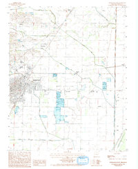
1983 Map of Paragould East
USGS Topo · Published 1993About this map
The eastern edge of Paragould anchors this 1980s landscape, where the urban grid gives way to the drainage systems of the St. Francis River basin. The area is defined by a dense network of watercourses and agricultural infrastructure, including Locust Creek, Johnson Creek, and the extensive channel of Mud Slough near Big Island. Small crossroads and rural communities like Morning Star, Twin Oaks, and Coffman are scattered throughout the low-lying terrain. Evidence of the region's transportation history is visible in the prominent Cotton Belt rail line and an Abandoned R R Rd that once served the local timber or cotton trade. The map illustrates a transitional zone where human engineering, through ditches and levees, manages the natural wetlands to support the small settlements of Noxburn and Halliday.
Find a feature on this map
25 named features on this map. Tap any name to fly to it.
Don’t see what you’re looking for? This feature index may not catch every label — zoom into the map to look around manually.
Map Details
Editions of this 1983 Paragould East Map
2 editions found
Other maps of this area

1939 · Jonesboro
USGS Topo · 1:62,500

1940 · Gainesville
USGS Topo · 1:62,500

1940 · Marmaduke
USGS Topo · 1:62,500

1941 · Leachville
USGS Topo · 1:62,500

1953 · Memphis
USGS Topo · 1:250,000

1956 · Leachville
USGS Topo · 1:62,500

1956 · Memphis
USGS Topo · 1:250,000

1957 · Poplar Bluff
USGS Topo · 1:250,000

1958 · Jonesboro
USGS Topo · 1:62,500

1958 · Marmaduke
USGS Topo · 1:62,500