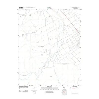
2012 Map of Paraiso Springs
USGS Topo · Published 2012About this map
The Salinas Valley city of Greenfield anchors the eastern edge of this landscape, showing a dense residential grid of avenues named for trees and numbered streets transitioning into the surrounding agricultural fields. West of the Us 101 S corridor, the terrain rises sharply into the foothills of the Santa Lucia Range. This area is defined by complex drainage systems and named canyons, including Reliz Canyon and the winding course of the Arroyo Seco.
Find a feature on this map
46 named features on this map. Tap any name to fly to it.
Don’t see what you’re looking for? This feature index may not catch every label — zoom into the map to look around manually.
Map Details
Editions of this 2012 Paraiso Springs Map
This is the sole edition of this map. No revisions or reprints were ever made.
Other maps of this area

1910 · Soledad
USGS Topo · 1:31,680

1912 · Metz
USGS Topo · 1:31,680

1915 · Soledad
USGS Topo · 1:62,500

1919 · King City
USGS Topo · 1:62,500

1919 · Junipero Serra
USGS Topo · 1:62,500

1921 · Metz
USGS Topo · 1:62,500

1939 · King City
USGS Topo · 1:62,500

1940 · Metz
USGS Topo · 1:62,500

1940 · Soledad
USGS Topo · 1:62,500

1941 · Junipero Serra
USGS Topo · 1:62,500