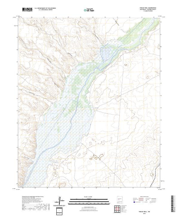
2023 Map of Paraje Well
USGS Topo · Published 2023About this map
Rio Grande wetlands dominate the center of this Socorro County landscape, where the river's broad valley cuts through a series of rugged western drainages. The area is characterized by an intricate network of arroyos and canyons that descend from the high ground of the west toward the river basin, including Quates Canyon and Simon Canyon. The solitary presence of Paraje Well on the eastern terrace above the floodplain suggests the historical importance of localized water sources in this arid environment.
Find a feature on this map
12 named features on this map. Tap any name to fly to it.
Don’t see what you’re looking for? This feature index may not catch every label — zoom into the map to look around manually.
Map Details
Editions of this 2023 Paraje Well Map
This is the sole edition of this map. No revisions or reprints were ever made.
Other maps of this area

1916 · Salinas Peak
USGS Topo · 1:125,000

1948 · Val Verde
USGS Topo · 1:62,500

1948 · Malpais Well
USGS Topo · 1:62,500

1954 · Tularosa
USGS Topo · 1:250,000

1958 · Tularosa
USGS Topo · 1:250,000

1961 · Hickman Ranch
USGS Topo · 1:24,000

1961 · Paraje Well
USGS Topo · 1:24,000

1961 · Black Hill
USGS Topo · 1:24,000

1961 · Fort Craig
USGS Topo · 1:24,000

1961 · Lava
USGS Topo · 1:24,000