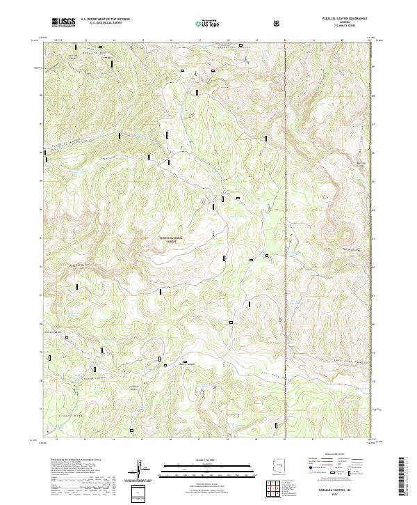
2021 Map of Parallel Canyon
USGS Topo · Published 2021About this map
Tonto National Forest land defines this portion of Gila County, where the dramatic topography of the Mogollon Rim country is etched by numerous drainages and canyons. The landscape is marked by high points like Colcord Mtn and Crouch Mesa, which oversee a network of deep incisions including Parallel Canyon and Hells Canyon. The reliance on seasonal water in this arid environment is evident from the numerous catchment features scattered across the terrain, such as Valentine Tank, Naegelin Rim Tank, and Billy June Tank.
Find a feature on this map
42 named features on this map. Tap any name to fly to it.
Don’t see what you’re looking for? This feature index may not catch every label — zoom into the map to look around manually.
Map Details
Editions of this 2021 Parallel Canyon Map
This is the sole edition of this map. No revisions or reprints were ever made.
Other maps of this area

1886 · Holbrook
USGS Topo · 1:250,000

1893 · Holbrook
USGS Topo · 1:250,000

1954 · Holbrook
USGS Topo · 1:250,000

1957 · Holbrook
USGS Topo · 1:250,000

1958 · Holbrook
USGS Topo · 1:250,000

1960 · Holbrook
USGS Topo · 1:250,000

1961 · Woods Canyon
USGS Topo · 1:62,500

1961 · Heber
USGS Topo · 1:62,500

1961 · Chediski Peak
USGS Topo · 1:62,500
1961 · Young
USGS Topo · 1:62,500