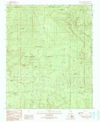
1990 Map of Parallel Canyon
USGS Topo · Published 1991About this map
Colcord Mountain and its lookout tower anchor the northern reaches of this highland landscape, which transitions between the Tonto National Forest and the Fort Apache Indian Reservation. The terrain is defined by its water-management infrastructure and rugged geological features, including the Lost Tank Ridge and Crouch Mesa. A network of 4WD trails connects isolated points like the Red Lake FS Station and Oak Creek Ranch, reflecting the area's history of forest management and ranching.
Find a feature on this map
41 named features on this map. Tap any name to fly to it.
Don’t see what you’re looking for? This feature index may not catch every label — zoom into the map to look around manually.
Map Details
Editions of this 1990 Parallel Canyon Map
This is the sole edition of this map. No revisions or reprints were ever made.
Other maps of this area

1886 · Holbrook
USGS Topo · 1:250,000

1893 · Holbrook
USGS Topo · 1:250,000

1954 · Holbrook
USGS Topo · 1:250,000

1957 · Holbrook
USGS Topo · 1:250,000

1958 · Holbrook
USGS Topo · 1:250,000

1960 · Holbrook
USGS Topo · 1:250,000

1961 · Woods Canyon
USGS Topo · 1:62,500

1961 · Heber
USGS Topo · 1:62,500

1961 · Chediski Peak
USGS Topo · 1:62,500
1961 · Young
USGS Topo · 1:62,500