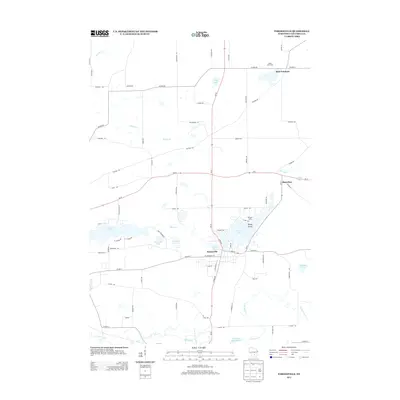
2013 Map of Pardeeville
USGS Topo · Published 2013About this map
Pardeeville sits at the heart of this Columbia County landscape, where the Fox River connects a chain of significant water bodies including Park Lake, Spring Lake, and Swan Lake. The village's street grid is clearly defined, showing the development around W Chestnut St and Lake St during the early 21st century. To the east, the rural character of Marcellon remains distinct, while the northern reaches of the map include the settlement of Belle Fountain. This topography is defined by its glaciated hydrology, featuring numerous named waterways like French Cr, Duck Creek, and Cuff Lake. Small localized landmarks such as Sheep Island and Williams Camp provide specific points of interest for those studying the social and recreational geography of the region. The map also traces the drainage southward toward the Wyocena Millpond and N Br Duck Cr.
Find a feature on this map
73 named features on this map. Tap any name to fly to it.
Don’t see what you’re looking for? This feature index may not catch every label — zoom into the map to look around manually.
Map Details
Editions of this 2013 Pardeeville Map
This is the sole edition of this map. No revisions or reprints were ever made.
Other maps of this area

1901 · Poynette
USGS Topo · 1:62,500

1902 · Portage
USGS Topo · 1:62,500

1955 · Randolph
USGS Topo · 1:62,500

1955 · Columbus
USGS Topo · 1:62,500

1957 · Madison
USGS Topo · 1:250,000

1960 · Madison
USGS Topo · 1:250,000

1962 · Poynette
USGS Topo · 1:62,500

1962 · Portage
USGS Topo · 1:62,500
1980 · Rio
USGS Topo · 1:24,000
1980 · Marquette
USGS Topo · 1:24,000