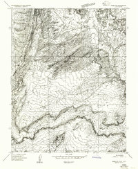
1954 Map of Paria SW
USGS Topo · Published 1956About this map
Adairville (Ruins) and the Johnson Store stand as small human markers in this high-desert landscape along the Paria River. This 1954 survey captures the border region between Utah and Arizona, where the terrain is dominated by deep drainage systems like Buckskin Gulch and Kaibab Gulch. The map reveals a network of primitive infrastructure, including a Pump House (Ruins) and various Jeep Trails that navigate the precarious topography between East Bench and West Bench.
Find a feature on this map
21 named features on this map. Tap any name to fly to it.
Don’t see what you’re looking for? This feature index may not catch every label — zoom into the map to look around manually.
Map Details
Editions of this 1954 Paria SW Map
This is the sole edition of this map. No revisions or reprints were ever made.
Other maps of this area

1886 · Kanab
USGS Topo · 1:250,000

1886 · Escalante
USGS Topo · 1:250,000

1886 · Echo Cliffs
USGS Topo · 1:250,000

1886 · Kaibab
USGS Topo · 1:250,000

1891 · Echo Cliffs
USGS Topo · 1:250,000

1953 · Cedar City
USGS Topo · 1:250,000

1953 · Grand Canyon
USGS Topo · 1:250,000

1954 · Buckskin Gulch NE
USGS Topo · 1:24,000

1954 · Buckskin Gulch SE
USGS Topo · 1:24,000

1954 · Paria Plateau NW
USGS Topo · 1:24,000