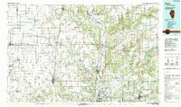
1986 Map of Paris
USGS Topo · Published 1990About this map
Paris serves as the central hub for this expansive mid-1980s look at the Illinois-Indiana borderlands. The landscape transitions from the grid-like prairie farms of Edgar County into the deeply dissected river valleys of the Wabash River and Big Raccoon Creek. This survey captures a significant intersection of heavy industry and conservation, showing the sprawling Newport Army Ammunition Plant alongside established recreational areas like Turkey Run State Park and Shades State Park.
Find a feature on this map
208 named features on this map. Tap any name to fly to it.
Don’t see what you’re looking for? This feature index may not catch every label — zoom into the map to look around manually.
Map Details
Editions of this 1986 Paris Map
2 editions found
Other maps of this area

1899 · Danville
USGS Topo · 1:62,500

1900 · Danville
USGS Topo · 1:62,500

1906 · Urbana
USGS Topo · 1:62,500

1908 · Clay City
USGS Topo · 1:48,000

1910 · Clay City
USGS Topo · 1:62,500

1931 · Fithian
USGS Topo · 1:48,000

1932 · Marshall
USGS Topo · 1:62,500

1933 · Toledo
USGS Topo · 1:62,500

1936 · Oakland
USGS Topo · 1:48,000

1936 · Casey
USGS Topo · 1:48,000