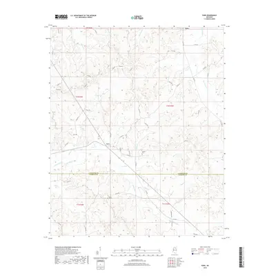
2018 Map of Paris
USGS Topo · Published 2018About this map
Delay marks the northern reaches of this rural landscape where the topography is defined by the winding course of Tarvers Cr. Located along the border of Lafayette and Calhoun counties, the area reflects a deeply rooted Southern agricultural character. The network of county roads shown provides a clear picture of how rural communities are interconnected by simple infrastructure, emphasizing the geographic isolation and quiet pace of this part of Mississippi. The map offers a detailed perspective of the land before further modern developments altered the character of these small, unincorporated settlements.
Find a feature on this map
2 named features on this map. Tap any name to fly to it.
Don’t see what you’re looking for? This feature index may not catch every label — zoom into the map to look around manually.
Map Details
Editions of this 2018 Paris Map
This is the sole edition of this map. No revisions or reprints were ever made.
Other maps of this area

1940 · Oxford
USGS Topo · 1:62,500

1942 · Denmark
USGS Topo · 1:62,500

1943 · Denmark
USGS Topo · 1:62,500

1943 · Oxford
USGS Topo · 1:62,500

1954 · Water Valley
USGS Topo · 1:62,500

1955 · Water Valley
USGS Topo · 1:62,500

1956 · Tupelo
USGS Topo · 1:250,000

1958 · Tupelo
USGS Topo · 1:250,000

1972 · Paris
USGS Topo · 1:24,000
1972 · Banner
USGS Topo · 1:24,000