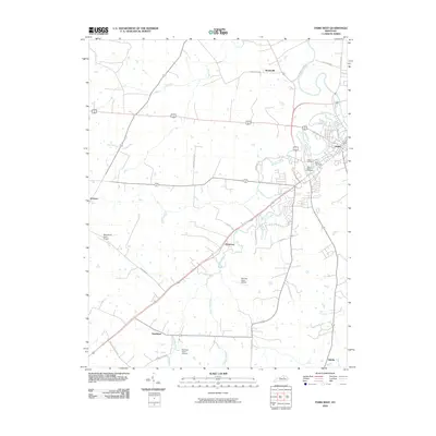
2010 Map of Paris West
USGS Topo · Published 2010About this map
Paris sits at the eastern edge of this Kentucky survey, where the winding waters of Stoner Creek and Houston Creek converge. The landscape is defined by the intersection of numerous rural thoroughfares like Ferguson Rd and Brentsville Rd, connecting several small settlements including Hutchison, Jimtown, and Monterey. This modern topographic study reveals a regional infrastructure heavily influenced by aviation, with private facilities such as Blue Haven Farm Airport, Brennan Farm Airport, and Zanzibar Farm Airport dotting the countryside. Genealogy researchers will find several well-defined burial grounds near the town center, including the sprawling Paris Cemetery, Mount Olive Cemetery, and Fisher Cemetery. The terrain is also crisscrossed by multiple runs and creeks, such as Cooper Run and Hutchison Creek, which have long dictated the placement of farms and homesteads across this part of the Bluegrass region.
Find a feature on this map
29 named features on this map. Tap any name to fly to it.
Don’t see what you’re looking for? This feature index may not catch every label — zoom into the map to look around manually.
Map Details
Editions of this 2010 Paris West Map
This is the sole edition of this map. No revisions or reprints were ever made.
Other maps of this area

1927 · Lexington
USGS Topo · 1:48,000

1929 · Cynthiana
USGS Topo · 1:48,000

1929 · Lexington
USGS Topo · 1:62,500

1934 · Cynthiana
USGS Topo · 1:62,500

1950 · Lexington East
USGS Topo · 1:24,000

1952 · Paris East
USGS Topo · 1:24,000

1952 · Clintonville
USGS Topo · 1:24,000

1952 · Austerlitz
USGS Topo · 1:24,000

1953 · Millersburg
USGS Topo · 1:24,000
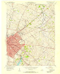
1954 · Lexington East
USGS Topo · 1:24,000