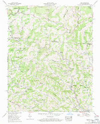
1959 Map of Park
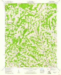
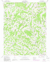
USGS Topo · Published 1971About this map
Big Horse Creek and its many tributaries, including Little Horse Creek and Western Fork, define the settlement patterns of this borderland during the late 1950s. The landscape is characterized by a dense network of family-named cemeteries and rural institutions, such as the Sabbath Home Ch and Mt Rogers Sch, which served isolated mountain communities. The Norfolk and Western railroad tracks follow the winding path of the creek through Lansing and Tuckerdale, illustrating the era's reliance on rail for transporting goods through the Blue Ridge. Small hubs like Apple Grove Post Office and Nella Husk (PO) represent the vital communication points for residents living along the steep ridges of Flat Top Ridge and Hurricane. This Tennessee Valley Authority survey captures a moment of transition where traditional mountain life met modern infrastructure like the Jeb Stuart Highway.
Find a feature on this map
138 named features on this map. Tap any name to fly to it.
Don’t see what you’re looking for? This feature index may not catch every label — zoom into the map to look around manually.
Map Details
Editions of this 1959 Park Map
3 editions found
Other maps of this area

1889 · Wytheville
USGS Topo · 1:125,000

1889 · Wilkesboro
USGS Topo · 1:125,000

1891 · Abingdon
USGS Topo · 1:125,000

1891 · Wilkesboro
USGS Topo · 1:125,000

1892 · Wytheville
USGS Topo · 1:125,000

1893 · Cranberry
USGS Topo · 1:125,000

1894 · Abingdon
USGS Topo · 1:125,000

1895 · Cranberry
USGS Topo · 1:125,000

1899 · Cranberry
USGS Topo · 1:125,000

1902 · Cranberry
USGS Topo · 1:125,000