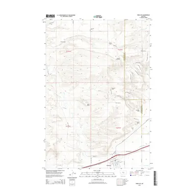
2014 Map of Park City
USGS Topo · Published 2014About this map
Park City sits at the southern edge of this landscape, positioned along the historical corridor of Old US-10 near the boundary between Stillwater and Yellowstone Counties. The area's agricultural reliance is evidenced by an extensive irrigation network, including the Italian Ditch and Old Mill Ditch, which redirect water from the nearby river systems to the flatlands. To the north, the terrain transitions into a rugged series of gulches and plateaus, such as Sawmill Gulch and Coombs Flat, where local roads like Rieland Rd and Clapper Flat Rd provide access to the higher elevations. Genealogy researchers can locate the Pioneer Cem situated just north of the main settlement. The map also documents a series of distinct geological landmarks like Miller Butte and Square Butte, alongside numerous seasonal watercourses including Swamp Cr and Dry Cr that carve through the northern hills.
Find a feature on this map
52 named features on this map. Tap any name to fly to it.
Don’t see what you’re looking for? This feature index may not catch every label — zoom into the map to look around manually.
Map Details
Editions of this 2014 Park City Map
This is the sole edition of this map. No revisions or reprints were ever made.
Other maps of this area

1892 · Stillwater
USGS Topo · 1:125,000

1954 · Billings
USGS Topo · 1:250,000

1956 · Hunter Lake
USGS Topo · 1:24,000

1956 · Horse Butte
USGS Topo · 1:24,000

1956 · Molt
USGS Topo · 1:24,000

1956 · Silesia
USGS Topo · 1:24,000

1956 · Rapids
USGS Topo · 1:24,000

1956 · Two Pine School
USGS Topo · 1:24,000

1956 · Laurel
USGS Topo · 1:24,000

1956 · Park City
USGS Topo · 1:24,000