2024 Map of Park City
USGS Topo · Published 2024About this map
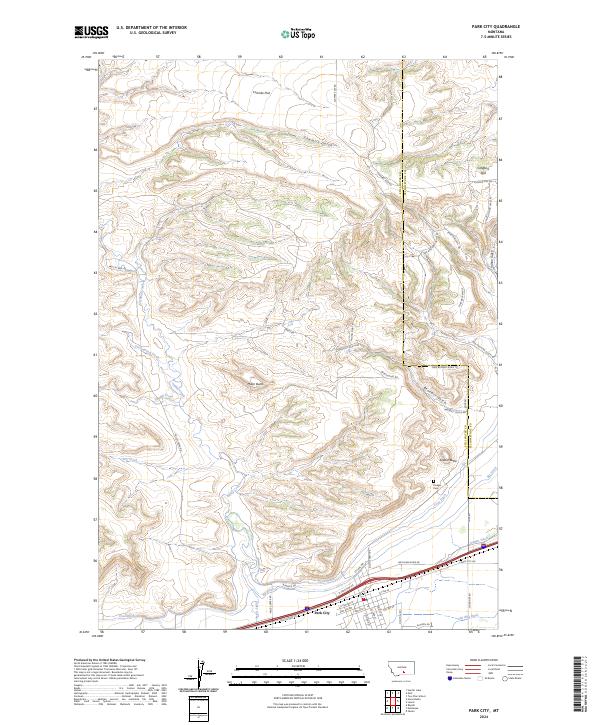
Park City serves as the focal point for this survey, situated where the high plains meet the intricate drainage systems of the Yellowstone River valley. The landscape is defined by an extensive network of irrigation infrastructure, including the Cove Ditch, Big Ditch, Old Mill Ditch, and Italian Ditch, which redirect water across the arid benches. These waterworks are essential to the agricultural character of the region, supporting the settlements below the prominent heights of Miller Butte and Square Butte. North of the town center, the terrain rises into more complex topography characterized by Sawmill Gulch, Coombs Flat, and Clappers Flat. Historical markers like the Pioneer Cem provide genealogical value, while the route of Old US Hwy 10 traces the traditional east-west transit corridor that has shaped the growth of this community for generations.
Find a feature on this map
52 named features on this map. Tap any name to fly to it.
Don’t see what you’re looking for? This feature index may not catch every label — zoom into the map to look around manually.
Map Details
Editions of this 2024 Park City Map
This is the sole edition of this map. No revisions or reprints were ever made.