
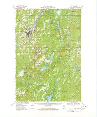
1968 Map of Park Falls
USGS Topo · Published 1971About this map
Park Falls serves as the industrial and transport hub for this region of northern Wisconsin, where the timber and paper economy is evident in the dense rail infrastructure and river management. The town is situated at the junction of the Soo Line and the Chicago and North Western Railroad, with local landmarks like the Powerplant and several Lookout Tower locations underscoring its role in resource management. South of the city, the town of Fifield sits at the confluence of the South Fork Flambeau River and Sailor Creek, marking a transition into the vast Chequamegon National Forest. This 1960s-era landscape is defined by its complex hydrology, featuring numerous flowages and bogs such as the Sailor Creek Flowage and Cranberry Bog. Genealogists and local historians will find value in the detailed plotting of rural landmarks, from the Nola Cem to the Holy Cross King of Martyrs Priory, alongside old logging paths like the Smith Grade.
Find a feature on this map
82 named features on this map. Tap any name to fly to it.
Don’t see what you’re looking for? This feature index may not catch every label — zoom into the map to look around manually.
Map Details
Editions of this 1968 Park Falls Map
2 editions found
Other maps of this area

1940 · Mercer
USGS Topo · 1:48,000

1940 · Butternut
USGS Topo · 1:48,000

1941 · Park Falls
USGS Topo · 1:48,000

1941 · Pike Lake
USGS Topo · 1:48,000

1941 · Kennan
USGS Topo · 1:48,000

1941 · Kennedy
USGS Topo · 1:48,000

1941 · Phillips
USGS Topo · 1:48,000

1941 · Brantwood
USGS Topo · 1:48,000

1942 · Pike Lake
USGS Topo · 1:48,000

1942 · Glidden
USGS Topo · 1:48,000