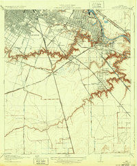
1922 Map of Park Place
USGS Topo · Published 1932About this map
The Turning Basin and Municipal Wharf anchor the industrial expansion of southeast Houston in this early 1920s survey. The landscape is defined by the winding course of Buffalo Bayou, where islands like Marine Park Island and Long Island break the water before it flows toward Port Houston. Along the banks, residential developments like Magnolia Park, Forest Hills, and Brookline show the city's outward growth, while the Houston Country Club and Evergreen Cemetery mark established community spaces.
Find a feature on this map
40 named features on this map. Tap any name to fly to it.
Don’t see what you’re looking for? This feature index may not catch every label — zoom into the map to look around manually.
Map Details
Editions of this 1922 Park Place Map
3 editions found

Other maps of this area

1915 · Bellaire
USGS Topo · 1:24,000

1915 · Park Place
USGS Topo · 1:24,000

1915 · Houston Heights
USGS Topo · 1:24,000

1915 · Deepwater
USGS Topo · 1:24,000

1916 · Genoa
USGS Topo · 1:24,000

1916 · Settegast
USGS Topo · 1:24,000

1916 · Fauna
USGS Topo · 1:24,000

1919 · Deepwater
USGS Topo · 1:31,680

1920 · Genoa
USGS Topo · 1:31,680
1920 · Fauna
USGS Topo · 1:31,680