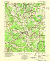
1955 Map of Park Place
USGS Topo · Published 1955About this map
Crowleys Ridge rises above the alluvial bottomlands of the St. Francis River in this mid-century survey of Lee County. The landscape is defined by the shifting course of the river, leaving behind a complex network of oxbows and sloughs such as Big Yancopin Lake and Council Lake. The river's influence on local movement is evident in the numerous named river crossings, including Point Look Around Crossing and Vanness Crossing, which once linked the agricultural communities scattered across the delta.
Find a feature on this map
130 named features on this map. Tap any name to fly to it.
Don’t see what you’re looking for? This feature index may not catch every label — zoom into the map to look around manually.
Map Details
Editions of this 1955 Park Place Map
2 editions found

Other maps of this area

1931 · Horseshoe Lake
USGS Topo · 1:62,500

1939 · Clayton
USGS Topo · 1:62,500

1939 · Horseshoe Lake
USGS Topo · 1:62,500

1939 · Park Place
USGS Topo · 1:62,500

1939 · Wynne
USGS Topo · 1:62,500

1939 · Edmondson
USGS Topo · 1:62,500

1939 · Latour
USGS Topo · 1:62,500

1940 · Marvell
USGS Topo · 1:62,500

1940 · Whitmore
USGS Topo · 1:62,500

1940 · Marianna
USGS Topo · 1:62,500