
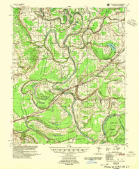
1955 Map of Park Place
USGS Topo · Published 1955About this map
Crowley's Ridge rises above the alluvial landscape of eastern Arkansas, framing the western edge of this mid-century survey. The terrain is defined by a dense network of meandering waterways, including Blackfish Bayou, Frenchman Bayou, and Linder Island. The settlement pattern follows the fertile but flood-prone lands, with river landings like Soudan Ldg and numerous family-named landmarks such as Spencer Place and Greer Place.
Find a feature on this map
153 named features on this map. Tap any name to fly to it.
Don’t see what you’re looking for? This feature index may not catch every label — zoom into the map to look around manually.
Map Details
Editions of this 1955 Park Place Map
2 editions found
Other maps of this area

1931 · Horseshoe Lake
USGS Topo · 1:62,500

1939 · Clayton
USGS Topo · 1:62,500

1939 · Horseshoe Lake
USGS Topo · 1:62,500

1939 · Park Place
USGS Topo · 1:62,500

1939 · Wynne
USGS Topo · 1:62,500

1939 · Edmondson
USGS Topo · 1:62,500

1939 · Latour
USGS Topo · 1:62,500

1940 · Marvell
USGS Topo · 1:62,500

1940 · Whitmore
USGS Topo · 1:62,500

1940 · Marianna
USGS Topo · 1:62,500