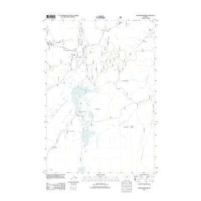
2012 Map of Park Reservoir
USGS Topo · Published 2012About this map
Park Reservoir and a series of high-altitude catchments dominate this 2012 study of Wyoming's Bighorn Mountains. The landscape is defined by managed water and seasonal retreats, including the Spear-O-Wigwam Resort and Saint Louis Cabins. A complex network of irrigation and storage is visible through features like the Peralta Ditch, Bighorn Reservoir, and Last Chance Reservoir, which capture the runoff from the E Fork Big Goose Cr and W Fork Little Goose Cr.
Find a feature on this map
41 named features on this map. Tap any name to fly to it.
Don’t see what you’re looking for? This feature index may not catch every label — zoom into the map to look around manually.
Map Details
Editions of this 2012 Park Reservoir Map
This is the sole edition of this map. No revisions or reprints were ever made.
Other maps of this area

1895 · Dayton
USGS Topo · 1:125,000

1899 · Cloud peak
USGS Topo · 1:125,000

1901 · Cloud Peak
USGS Topo · 1:125,000

1901 · Dayton
USGS Topo · 1:125,000

1955 · Sheridan
USGS Topo · 1:250,000

1958 · Sheridan
USGS Topo · 1:250,000

1960 · Shell Lake
USGS Topo · 1:24,000

1962 · Sheridan
USGS Topo · 1:250,000

1964 · Walker Mountain
USGS Topo · 1:24,000

1964 · Beckton
USGS Topo · 1:24,000