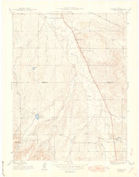
1949 Map of Parker
USGS Topo · Published 1949About this map
Parker serves as the focal point for this late-1940s survey of the high plains south of Denver, capturing a transitional period of agricultural land use and early infrastructure. The landscape is defined by the drainage network of Cherry Creek, where numerous gulches like Baldwin Gulch and Taleman Gulch feed into the primary waterway. Irrigation is a prominent feature of the era, evidenced by the Arapaho Canal, the Lateral Canal, and the two reservoirs, Clark Reservoir No 1 and Clark Reservoir No 2.
Find a feature on this map
31 named features on this map. Tap any name to fly to it.
Don’t see what you’re looking for? This feature index may not catch every label — zoom into the map to look around manually.
Map Details
Editions of this 1949 Parker Map
This is the sole edition of this map. No revisions or reprints were ever made.
Other maps of this area

1890 · East Denver
USGS Topo · 1:125,000

1894 · Castle Rock
USGS Topo · 1:125,000

1913 · Castle Rock
USGS Topo · 1:125,000

1935 · East Denver Nos. 3 and 4
USGS Topo · 1:48,000

1939 · Coal Creek
USGS Topo · 1:24,000

1939 · Elizabeth
USGS Topo · 1:62,500

1940 · Englewood
USGS Topo · 1:31,680

1940 · Piney Creek
USGS Topo · 1:24,000

1940 · Castle Rock
USGS Topo · 1:62,500

1941 · Fitzsimons
USGS Topo · 1:31,680