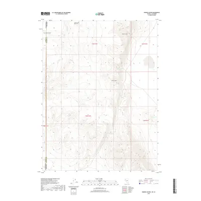
2018 Map of Parker Canyon
USGS Topo · Published 2018About this map
The Smoke Creek Mountains dominate this high-desert landscape on the border of Washoe County, Nevada, and Lassen County, California. This 2018 survey details a drainage network defined by Parker Canyon and Thomas Canyon, which channel seasonal water from the ridgelines toward the valley floor. The presence of water sources such as Telephone Spring and Pipe Spring, along with the Slick Reservoir to the southeast, indicates the vital importance of water management in this arid environment, likely supporting livestock or local wildlife management.
Find a feature on this map
14 named features on this map. Tap any name to fly to it.
Don’t see what you’re looking for? This feature index may not catch every label — zoom into the map to look around manually.
Map Details
Editions of this 2018 Parker Canyon Map
This is the sole edition of this map. No revisions or reprints were ever made.
Other maps of this area

1886 · Honey Lake
USGS Topo · 1:250,000

1886 · Granite Range
USGS Topo · 1:250,000

1891 · Honey Lake
USGS Topo · 1:250,000

1893 · Honey Lake
USGS Topo · 1:250,000

1894 · Granite Range
USGS Topo · 1:250,000

1954 · Wendel
USGS Topo · 1:62,500

1954 · Doyle
USGS Topo · 1:62,500

1955 · Westwood
USGS Topo · 1:250,000

1955 · Lovelock
USGS Topo · 1:250,000

1958 · Westwood
USGS Topo · 1:250,000