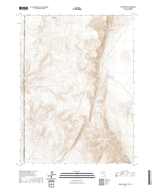
2021 Map of Parker Canyon
USGS Topo · Published 2021About this map
The Smoke Creek Mountains dominate this high-desert landscape along the border of Lassen County and Washoe County. The terrain transitions from the elevations of Thomas Canyon and Parker Canyon in the north down toward the wide expanse of Honey Lake Valley at the southern edge. This 2021 survey documents the sparse but vital water resources of the Great Basin, including Telephone Spring, Pipe Spring, and the Slick Reservoir. The drainage patterns are defined by the seasonal flow of Skedaddle Cr, which carves through the foothills between the California and Nevada state line. This map is particularly useful for understanding the public land survey system divisions, including Township 28 and 29 North, and the geographic relationship between the two states in this remote corridor.
Find a feature on this map
15 named features on this map. Tap any name to fly to it.
Don’t see what you’re looking for? This feature index may not catch every label — zoom into the map to look around manually.
Map Details
Editions of this 2021 Parker Canyon Map
This is the sole edition of this map. No revisions or reprints were ever made.
Other maps of this area

1886 · Honey Lake
USGS Topo · 1:250,000

1886 · Granite Range
USGS Topo · 1:250,000

1891 · Honey Lake
USGS Topo · 1:250,000

1893 · Honey Lake
USGS Topo · 1:250,000

1894 · Granite Range
USGS Topo · 1:250,000

1954 · Wendel
USGS Topo · 1:62,500

1954 · Doyle
USGS Topo · 1:62,500

1955 · Westwood
USGS Topo · 1:250,000

1955 · Lovelock
USGS Topo · 1:250,000

1958 · Westwood
USGS Topo · 1:250,000