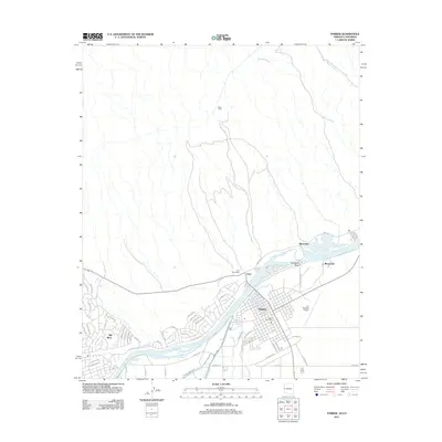
2011 Map of Parker
USGS Topo · Published 2011About this map
The Colorado River defines the rhythm of this desert landscape, serving as the border between Arizona and California. The town of Parker sits on the eastern bank, its grid extending toward the Avi Suquilla Airport, while the smaller settlement of Earp lies directly across the water in California. The engineering of the river is evident at Headgate Rock, which facilitates the diversion of water into the Main Canal, a critical piece of local infrastructure.
Find a feature on this map
54 named features on this map. Tap any name to fly to it.
Don’t see what you’re looking for? This feature index may not catch every label — zoom into the map to look around manually.
Map Details
Editions of this 2011 Parker Map
This is the sole edition of this map. No revisions or reprints were ever made.
Other maps of this area

1911 · Parker
USGS Topo · 1:125,000

1943 · Giers Basin
USGS Topo · 1:62,500

1943 · Whipple Mts.
USGS Topo · 1:62,500

1943 · Parker
USGS Topo · 1:62,500

1949 · Parker
USGS Topo · 1:62,500

1950 · Parker Dam Area
USGS Topo · 1:62,500

1950 · Parker
USGS Topo · 1:62,500

1950 · Whipple Mts
USGS Topo · 1:62,500

1952 · Whipple Mts
USGS Topo · 1:62,500

1954 · Needles
USGS Topo · 1:250,000