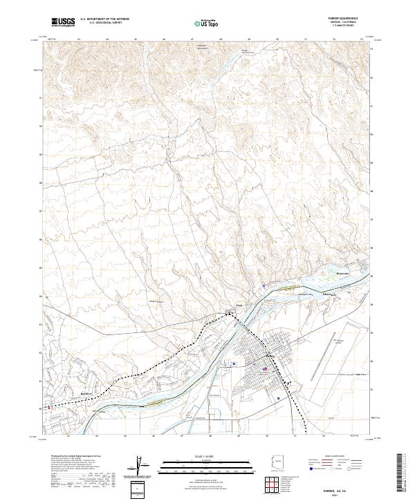
2021 Map of Parker
USGS Topo · Published 2021About this map
The Colorado River serves as the central artery for this borderland, separating the California and Arizona state lines. On the Arizona side, the town of Parker is organized around a dense grid of streets like W Arizona Ave and S Navajo Ave, anchored by the La Paz County Courthouse. The local economy and infrastructure are clearly defined by the river’s water management systems, including the Main Canal, Lateral Nineteen R, and the massive Colorado River Aqueduct which draws from the river to the north. Across the water in California, the settlements of Earp and Big River sit at the edge of the Mojave Desert. To the north, the terrain shifts abruptly into the Whipple Mountains, where the Whipple Mountain Tunnel facilitates the transport of water through the high desert peaks.
Find a feature on this map
98 named features on this map. Tap any name to fly to it.
Don’t see what you’re looking for? This feature index may not catch every label — zoom into the map to look around manually.
Map Details
Editions of this 2021 Parker Map
This is the sole edition of this map. No revisions or reprints were ever made.
Other maps of this area

1911 · Parker
USGS Topo · 1:125,000

1943 · Giers Basin
USGS Topo · 1:62,500

1943 · Whipple Mts.
USGS Topo · 1:62,500

1943 · Parker
USGS Topo · 1:62,500

1949 · Parker
USGS Topo · 1:62,500

1950 · Parker Dam Area
USGS Topo · 1:62,500

1950 · Parker
USGS Topo · 1:62,500

1950 · Whipple Mts
USGS Topo · 1:62,500

1952 · Whipple Mts
USGS Topo · 1:62,500

1954 · Needles
USGS Topo · 1:250,000