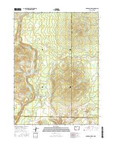
2017 Map of Parker Mountain
USGS Topo · Published 2017About this map
Pinehurst sits at the northern edge of this terrain, where Beaver Cr and Keene Cr descend toward the higher elevations of the Rogue River National Forest. The landscape is defined by a series of prominent peaks and ridges, including Parker Mountain, Rosebud Mtn, and the high ground of Keene Creek Ridge. A network of water management features and springs is evident throughout the region, with the Rim Reservoir, Fall Cr Reservoir, and Ling Reservoir providing water storage amidst the mountain draws.
Find a feature on this map
60 named features on this map. Tap any name to fly to it.
Don’t see what you’re looking for? This feature index may not catch every label — zoom into the map to look around manually.
Map Details
Editions of this 2017 Parker Mountain Map
This is the sole edition of this map. No revisions or reprints were ever made.
Other maps of this area

1886 · Shasta
USGS Topo · 1:250,000

1891 · Ashland
USGS Topo · 1:250,000

1893 · Ashland
USGS Topo · 1:250,000

1894 · Shasta
USGS Topo · 1:250,000

1897 · Ashland
USGS Topo · 1:250,000

1922 · Shasta Valley Sheet No 16
USGS Topo · 1:24,000

1934 · Macdoel
USGS Topo · 1:96,000

1941 · Macdoel
USGS Topo · 1:125,000

1948 · Weed
USGS Topo · 1:250,000

1950 · Weed
USGS Topo · 1:250,000