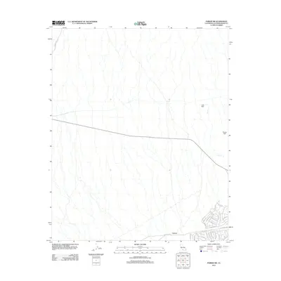
2012 Map of Parker NW
USGS Topo · Published 2012About this map
Calzona anchors the southeastern corner of this arid landscape in San Bernardino County, where a dense network of residential streets with evocative names meets the open desert. The topography is defined by the prominent heights of Vista Peak and Squaw Peak, with drainage patterns moving through ephemeral channels like Arch Cr. A series of long-standing desert routes, including Chambers Well Rd and Old Parker Rd, cut across the alluvial fans and scrubland. The development patterns at Calzona are notable for their thematic street naming, featuring labels such as Geronimo Trl, Moccasin Trl, and Cochise Rd, reflecting a mid-century style of desert community planning that sought to establish a sense of place in this remote environment.
Find a feature on this map
33 named features on this map. Tap any name to fly to it.
Don’t see what you’re looking for? This feature index may not catch every label — zoom into the map to look around manually.
Map Details
Editions of this 2012 Parker NW Map
This is the sole edition of this map. No revisions or reprints were ever made.
Other maps of this area

1911 · Parker
USGS Topo · 1:125,000

1943 · Whipple Mts.
USGS Topo · 1:62,500

1943 · Parker
USGS Topo · 1:62,500

1943 · Vidal
USGS Topo · 1:62,500

1949 · Parker
USGS Topo · 1:62,500

1949 · Vidal
USGS Topo · 1:62,500

1950 · Parker
USGS Topo · 1:62,500

1950 · Vidal
USGS Topo · 1:62,500

1950 · Whipple Mts
USGS Topo · 1:62,500

1950 · Savahia Peak
USGS Topo · 1:62,500