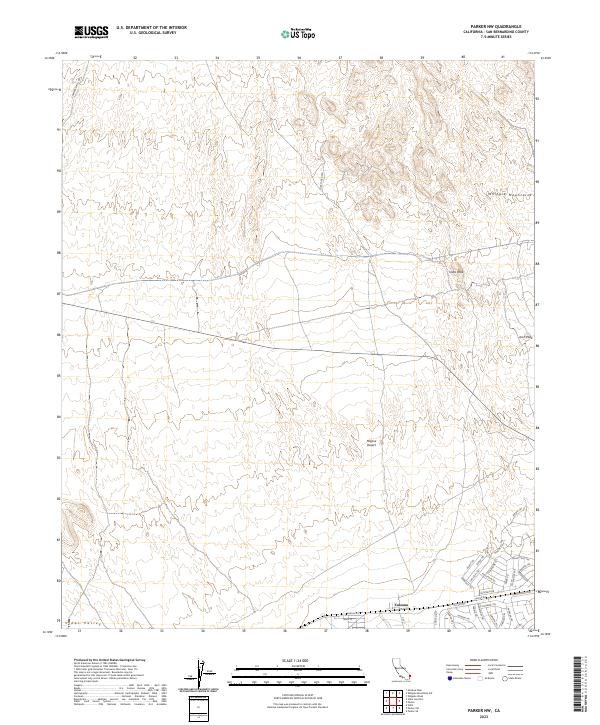
2023 Map of Parker NW
USGS Topo · Published 2023About this map
The Whipple Mountains Wilderness dominates the northern reaches of this desert landscape, characterized by the prominent elevations of Vista Peak and Arch Peak. This arid region of the Mojave Desert shows a stark contrast between the protected wilderness and the grid-based development emerging to the south. In the southeastern corner, the settlement of Calzona serves as a focal point for a dense network of residential streets and trails, such as Lakota Trl and Choctaw Trl, situated along Parker Rd. The presence of Turk Mine Rd and Chambers Well Rd suggests a history of resource extraction and desert travel, while the broad Vidal Valley opens up to the west. The map captures the meeting of high desert terrain and organized land use at the edge of the Colorado River valley.
Find a feature on this map
38 named features on this map. Tap any name to fly to it.
Don’t see what you’re looking for? This feature index may not catch every label — zoom into the map to look around manually.
Map Details
Editions of this 2023 Parker NW Map
This is the sole edition of this map. No revisions or reprints were ever made.
Other maps of this area

1911 · Parker
USGS Topo · 1:125,000

1943 · Whipple Mts.
USGS Topo · 1:62,500

1943 · Parker
USGS Topo · 1:62,500

1943 · Vidal
USGS Topo · 1:62,500

1949 · Parker
USGS Topo · 1:62,500

1949 · Vidal
USGS Topo · 1:62,500

1950 · Parker
USGS Topo · 1:62,500

1950 · Vidal
USGS Topo · 1:62,500

1950 · Whipple Mts
USGS Topo · 1:62,500

1950 · Savahia Peak
USGS Topo · 1:62,500