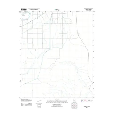
2011 Map of Parker SE
USGS Topo · Published 2011About this map
The Colorado River defines the northwestern corner of this territory, where Deer Island sits just off the riverbank. This desert landscape is heavily shaped by an irrigation network, dominated by the Main Canal which cuts through the region alongside a systematic grid of numbered avenues and named corridors like Laffoon Rd and Indian School Rd. The interaction between these artificial waterways and the natural drainage of Bouse Wash illustrates the agricultural development of the Colorado River Indian Reservation area in the early 21st century.
Find a feature on this map
32 named features on this map. Tap any name to fly to it.
Don’t see what you’re looking for? This feature index may not catch every label — zoom into the map to look around manually.
Map Details
Editions of this 2011 Parker SE Map
This is the sole edition of this map. No revisions or reprints were ever made.
Other maps of this area

1911 · Parker
USGS Topo · 1:125,000

1930 · Linskey
USGS Topo · 1:62,500

1931 · Moon Mtn
USGS Topo · 1:62,500

1932 · Moon Mtn
USGS Topo · 1:62,500

1942 · Blythe
USGS Topo · 1:250,000

1942 · MOON MTN
USGS Topo · 1:62,500

1943 · Parker
USGS Topo · 1:62,500

1949 · Parker
USGS Topo · 1:62,500

1950 · Parker
USGS Topo · 1:62,500

1954 · Salton Sea
USGS Topo · 1:250,000