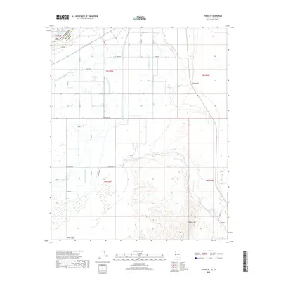
2018 Map of Parker SE
USGS Topo · Published 2018About this map
Parker and the productive expanse of Parker Valley define this landscape along the border of Arizona and California. The Colorado River enters at the northwest corner, separated by Deer Island and a complex levee system from a vast network of irrigation infrastructure. This engineered landscape relies on features like the Main Canal, Lateral Nineteen R, and Pump Drain Number One to manage water across the arid basin. To the east, the terrain shifts abruptly as the flat agricultural valley meets the rising slopes of Mesquite Mtn and the prominent Fivemile Hill. Local transit and land use are etched into the grid by named thoroughfares such as Indian School Rd, Agnes Wilson Rd, and Burns RD. The map also captures the natural drainage of Bouse Wash as it cuts through the desert floor, providing a detailed look at the intersection of intensive river-based agriculture and the stark Mojave Desert geology.
Find a feature on this map
33 named features on this map. Tap any name to fly to it.
Don’t see what you’re looking for? This feature index may not catch every label — zoom into the map to look around manually.
Map Details
Editions of this 2018 Parker SE Map
This is the sole edition of this map. No revisions or reprints were ever made.
Other maps of this area

1911 · Parker
USGS Topo · 1:125,000

1930 · Linskey
USGS Topo · 1:62,500

1931 · Moon Mtn
USGS Topo · 1:62,500

1932 · Moon Mtn
USGS Topo · 1:62,500

1942 · Blythe
USGS Topo · 1:250,000

1942 · MOON MTN
USGS Topo · 1:62,500

1943 · Parker
USGS Topo · 1:62,500

1949 · Parker
USGS Topo · 1:62,500

1950 · Parker
USGS Topo · 1:62,500

1954 · Salton Sea
USGS Topo · 1:250,000