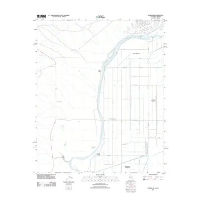
2012 Map of Parker SW
USGS Topo · Published 2012About this map
The Colorado River defines this landscape on the California-Arizona border, winding through a series of dramatic turns including Gravel Hill Bend and passing by Deer Island. The map illustrates a highly organized agricultural and irrigation system, evidenced by the strict grid of numbered avenues and various water control features like Lateral Twenty-seven R-25 and the Twelvemile Slough. This network services the fertile Vidal Valley, where drainage from Vidal Wash meets the river's floodplain.
Find a feature on this map
50 named features on this map. Tap any name to fly to it.
Don’t see what you’re looking for? This feature index may not catch every label — zoom into the map to look around manually.
Map Details
Editions of this 2012 Parker SW Map
This is the sole edition of this map. No revisions or reprints were ever made.
Other maps of this area

1911 · Parker
USGS Topo · 1:125,000

1931 · Moon Mtn
USGS Topo · 1:62,500

1932 · Moon Mtn
USGS Topo · 1:62,500

1942 · Blythe
USGS Topo · 1:250,000

1942 · MOON MTN
USGS Topo · 1:62,500

1943 · Parker
USGS Topo · 1:62,500

1943 · Vidal
USGS Topo · 1:62,500

1945 · Big Maria Mtns
USGS Topo · 1:62,500

1949 · Parker
USGS Topo · 1:62,500

1949 · Vidal
USGS Topo · 1:62,500