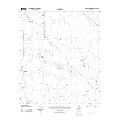
2011 Map of Parkers Crossroads
USGS Topo · Published 2011About this map
Spring Villa and Parkers Crossroads anchor this Lee County landscape, where the headwaters of Little Uchee Creek and Chewacla Creek carve through the terrain. The map reveals a community structured by local industries and landmarks, notably the Griffen Mill and Meadows Mill in the southeastern quadrant near Meadows Crossroads. The area is characterized by an extensive network of county roads and numerous water management features, including the Lee County Public Lake and several private impoundments like Samford Lake Number One. For genealogists, the map is a vital resource, plotting several family and community burial grounds such as Morris Chapel Cemetery, Providence Cemetery, and Macedonia Cemetery. The presence of the Ivey Lookout Tower near Beauregard highlights the area's forest management history, while scattered settlements like Hopewell and Prince Crossroads show the persistent rural settlement patterns of the early 21st century.
Find a feature on this map
110 named features on this map. Tap any name to fly to it.
Don’t see what you’re looking for? This feature index may not catch every label — zoom into the map to look around manually.
Map Details
Editions of this 2011 Parkers Crossroads Map
This is the sole edition of this map. No revisions or reprints were ever made.
Other maps of this area

1907 · Opelika
USGS Topo · 1:125,000

1909 · Opelika
USGS Topo · 1:125,000

1914 · Seale
USGS Topo · 1:62,500

1950 · Crawford
USGS Topo · 1:24,000

1950 · Seale
USGS Topo · 1:62,500

1955 · Crawford
USGS Topo · 1:24,000

1955 · Seale
USGS Topo · 1:62,500

1955 · Phenix City
USGS Topo · 1:250,000

1957 · Phenix City
USGS Topo · 1:250,000

1958 · Phenix City
USGS Topo · 1:250,000