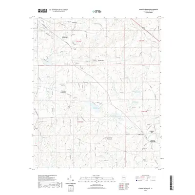
2020 Map of Parkers Crossroads
USGS Topo · Published 2020About this map
The southeastern outskirts of Opelika anchor a landscape defined by traditional rural settlements and an extensive network of small lakes and creeks. Toward the center of this terrain, Parkers Crossroads and Spring Villa mark long-standing community nodes, while the eastern edge is characterized by the water-powered industrial legacy of Griffen Mill and Meadows Mill along Little Uchee Creek. The map provides significant detail for family historians, documenting numerous burial sites such as the Penn Young Gravesite, Morris Chapel Cem, and Providence Cem. Water features are a dominant theme, ranging from the recreational waters of Lees Lake and Lee County Public Lake to the various numbered basins of Samford Lake and Pope Lake. These reservoirs, combined with the meandering courses of Chewacla Creek and Wandila Creek, illustrate the complex drainage patterns of this corner of Lee County.
Find a feature on this map
122 named features on this map. Tap any name to fly to it.
Don’t see what you’re looking for? This feature index may not catch every label — zoom into the map to look around manually.
Map Details
Editions of this 2020 Parkers Crossroads Map
This is the sole edition of this map. No revisions or reprints were ever made.
Other maps of this area

1907 · Opelika
USGS Topo · 1:125,000

1909 · Opelika
USGS Topo · 1:125,000

1914 · Seale
USGS Topo · 1:62,500

1950 · Crawford
USGS Topo · 1:24,000

1950 · Seale
USGS Topo · 1:62,500

1955 · Crawford
USGS Topo · 1:24,000

1955 · Seale
USGS Topo · 1:62,500

1955 · Phenix City
USGS Topo · 1:250,000

1957 · Phenix City
USGS Topo · 1:250,000

1958 · Phenix City
USGS Topo · 1:250,000